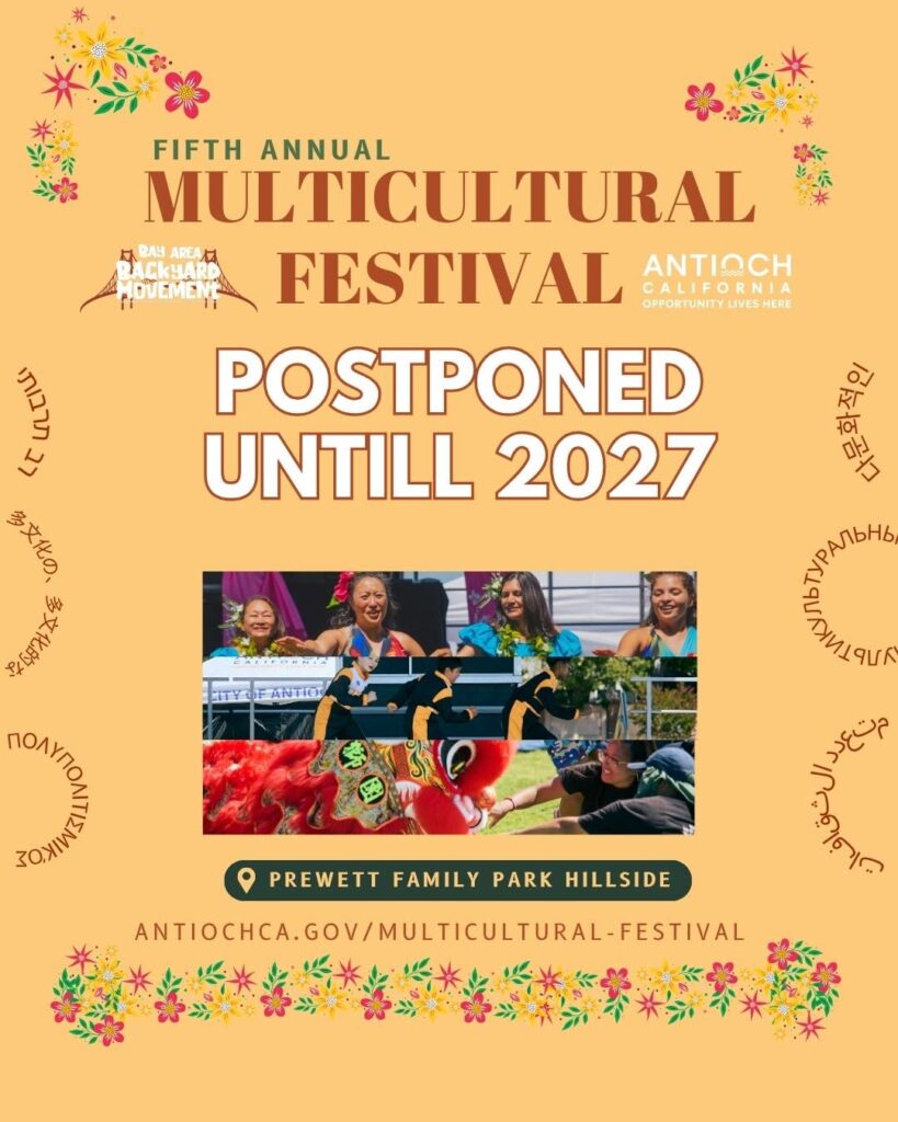
Thank you for your excitement and support for Antioch’s Fifth Annual Multicultural Festival. After careful consideration, this year’s festival has been postponed until 2027. While we’re disappointed we won’t gather this year, we’re looking forward to bringing our community an even more memorable celebration of the diverse cultures that make Antioch so special.
Thank you for your understanding and continued support. Stay tuned for future updates!
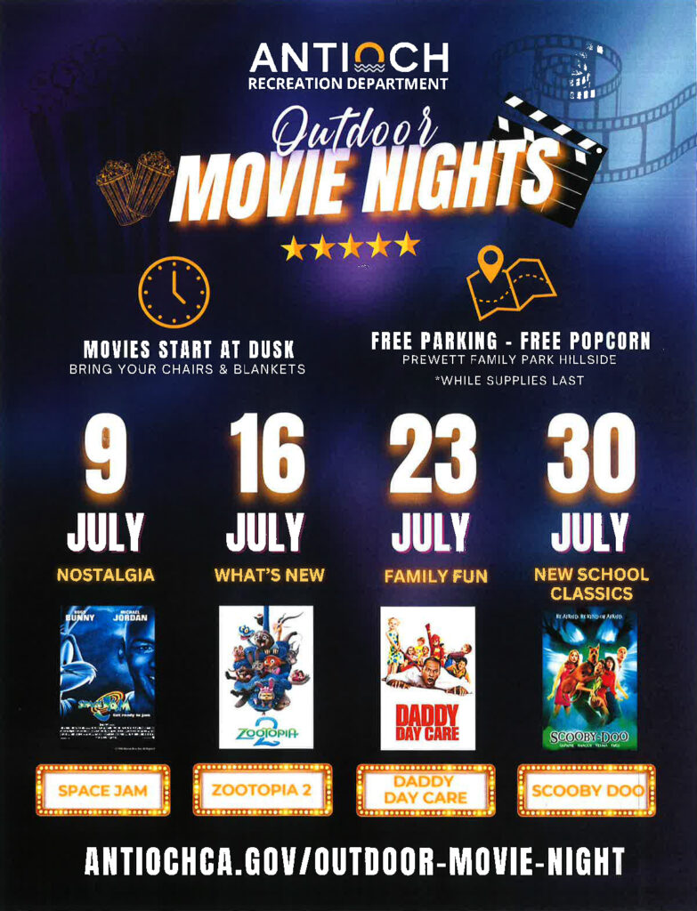
Start Time: Dusk (approximately between 8:30 pm and 8:45 pm)
Location: Prewett Family Park Hillside (Located next to the Antioch Water Park)
Grab your blankets and lawn chairs, and bring the entire family out to enjoy popcorn, kids’ crafts and a movie. Happening on the Prewett Family Park Hillside, next to the Antioch Water Park, movies will begin just after dusk (approximately 8:30 pm to 8:45 pm depending on sunset). Did we mention it will also be Food Truck Thursday, brought to you by FoodieCrewSF? Don’t forget to grab dinner before the movie begins! You won’t want to miss this.
**Free popcorn, refreshments, and kids’ crafts while supplies last.
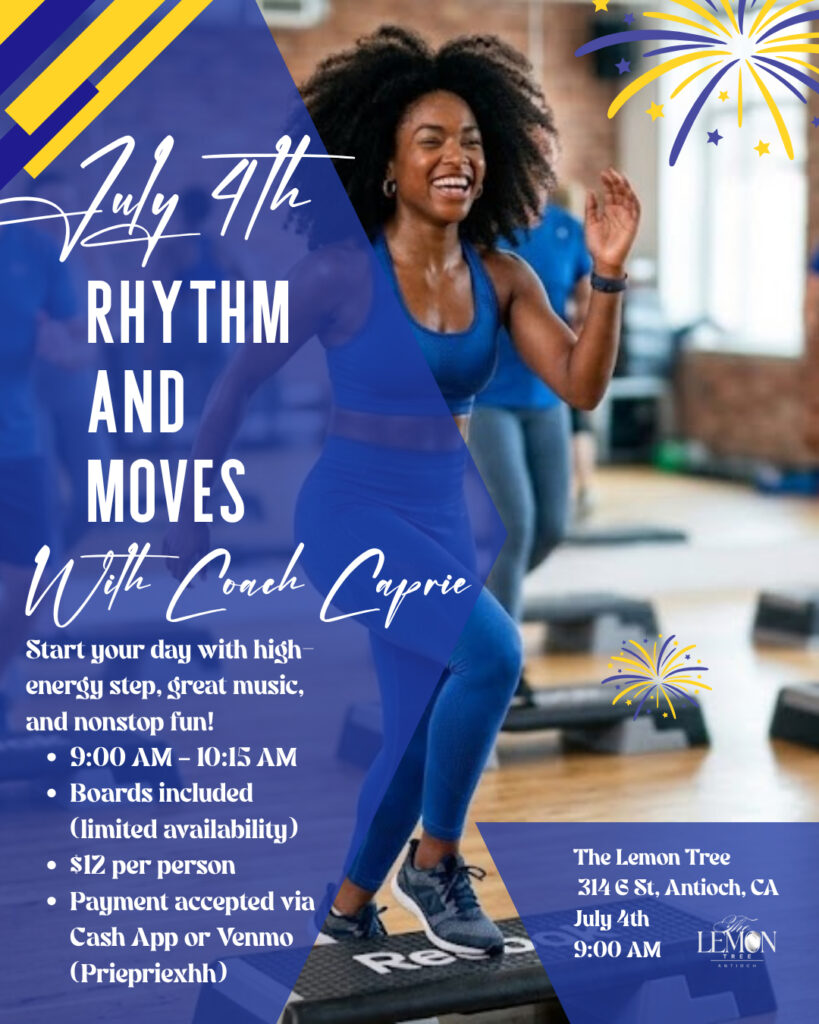
For the Fourth of July, The Lemon Tree will have a 9:00 AM workout class open to both men and women. Payment details are included on the flyer.
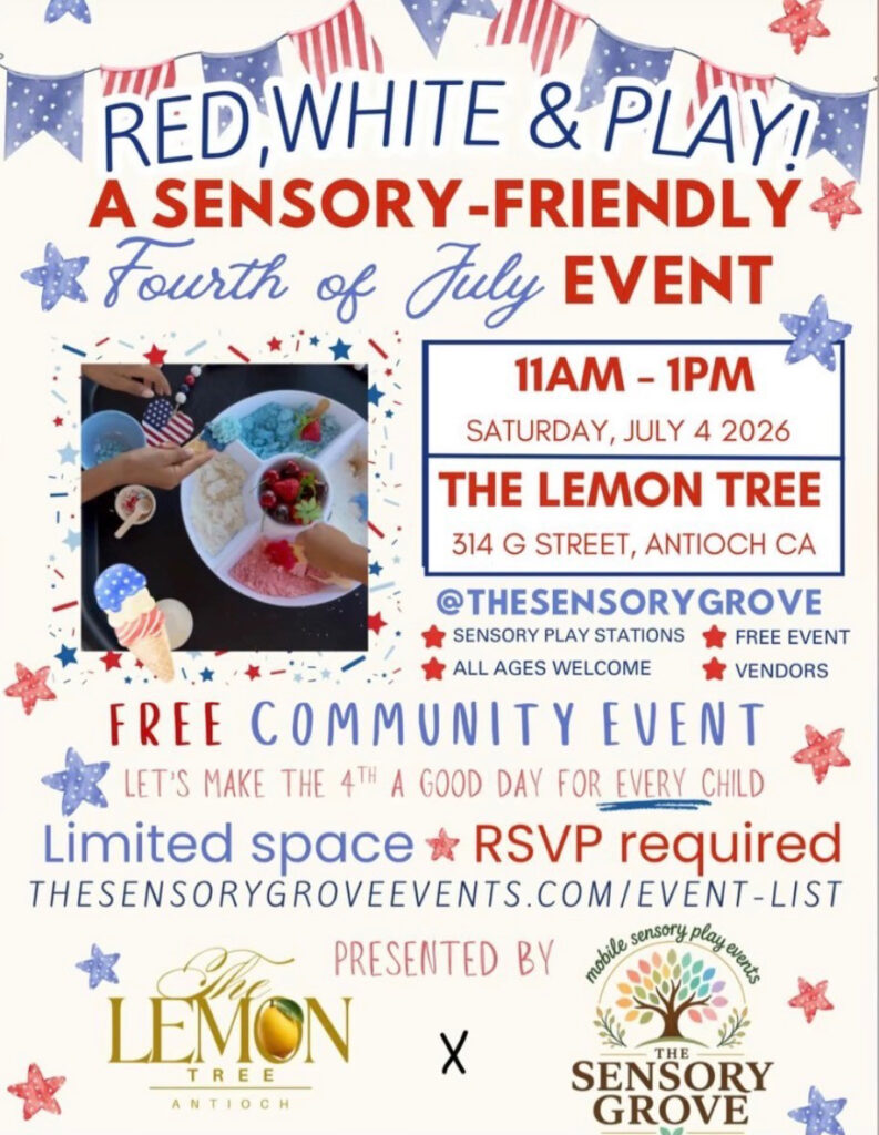
At 11am we’re also hosting a kids’ event designed with neurodivergent and children on the spectrum in mind. It is open to all kids but created with extra care for families who benefit from a calmer, more supportive space.
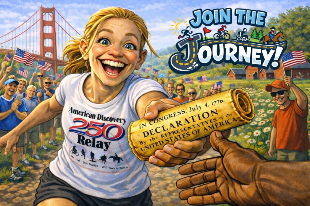
Longest continuous, non-motorized coast-to-coast relay in world history begins July 1st in California
By Dave Whitson, Director, 250 Relay, American Discovery Trail Society
Starting next Wednesday, July 1st, the American Discovery Trail Society (ADTS) celebrates the outdoors and 250 years of our independence with the American Discovery250 Relay— a 6,800-mile (11,000 km) journey along the entire American Discovery Trail from California to Delaware. This event will be the longest continuous, non-motorized relay in world history. Participants will carry specialized batons carrying a replica of the Declaration of Independence. (See related article)
Source: American Discovery Trail
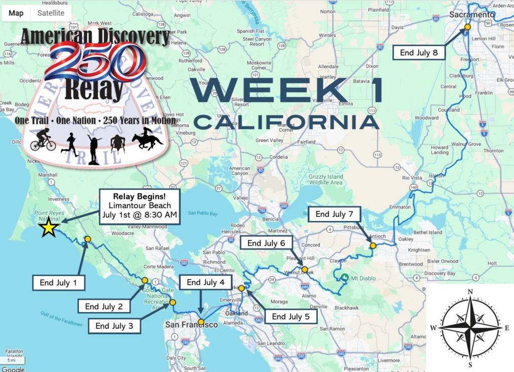
The FIRST WEEK highlights are as follows:
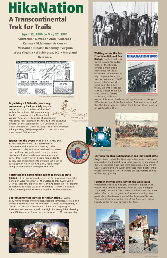
Wednesday, July 1st: Relay begins at Point Reyes National Seashore at Limantour Beach. Members of the 1980-81 HikaNation event will be on hand to help start the relay. This event inspired the establishment of the American Discovery Trail, and details can be found in the attachment, below. The relay will start at 8:30 AM PT.
Saturday, July 4th: The Relay crosses the Golden Gate Bridge. A July 4th party hosted by Pier 39 takes place from 11AM to NOON.
Monday, July 6th UC Berkeley, CA to Heather Farms Walnut Creek, CA. Start time: 8AM
Tuesday, July 7th: Heather Farms Walnut Creek, CA to Antioch Community Park, CA. Start time: 8:30AM
Tuesday, July 7th: City of Clayton Welcome. Noon to 1PM. Contact Chris Karney, chrisk@claytonca.gov or 925-943-2680.
Wednesday, July 8th: Antioch Community Park, CA to Sacramento – William Land Park, CA. Start time: 7:30AM
Wednesday, July 8th: City of Oakley Welcome. Time TBA. Contact Troy Faulk, Faulk@ci.oakley.ca.us or 925-625-7038.
Wednesday, July 8th: Yolo County Welcome. Noon to 1PM. Contact Terry Selk, terry@visityolo.com or 530-297-1900
Interested participants or teams are asked to register for FREE at discoverytrail.org/america-250-relay. Runners, cyclists, hikers, wheelchair users and horseback riders are all encouraged to take part. We also encourage interest from those who wish to help with logistics, welcoming events or sponsorships.
About the American Discovery Trail
The American Discovery Trail is the nation’s first non-motorized coast-to-coast trail. It runs for 6,800 miles through 15 states and Washington, D.C. The route incorporates numerous local, state, and national trails, with most of them designed for walking, hiking, and running and for bicycle and equestrian use. It connects scores of scenic and historic trails, backcountry roads, national parks and forests plus thousands of state and local properties of historic, cultural and natural significance. Users can experience their local environment, or the 23 ecosystems the trail passes through – deserts, mountains, forests, waterfronts, and plains. You can learn more about the ADT by visiting www.discoverytrail.org.
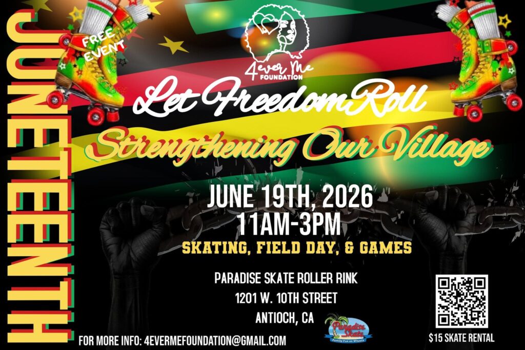
Calling all youth and young adults, join us for our Annual “Let Freedom Roll” Juneteenth Celebration as we Strengthen Our Village! We have a late morning-early afternoon of fun, excitement and educational moment celebrating FREEDOM, so grab your skates or rent them from Paradise Skate Roller Rink in addition to some field games and activities. Scan the QR code and we look forward to seeing you on Friday, June 19th as we let FREEDOM ROLL!!
Longest continuous, non-motorized relay in world history will have stops in Walnut Creek, Antioch July 6-8
Interested individuals or teams can participate
By Dave Whitson, ADT 250 Relay Director, American Discovery Trail Society
FRONT ROYAL, VA – In 2026, the American Discovery Trail Society (ADTS) celebrates the outdoors and 250 years of our independence with the American Discovery250 Relay— a 6,800-mile (11,000 km) journey along the entire American Discovery Trail from California to Delaware, traversing through hundreds of cities, towns, villages and hamlets, starting in July and ending around Thanksgiving. This event will be the longest continuous, non-motorized relay in world history. The ADTS invites all to join in the celebration by participating for a day or more in a relay, attending one of over 100 local events, or sharing your story of personal growth and adventure. Together, we commemorate America’s past and unify our country.
Source: ADR250
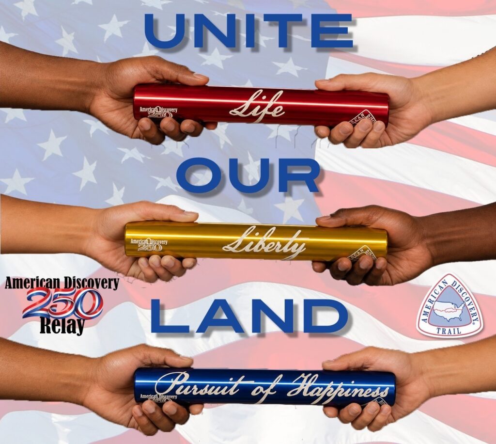
Specialized Batons
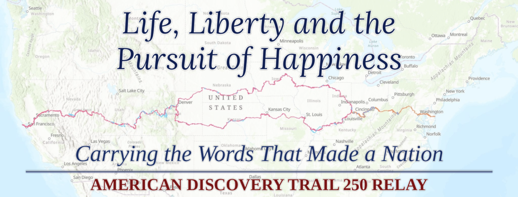
Participants will carry a specialized baton displaying the header and carrying a copy of the Declaration of Independence. There will be three batons to choose from – each engraved with the three founding principles in the document: Life, Liberty and the Pursuit of Happiness. There will be three different colors assigned to each baton as well – red, gold and blue.
Source: ADR250
We have provided an informational webinar presenting an overview of the event which you can link to HERE.
Interested participants or teams are asked to register for free at discoverytrail.org/america-250-relay. Runners, cyclists, hikers, wheelchair users and horseback riders are all encouraged to take part. We also encourage interest from those who wish to help with logistics, welcoming events or sponsorships.
The ADTS is making the turn-by-turn route instructions and GPS tracks free to the public during the 2026 year as part of the celebrations thanks to a generous donation from Indiana Trails.
Source: ADR250
DATES HAVE BEEN SET!
California dates are from July 1st-15th with stops in Walnut Creek and Antioch on July 6th and 7th, leaving on the 8th. The California segment will begin at Limantour Beach in Marin County where we’ll gather for the American Discovery 250 Relay kick-off, cross the Golden Gate Bridge and end with a final leg from Tahoe City on the Tahoe Rim Trail into Nevada on July 15th.
Contra Costa County Segments
Monday 07/06/2026 — UC Berkeley, CA at 8:00 a.m. run and walk to Heather Farms Walnut Creek, CA — 28.3 miles We’ll meet on the corner of Bancroft and College Ave, right on the edge of the UC Berkeley campus. The Telegraph Channing Garage is a nearby parking option. Estimated arrival time: 5pm
Tuesday 07/07/2026 — Heather Farms Walnut Creek, CA at 8:30 a.m. run and walk to Antioch Community Park, CA — 36.6 miles The day begins with a special event–a breakfast hosted by the City of Walnut Creek, in collaboration with Save Mount Diablo. Free food! (We’re going to need it.) We’ll aim to hit the road around 9am. Lunch-time gathering in Clayton, hosted by the City of Clayton. Details to follow. Estimated arrival time: 7pm.
Wednesday 07/08/2026 — Antioch Community Park, CA at 8:30 a.m. bike to Sacramento – William Land Park, CA — 69.4 miles We depart from Antioch / Worth Shaw Community Park. The City of Oakley will offer a refreshment stop for participants at Antioch/Oakley Regional Shoreline around 9:30am. A support vehicle will be accessible in Oakley (7.5 miles), Isleton (30 miles), Locke (39.6 miles), and Clarksburg (55 miles), and also on-call for road-side support. Water will be available in the vehicle to top off bottles, and it will also be possible for participants to have some of their own supplies transported. Estimated arrival time: 4pm.
Many Sections of the Trail are Multi-Modal and ADA Accessible
On many days we can have hikers, runners, bicyclers, and others. Thus, a 70-mile “bike” day will certainly include bicyclists who go the full distance, but there also can be people who meet up at the starting point in the morning and walk for a mile or more, or there may be walkers who gather at sites where the bikers stop for lunch or at the end of the day. Also some days listed as “hike” can include families or others who wish to ride their bikes.
There are some days when certain modes are not practical or allowed, such as no bicycles in wilderness areas. Thus, the sign-up form asks the date, the mode of transit, and the desired starting and ending points. Note that the relay will split in Denver, so in September and October we are running two relays at the same time, one through the south-central region and through the north-central region. We unite in late October in Cincinnati.
Source: ADR250
About the American Discovery Trail
The American Discovery Trail is the nation’s first non-motorized coast-to-coast trail established in the USA in 1990. Since then, hundreds have taken the challenge to walk, bike, wheelchair or horseback the entire trail (or sections thereof) with life-changing results.
It runs for 6,800 miles through 15 states and Washington, D.C. The route incorporates numerous local, state and national trails, with most of them designed for walking, hiking, and running and for bicycle and equestrian use. It connects scores of scenic and historic trails, backcountry roads, national parks and forests plus thousands of state and local properties of historic, cultural and natural significance. Users can experience their local environment, or the 23 ecosystems the trail passes through – deserts, mountains, forests, waterfronts, and plains. You can learn more about the ADT by visiting www.discoverytrail.org.
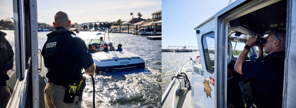
The Contra Costa County Sheriff’s Marine Unit Officers assist boaters in the Delta. Photos: CCCSO
By Jimmy Lee, Director of Public Affairs, Contra Costa County Office of the Sheriff
Memorial Day weekend marks the traditional start of boating season on the Delta. The Contra Costa County Office of the Sheriff is urging all boaters to stay safe while enjoying the water.
“Many boating accidents can be avoided by planning ahead,” said Contra Costa Sheriff David Livingston. “80% of boating fatalities could have been prevented by wearing a life jacket. Fol-lowing the law and these tips could help you stay safe on the water.”
California Boater Card Required – Anyone who operates a motorized vessel must carry a California Boater Card. Learn more at californiaboatercard.com.
Engine Cut-off Switch – Last year, California law required the use of an engine cut-off switch—also known as a kill switch or lanyard—on ves-sels under 26 feet. This safety device must be worn by the operator when at the helm and operating above 5 mph or dis-placement speeds. This law is designed to prevent runaway boat incidents in the event the operator is thrown from the helm, adding another layer of safety to California waterways.
Life Jackets Save Lives – All vessels, including stand-up paddleboards (SUPs), must carry a U.S. Coast Guard-approved life jacket for each person on board. Life jackets must be the correct size for the intended wearer and children under 13 must wear a life jacket at all times aboard a vessel, unless in a fully enclosed cabin. Everyone is strongly encouraged to wear a life jacket at all times on the water.
Boating Under the Influence (B.U.I.) – Operating a vessel under the influence of drugs or alcohol is illegal and dangerous. Boaters arrested for B.U.I. face similar consequences to D.U.I. drivers, including fines, license suspension, and possible jail.
Safe Navigation Practices – Always operate at safe speeds, especially in narrow channels or areas with limited visibility. Stay to the right side of the waterway. In crossing situations, the vessel to the right has the right of way.
Ski Flags and Observers – While engaged in towing activities, an observer who holds the ski flag, at the minimum age of 12 years old, must display the ski flag when required: a downed skier in the water, a skier in the water preparing to ski, a line is in the water extended from the vessel, and a ski or similar equipment is in the water in the vicinity of the vessel.
Blue Light Law – Boaters must slow to a no-wake speed when approaching/being approached by any law enforcement or emergency vessel displaying an illuminated blue light, whether the patrol vessel is moving or stationary.
Emergency Preparedness – Carry an emergency kit that includes a flashlight, warm clothing, a cell phone, VHF radio, and navigational charts. Before heading out, file a float plan. Learn how to create a float plan at: https://uscgboating.org/recreational-boaters/floating-plan.php
Carbon Monoxide Awareness – Be cautious of carbon monoxide buildup, especially when sitting on the swim platform or near the boat’s transom while the engine is running.
Youth Operation Rules – Children ages 12–15 may operate boats with motors over 15 horse-power or sailboats over 30 feet only if directly supervised by an adult (18+) who holds a California Boater Card.
Throwables Required – Boats 16 feet and longer must carry a U.S. Coast Guard-approved throwable flotation device, such as a life ring or square cushion, which must be easily accessible.
Additional Resources – The ABC’s of Boating safety handbook is available at most boating retailers. Visit dbw.ca.gov for more boating laws, safety tips, and California Boater Card information. For questions or non-emergency assistance, contact the Marine Services Unit at (925) 427-8507.
In emergencies, Dial 911 or call Contra Costa Sheriff’s Office Dispatch at (925) 646-2441.
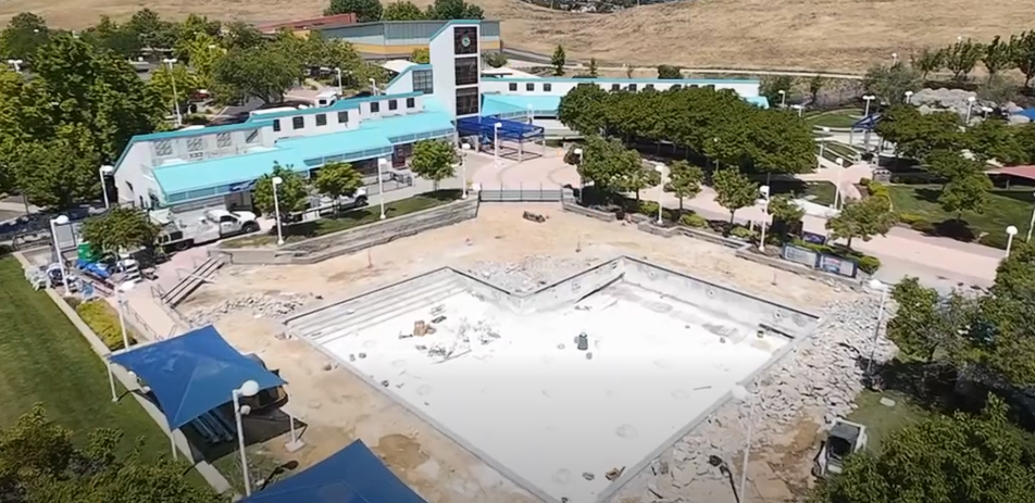
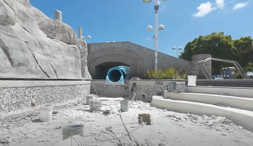
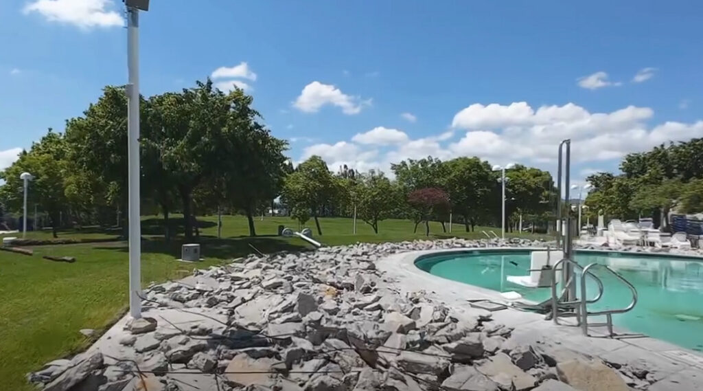
The Lap Pool at the Antioch Water Park is undergoing repairs. Video screenshots source: Antioch Recreation Dept.
Season opening postponed, closed until further notice
By City of Antioch Recreation Department
The City is pleased to share progress on the ongoing renovation of the Antioch Water Park, a project focused on improving safety, accessibility, and the overall guest experience.
Current work includes the re-plastering of the Lap Pool and Boulder Pool to enhance durability and water quality, as well as concrete repairs throughout the pool deck to address uneven surfaces and eliminate tripping hazards. These upgrades are essential to ensuring a safer environment for all visitors.
Repairs are also being made to the slides.
In addition, new pool lighting is being installed to improve visibility and extend usability during evening hours. Renovations to the park’s restroom facilities are also underway, bringing updated fixtures and improved accessibility for guests.
To further support accessibility, new ADA-compliant pool lift chairs are being installed at each pool, ensuring that guests of all abilities can safely and comfortably enjoy the facility.
To enhance communication and safety, a new public address (PA) system is also being installed, allowing staff to deliver clear announcements and emergency information throughout the facility.
The walkway around the Boulder Pool is being replaced.
5/22/26 UPDATE: Due to ongoing renovations, the Antioch Water Park is closed until further notice.
We appreciate the community’s patience during this renovation period. Please check our social media pages and website for the latest updates on park status. www.facebook.com/antiochrecreation