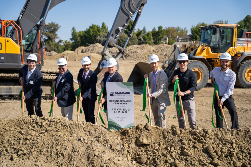
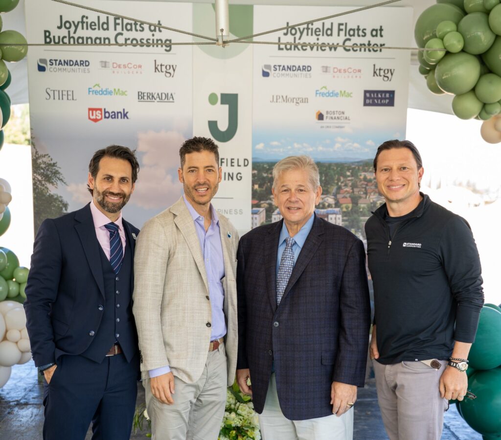
The Standard Communities Leadership Team along with the financing and project partners with Antioch Mayor Pro Tem Don Freitas breaking ground for the Joyfield Flats Lakeview Center project on Tuesday, Sept. 22, 2026. Photo: Standard Communities
Without state or local subsidy, but with public financing
Standard Communities brings extremely-low, very-low and low-income units being built near City’s neighborhood of highest valued homes that successfully fought to stop nearby apartment project over 20 years ago
The Joyfield Flats projects represent a $192 million investment in two family designed communities and will deliver workforce housing in less than 2 years
By Allen D. Payton
ANTIOCH, Calif. — Los Angeles-based Standard Communities, a leading national affordable housing investor, developer and operator, broke ground Tuesday, Sept. 22, 2026, on two affordable apartment communities that will together make up a $192 million investment and deliver 428 new homes for working families in Antioch, CA. Mayor Pro Tem Don Freitas was the only council member to participate in the groundbreakings and he spoke during the brief ceremony on behalf of Mayor Ron Bernal who was at another event representing the Mayor’s Conference.
In a press release issued Tuesday, the company said, “Joyfield Flats at Lakeview Center and Joyfield Flats at Buchanan Crossing are the first Joyfield communities on the West Coast, following the brand’s first community in Virginia. Through the innovative model of Joyfield Living, combined with the strong public-private partnership with the City of Antioch and Contra Costa County, Standard Communities will build these income-restricted units with the finishes, amenities and service standards of a market-rate apartment in less than two years, without state or local subsidies.”
They are on two of the 10 parcels the City Council rezoned using Commercial Infill Housing overlays allowing for either medium- and high-density residential or mixed-use projects. They only require administrative design review and project approval by City staff without any hearings by the Planning Commission or City Council for public input. (See related article)
Standard Communities leadership team, consisting of Feras Qumseya, Chief Development Officer and Jeff Jaeger and Scott Alter, Co-Founders and Managing Principals, were joined by Antioch Mayor Pro Tem Don Freitas (second from right) during the groundbreaking ceremony Tuesday, Sept. 22, 2026. Photo: Standard Communities
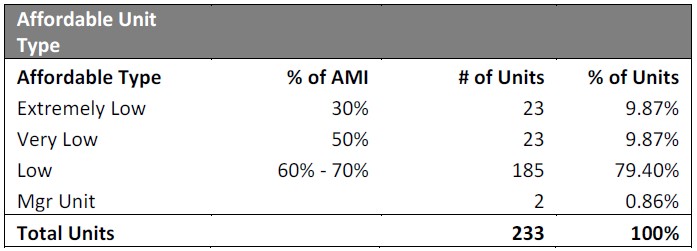
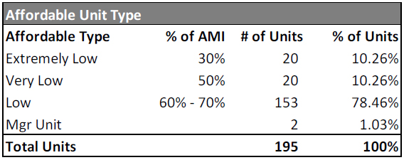
The Lakeview project, located on the south side of Lone Tree Way next to the CVS store and shopping center, will consist of 233 affordable units and the Buchanan project, located next to the Grocery Outlet store on the north side of Buchanan Road west of Somersville Road, will include 195 affordable units, both for extremely-low, very-low and low-income residents.
In 2004, residents who live in the neighborhoods off Golf Course Road rose up and successfully defeated a proposed apartment complex on Blue Rock Drive on the north side of Lone Tree Way, across from the Lakeview project site.
Breakdown of Joyfield Flats at Lakeview Center average median income levels and units per category. Source: City of Antioch
According to the Standard Communities press release, “The communities are designed with families in mind, including offering two- and three-bedroom apartments. Because of the innovative model of Joyfield Living, both communities are being delivered for under $500,000 per home, an atypical cost basis for the Bay Area, and all 428 homes are income-restricted under the federal Low-Income Housing Tax Credit program, serving households at 30% to 70% of area median income (AMI).”
“As our city continues to grow, and the cost of just about everything continues to go up, individuals and families need housing they can afford.” said Ron Bernal, Mayor of the City of Antioch. “More than 400 new homes are currently under construction because we made meeting our housing goals a priority, and Standard Communities is investing in and helping us meet that commitment. These units will serve every segment of our community with a quality place to call home for years to come.”
Standard Communities says they, “capitalized both transactions with private construction debt, federal Low-Income Housing Tax Credit equity and tax-exempt bonds issued by the California Municipal Finance Authority, without the city, county or state gap funding such projects typically require. Both communities were approved under the City of Antioch’s Commercial Infill Housing (CIH) Overlay, which allows by-right, ministerial approval for housing on underused commercial sites.”
Joyfield Flats at Buchanan Crossings Phase II AMI Units. Source: City of Antioch
“Antioch’s innovative commercial infill housing process gave us a predictable, efficient path to approval,” said Feras Qumseya, Chief Development Officer at Standard Communities. “That speed is what lets us build at scale and hold costs where they need to be. Joyfield Living is proof that a resident can have the finishes, the amenities and the services of a market-rate apartment at a workforce housing cost, and we are proud to bring it to the East Bay.”
Standard Communities further said, “These communities are designed for the teachers, nurses, first responders, service workers and other households who earn too much to qualify for deeply subsidized housing and too little to absorb Bay Area market rents. Residents will have access to a community lounge, fitness center, computer lab, children’s playground, picnic areas and a dog run, along with bike and tenant storage and on-site management.”
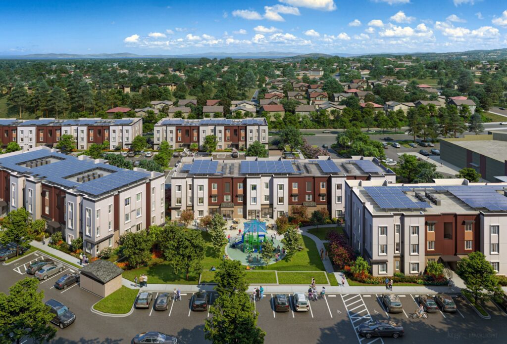
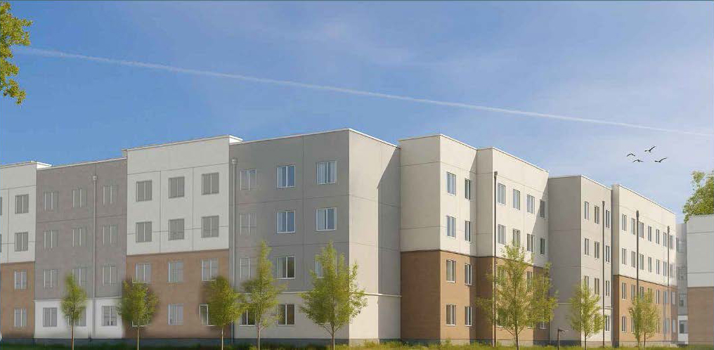
Rendering of the Joyfield Flats at Lakeview Center apartment complex currently under construction on Lone Tree Way near Golf Course Road. Source: Standard Communities
Joyfield Flats at Lakeview Center
Located at 4020 Lone Tree Way, Joyfield Flats at Lakeview Center will bring 233 homes across seven buildings, including 109 one-bedroom, 58 two-bedroom and 66 three-bedroom apartments. Vertical construction begins in December 2026, with completion anticipated in the third quarter of 2028.
JPMorgan Chase provides construction financing for the development of Lakeview Center, with federal tax credit equity from Freddie Mac, syndicated by Boston Financial, and permanent financing arranged by Freddie Mac, serviced by Walker & Dunlop.
“Communities grow stronger when families have access to quality, affordable housing, and Joyfield Flats at Lakeview Center will help drive that growth in Antioch,” said James Vossoughi, Executive Director, J.P. Morgan Community Development Banking. “J.P. Morgan is proud to provide the construction financing to bring 233 new homes for families to life, complete with amenities and spaces designed to help residents thrive. This development is an investment in Antioch’s future, and in the opportunity and stability of the families who will call it home.”
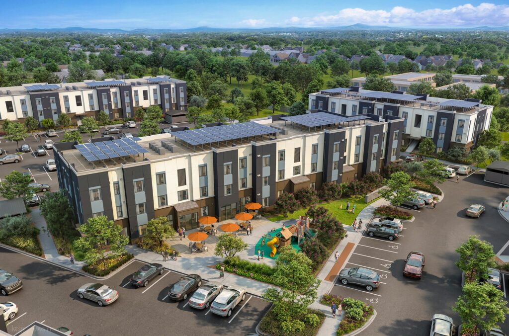
Rendering of the Joyfield Flats at Buchanan Crossing apartment complex located on Buchanan Road west of Somersville Road. Source: Standard Communities
Joyfield Flats at Buchanan Crossing
Located at 3210 Buchanan Road, Joyfield Flats at Buchanan Crossing will bring 195 homes across six buildings, including 91 one-bedroom, 49 two-bedroom and 55 three-bedroom apartments. Mass grading is complete and retaining wall construction is underway. Vertical construction begins in January 2027, with completion anticipated in July 2028.
U.S. Bank provides construction financing and federal tax credit equity investment for the development of Buchanan Crossing, with permanent financing arranged by Freddie Mac, serviced by Berkadia.
“We’re honored to support Buchanan Crossing as an equity investor and lender, working with Standard Communities to create 195 units of housing in Antioch, California,” said Yun Tong, affordable housing senior project manager at U.S. Bancorp Impact Finance, the community development and infrastructure finance division of U.S. Bank. “This is a great example of how our financing solutions help our clients expand access to affordable housing and help build a foundation of financial stability for future residents.”
233-Unit Extremely Low, Very Low and Low-Income Lakeview Center ApartmentsNear Golf Course Road
Asked if the leaders at Standard Communities would want this type of housing near their neighborhood and if they held community meetings with nearby neighbors before submitting their plans to the City and take into consideration their concerns, Marie Lloyd, Head of Corporate Affairs at Standard Communities responded:
“This didn’t happen behind closed doors. This project was approved through the City’s Commercial Infill Housing process that went through public forums and City Council meetings. Joyfield Lakeview Center and Joyfield Buchanan will transform unused, blighted commercial sites into high-quality and professionally managed housing built especially for the teachers, nurses, first responders, line cooks, and other working people who deserve the opportunity to live near and in the communities they serve.
Standard Communities has owned and operated housing in California since 2007. We don’t build and walk away. We plan to be in Antioch for decades. A healthy community — both economically and culturally — is one where working people cannot just survive, but thrive and contribute. Joyfield Lakeview Center and Joyfield Buchanan are meaningful steps in that direction.”
Split Council Votes on Public Financing, Only Matters They Could Decide
However, that’s not correct, as the only matter the city council could deal with was the public financing for both projects. Both complexes received split votes but were approved 3-2 with Freitas and District 4 Councilwoman Monica Wilson – who lives across Lone Tree Way from the Lakeview project – voting against the public financing. That’s in spite of the fact she voted for the CIH Overlay District rezoning in 2022 which allowed for the projects to be staff approved and built, and in spite of Bernal raising concerns about traffic at the Lone Tree Way, Golf Course Road and Bluerock Drive intersection.
As previously reported, under the Tax Equity Fiscal Responsibility Act of 1982, the Council voted to approve the issuance of one or more series of revenue bonds by the California Municipal Finance Authority to provide for the financing or refinancing of the acquisition, construction, improvement and equipping of the projects.
So, financing would not have been from City funds. But the developer’s rep for both Joyfield Flats projects said, if the Council voted against the financing it would have killed both projects. That’s due to timing on the financing and because the dirt from the Lakeview project will be used as fill for the Buchanan project.
Furthermore, the property behind CVS where the Lakeview project is under construction was not a “blighted commercial site”. It had merely sat vacant as open land after Lone Tree Way was rerouted in the 1980’s.
About Standard Communities
Standard Communities is a national affordable housing investment, development, and operations platform with approximately $7 billion in assets under management, nearly 30,000 units, and over 200 communities across 22 states and Washington, D.C. For more information, visit standard-communities.com.
Screenshot of El Campanil Theatre building listing on realty.com 9/2/26.
But wasn’t placed on council meeting agenda for discussion and vote
Council voted unanimously both times to just receive and file annual reports of available funds from developer fees
“We did talk to the current owner that he would entertain a sale to the City…we got blind-sided…” – Councilwoman Torres-Walker on this year’s efforts for the City to buy the building
By Allen D. Payton
In response to questions sent to Antioch City staff multiple times beginning Friday, August 28 and to staff and council members on Friday, Sept. 4, it was learned by the Herald on Tuesday, Sept. 8, that the City had more than enough funds to purchase the El Campanil Theatre in both 2023 before the first sale to a private owner, and prior to this year’s sale, as well.
In fact, according to a staff report to the council on Dec. 9, 2025, the City had over $7 million by June 30, 2025, sitting in a fund, as District 1 Councilwoman Tamisha Torres-Walker recently claimed, that can be used to “acquire existing buildings with the intent to convert them into Community Centers.” That is more than enough to have covered the $1.5 million asking price by the current owner and seller. In addition, by June 30, 2023, the month after the first sale of the theater to a private party closed, the City had almost $5.5 million in that same fund. Plus, the Fiscal Year 2021-22 report shows as of June 30, 2022, the fund had a balance of over $4.2 million. So, the City also had enough funds to purchase the theater in 2023 for the $800,000 asking price. (See fourth subsection of related article)
Source: City of Antioch
Questions to Staff and Council if Development Fees Could Be Used to Purchase Theater, More
The questions were sent to City Attorney Lori Asuncion (pronounced uh-SUN-shun), Acting Community & Economic Development Director Kevin Scudero and Acting City Manager Ana Cortez, but since they had not yet responded by Friday night, Sept. 4, those same questions plus, a few more, were then emailed to them, the mayor and all four council members, and City PIO Jaden Baird. Mayor Pro Tem and District 3 Councilman Don Freitas informed the Herald last Wednesday that he would be out of town and unreachable for the following two weeks, and an auto-response email shared that Baird is no longer with the City of Antioch.
They were informed of what Torres-Walker said, that she and Freitas were looking into having the City use development impact fees to purchase the El Campanil Theater and she said there are millions of dollars just sitting there. They were also informed that after researching it on the state’s website, this reporter could not find any legal limitations under the definition of “other civic and community facilities.” They were then provided with a link to the California Department of Housing and Community Development’s webpage regarding the impact fees, Residential Impact Fees in California | California Department of Housing and Community Development and asked the following questions:
“Can they be used by the City to purchase the El Campanil Theatre building? How much in impact fees collected does the City currently have? Why are they sitting there? What were they collected for? What nexus was determined in the study?” and “can the City change the use of the funds after the fact?” They were also asked, “what else can the funds be used for?”
Source: City of Antioch
Development Impact Fees Available to Acquire Community Centers
Scudero responded Tuesday evening with, “The development impact fee program adopted by the city in 2014 accounts for Community Center Expansion as part of the Parks and Recreation Facilities Development Impact Fee. This fee could be used to construct new Community Centers or acquire existing buildings with the intent to convert them into Community Centers.”
He continued writing, “Here is the link to the annual AB 1600 reports that the city files detailing the amount of development impact fees collected and expended in each fiscal year: https://www.antiochca.gov/299/AB1600-Reports.
“That page also has the 2014 study that details the fee program and cost allocation for the fees collected. We are currently in the process of updating the development impact fee study which will involve looking at the current needs of the city and identifying new projects that will need to be constructed to accommodate new development.”
According to the League of California Cities, “A development impact fee is a monetary exaction other than a tax or special assessment that is charged by a local governmental agency to an applicant in connection with approval of a development project for the purpose of defraying all or a portion of the cost of public facilities related to the…project.”
According to City staff, Assembly Bill (AB) 1600, passed in 1987, is part of California statutes that “are collectively known as the ‘Mitigation Fee Act’ and imposes specific requirements on cities that chose to collect development fees” including issuing an annual report within six months of the end of the fiscal year.
The fees can only be “Collected for Capital Facility, Equipment, and Infrastructure Improvements, Cannot Fund Existing Needs…of the City’s existing population, and Must Be Based on a Rational Nexus” i.e. “a reasonable…connection, between new growth and development and the need for a new facility or improvement” and “must be structured such that the revenue generated does not exceed the cost of providing the facility or improvement for which the fee is imposed.”
There are four impact fees imposed on new development in the City: one for General Administration, another for Public Works, a third for Police Facilities and Equipment, and a fourth for Parks and Recreation Facilities, each with a separate, designated fund.
Source: City of Antioch
UPDATE: 2014 Nexus Study Allows Impact Fees to Pay for 82 Percent of Purchase
However, after further research, only 82 percent of the purchase price could come from the development impact fees. According to the 2014 Development Impact Fee Study, under Community Center Facilities, (see page 26) the City is allowed to use development impact fees in the Park and Recreation Fund to pay for up to 82 percent of the purchase or construction of a community facility. At the $1,500,000 asking price for the theater building, that would have been $1,230,000 which meant the Council would have had to find the balance of $270,000 somewhere else in the City budget or negotiated down the price with the seller.
On that page it also reads, “New Community Center space will be predominantly required to maintain service standards as the City population grows. While the General Plan specifies a Community Center standard of 750 square feet per 1,000 residents, the current standard provided is below this level. As a result, 18 percent portion of the cost of developing new facilities…must be attributed to offsetting existing deficiency for existing population, while the remaining 82 percent of costs are attributable to new development’s impact on Community Center needs. The need for future space is estimated at about 20,170 square feet based on the City’s preferred service standard…”
In addition, the Fee Study, under Parks and Recreation Facilities, Nexus Findings, Use of Fee (see page 25), also reads, “Fee revenue will contribute towards parks and recreational facilities in a number of community parks as well as an additional 20,172 square feet of community facility space and new library.”
While the Antioch Community Center had already opened in 2010 before the Study was completed in 2014, the library planned for Prewett Community Park next to the Community Center has yet to be built, but it may not be. So, the 10,936 square-foot theater building fit into the amount of community facility space available as calculated in the nexus.
The new library planned to be 48,000 square feet was estimated to cost $31.9 million at that time but only “20 percent of the library development costs, or $6.5 million, could be funded through impact fees” in the Park and Recreation Fund.
Council Aware of Fund Balances Last December and in December 2022 But Did Not Discuss Using Money
The latest report for the 2024-25 Fiscal Year presented to the Council during their Regular Meeting on Dec. 9, 2025 (see Item 6.Q.), shows an Ending Balance in the Parks and Rec (Fund 324) of $7,404,937.33. So, the City did have the money to purchase the El Campanil Theatre this year for the $1.5 million asking price.
Yet, during the Dec. 9th council meeting, that agenda item on the Consent Calendar was not pulled by any council member for the Council to discuss use of the funds before they voted 5-0 to receive and file the report as part of approving all but four other items. (See 5:27:15 mark of meeting video)
The report also shows that at the end of the 2022-23 Fiscal Year, which was on June 30, 2023, the fund had a balance of $5,491,281.75. In addition, the 2021-22 Fiscal Year report, which shows an Ending Balance of $4,218,197, was presented to the Council during their regular meeting on Dec. 13, 2022. (See Item 4.H.)
Thus, the City also had plenty of money to purchase the theater in 2023 and could have for just $800,000. Yet, during that meeting, the Council did not remove that item from the Consent Calendar either, to discuss use of the money available in the fund before voting 5-0 to receive the report and approve all the other items. (See 1:23:30 mark of meeting video)
Source: City of Antioch
One Councilmember Made Requests to Agendize Protection, But Not Purchase of El Campanil Theatre
A montage of council meeting videos by the ContraCosta.news posted on the Facebook page, shows council members speaking about the theater and one repeatedly requesting to be placed on a future meeting agenda an item for protecting, but not purchasing it. During their meeting on May 13, 2025, under Council Communications and Future Agenda Items, District 4 Councilwoman Monica Wilson asked, “Can we have an agenda item on potential historical sites in the city and how we protect them?”
“Alright,” Mayor Ron Bernal said while taking notes.
“I put that on because I reached out to Councilman Freitas about this because I’m concerned about the El Campanil that it’s not a registered historical site…that someone could come in, purchase it and demolish it,” the councilwoman added.
Freitas responded, “So, I would just suggest we put, dash, because it really is El Campanil.”
“Specific to El Campanil,” Bernal interjected.
“Right?” Freitas asked Wilson. “Right,” she replied.
“So, the Carnegie is completely separate,” Bernal stated. He was referring to the building at 519 F Street, which, according to the Carnegie Libraries website, “has housed the Senior Citizens Center, City Recreation Department, and Antioch Historical Centers” and more recently was leased to a church.
Then during the council meeting on Nov. 4, 2025, Wilson reiterated, “I just wanted to remind or get an update on making sure our El Campanil Theatre is a historical landmark, and I think the Carnegie Library so nobody can come in and demolish it. I wanted to get an update on that.” She repeated the request during the council meeting on Feb. 20, 2026, saying while reading from notes, “Agendize historical sites in Antioch. I think this is getting confused with my other item in regards to identifying sites in Antioch and getting them on the California historical registry so we can protect them.”
Then, most recently, during their meeting last month, on August 25, Torres-Walker repeated what she said in her video posted on Facebook (referred to above) about Freitas and her discussing the theater since last year. But she did not request to place on a council meeting agenda the possible purchase of the theater as it was already in escrow.
Torres-Walker Explains What Transpired This Year
Screenshot of Torres-Walker video about the possible use of development impact fees by the City to purchase the El Campanil Theatre posted on her official Facebook page Aug. 24, 2026.
When reached for comment, Torres-Walker said the City did try to buy the theater building this year and shared details of what she, Freitas and City staff did in their efforts to purchase it, possibly using development impact fees in the Parks and Rec Fund.
“It was $8 million when I brought it up,” she stated referring to the balance in that fund.
About the sale she said, “How I found out this year was seeing a video on Instagram of the pastor in the theater,” (the same as this reporter).
“In July, it was me, Don, Ana Cortez, Shahad and Sharon and the conversation didn’t include ‘this needs to be a rushed process to stop a sale,’” Torres-Walker said referring to Freitas, the acting city manager, the City’s Recreation Department Director Shahad Wright, and current El Campanil Theatre Preservation Foundation board president Sharon Sobel Idul.
Based on the timeline shared by the pastor last week, the church’s offer was accepted after that meeting was held.
“I told Don, last year, we had to do something,” she continued. “I was told the theater was being sold to a church. But we found out that was the AMC (Deer Valley Theaters).” As previously reported, that building, located on Lone Tree Way, was sold to The Bay Area Pentacostals church, whose building in Pittsburg burned in 2022.
“We did talk to the current owner that he would entertain a sale to the City,” Torres-Walker stated referring to Tung Bui. (See related article) “It was brought up at the council that this needed to be a discussion. We have this 90-day list thing. So, it should be on the list that I’ve been asking for over the last 60 days.”
At the end of each council meeting agenda under Council Communications and Future Agenda Items, it reads, “any Council Member may place an item for discussion and direction on a future agenda. Timing determined by Mayor and City Manager – no longer than 90 days.”
However, that item is not included on Special Council Meeting agendas, and no request regarding discussing the theater was made at the end of the regular council meetings on May 12, May 26, June 9, June 23, July 28 or Aug. 11. Not until the Aug. 25th meeting was the theater brought up by Torres-Walker, as mentioned above, after the conditional sale to the church. (See related article) It was during the meeting on April 28th that the Council last discussed one item from their previous 90-Day List, which was to hold a joint meeting between the Council and the Police Oversight Commission.
“Ana Cortez did speak to the owner,” Torez-Walker added. “Me and Don were trying to see if he would entertain a sale to the City and I had questions for the owner because we knew it was on the market.”
“We were all blindsided, because the last conversation we had with Sharon was that the owner was excited about the City buying it and keeping it as an arts and cultural center for the city,” Torres-Walker stated.
“David Storrer told me about the development impact fees. I said, ‘is this a real option?’ He said he was going to look into it,” referring to the City’s then-Acting Community and Economic Development Director, “and he would talk to the Parks and Rec Director,” she continued. “I went to Don and told him about the development impact fees, that this would be an opportunity to bring the Carnegie Library back on and potentially purchase the El Campanil Theatre.”
“Don met with David Storrer, and they were going through legal to make sure it passed what David called, ‘the smell test,’” said Torres-Walker. “Conversations with David Storrer started back in March. David’s contract was terminated in June or July. But things were already in motion.”
“We met with Sharon in July at Monica’s,” the councilwoman stated. “Then conversations started with the City with either the seller or his broker. Ana said he was excited about being in conversations with the City about purchasing the theater and to move forward with an option from the City.”
“Then this video goes out by Pastor Eli of Legendary,” she shared. “I get it if you’re a private property owner, you’re going to go where the money is.”
“I was blind-sided because I didn’t know there was another offer on the table,” Torres-Walker exclaimed. “I thought we were in, right? I thought we were working things out.”
“This is not about being against any church. We can’t discriminate,” she stated. “It was never about a church; it was about preserving arts and culture in downtown. That was the goal before we even knew a sale was taking place.”
About using the development impact fees and what they can be used for Torres-Walker shared, “We have to think about how we’re spending taxpayer dollars. There was no specifics. It didn’t name any projects. It was broad enough terms to interpret what is allowed.”
Asked if she had received the statement from Scudero sent to the Herald she said, “No, I haven’t heard back from staff and I was unaware of Kevin making a statement.” However, the councilwoman was reminded of the annual reports received by the council, including the last one in December with the details of the balance in each fund.
“Once David Storrer left and Bessie was placed on leave and the conversation transferred to Ana, and Kevin was brought in and asked if he could find out about this. So, we’re all playing catch up,” Torres-Walker explained, referring to City Manager Bessie Scott who has been on paid leave since May 5th.
“Staff never tells us what monies can be used for. We have to ask,” the councilwoman stated. “David Storrer said, ‘I don’t know why council isn’t being informed you need to be spending this money.’ Because it is for improvements.”
“Once we found out about it, Councilman Freitas looked into using them,” said Torres-Walker. “The only reason we didn’t want to do a rush job is me and Mayor Pro Tem Freitas didn’t want it to be half-baked and brought to the council. Then we got caught in the trap that we didn’t know we had enough time and we got blind-sided by the sale.”
“We have to be careful speaking on the sale of private property,” she acknowledged. “Because if it puts the sale in jeopardy, we could face potential lawsuits if the sale to Legendary doesn’t go forward.”
“The option to work with the church if they get the keys on the 28th, you can only work together through collaboration,” Torres-Walker stated. “This issue has brought together unlikely partners because people care about this building.”
“I think the challenge I’m faced with is that I’ve been hearing some people say it’s the structure, I’ve heard others say it’s arts and culture. Either way it’s brought people together,” she added.
The councilwoman then switched her focus to the future of the city’s historic downtown, known as Rivertown.
“I think what we should focus on are what are the other opportunities,” she stated. “We’re still in conversations about security downtown, about the Economic Development Commission, Department and Director. We need to look at the mission and purpose of the commission. Oh, and the Rivertown Standing Committee – we have not met since I was elected. Even when me and Don started talking about meeting, the former council member before I was in, that was their thing, so, everyone else pulled out of the space. What we need is to talk about the standing committee and if it’s a pet project of a council member, it dies when they leave. It needs to be championed by the community.”
“Form an Ad Hoc committee and form a commission for Rivertown, downtown or whatever or a task force,” Torres-Walker continued. “Because an ad hoc committee gives council members free reign, rather than a standing committee which has to comply with the Brown Act, with notices and minutes, and two members who make a quorum, which limits the dialogue and people talking at us and us looking at information and people don’t want that right now.”
Again, Freitas informed the Herald last week that he will be unavailable while on vacation for two weeks. Once he has returned and if the City’s mayor pro tem offers any comments, they will be added to this article.
Bernal Was Not Asked to Agendize Purchase of Theater, Did Not Help Church
Mayor Bernal was asked if any of the council members had requested the matter of purchasing the El Campanil Theatre be placed on a meeting agenda for discussion in the past year to either take over the theater or purchase it. He responded simply, “No.”
Bernal was also asked if he was aware the theater was for sale this year before it went public last month. The mayor responded, “Yes. As Tamisha may have told you she, Don and Bessie were working together to find out more about it. I was not involved due to obvious Brown Act implications,” referring to the state’s Open Meeting Law.
Finally, he was asked if he helped the church purchase the theater as has been one of the rumors being spread to which he responded, “No.”
Questions for Current Owner
Questions were sent to current owner Tung Bui Tuesday evening asking if he spoke with Sobel Idul and Cortez or if his broker, Michael Temby did, and if he had anything else to share about what Torres-Walker said regarding entertaining an offer from the City. He was also asked, if it’s true, why he did not give the City enough time to make an offer. But he didn’t respond prior to publication time.
Questions for Theatre Board President
Similar questions were sent to foundation board president Sobel Idul Wednesday evening. But she did not respond prior to publication time.
Questions for Acting City Manager, Mayor
Cortez was appointed Acting City Manager effective May 6, 2026. Following receipt of the information from Scudero she was then asked via email Tuesday night and voicemail on Wednesday, since she was appointed acting city manager did any of the council members ask her to speak with the mayor about placing on a meeting agenda a discussion of using the funds from the Parks and Recreation Facilities Development Impact Fee to purchase the El Campanil Theatre, or were there any discussions about the matter outside of a council meeting with the mayor or council members.
Additional questions regarding what Torres-Walker shared were emailed to Cortez Wednesday evening.
UPDATE 1: Cortez responded Friday afternoon, Sept. 11th, simply writing, “As Mayor Bernal stated on September 8, the City is not in a position to comment on the pending El Campanil sale at this time. Thank you for your understanding!”
More Questions for Acting City Manager, City Attorney
In an immediate response, questions were sent to Cortez and City Attorney Asuncion asking why Cortez can’t tell the public if she spoke with the owner and what was discussed, and that while it was a real estate matter, there were no city council closed session meetings held to discuss it, based on what both the mayor and councilwoman shared, as it didn’t get that far. They were also asked, are such conversations outside of a closed session meeting still protected by the Brown Act (state open meeting law), even if they’re conducted without the city attorney present.
An auto response from Asuncion read, “I will be out of the office Friday September 11, 2026.”
Please check back later for any additional updates to this report.
Will receive findings of Community Outreach, Land Use Introduction
Top Quality of Life issue: Jobs
By Allen D. Payton
The second meeting of the General Plan Advisory Committee will be held on Tuesday, September 1st at 6:00 PM. It’s part of the process to update the City’s General Plan, the long-term policy document that guides the community’s growth and development, addressing physical, economic, social and environmental changes for years to come. (See related articles here and here)
There are two items on the agenda.
Under item 5.1, Beth Thompson and Elise Laws of the De Novo Planning Group, the City’s consultants for the General Plan Update, will present the Community Outreach Findings which includes the Visioning Outreach Summary from the Community Visioning Workshops, Online Visioning Survey and Pop-up Events.
Source: City of Antioch
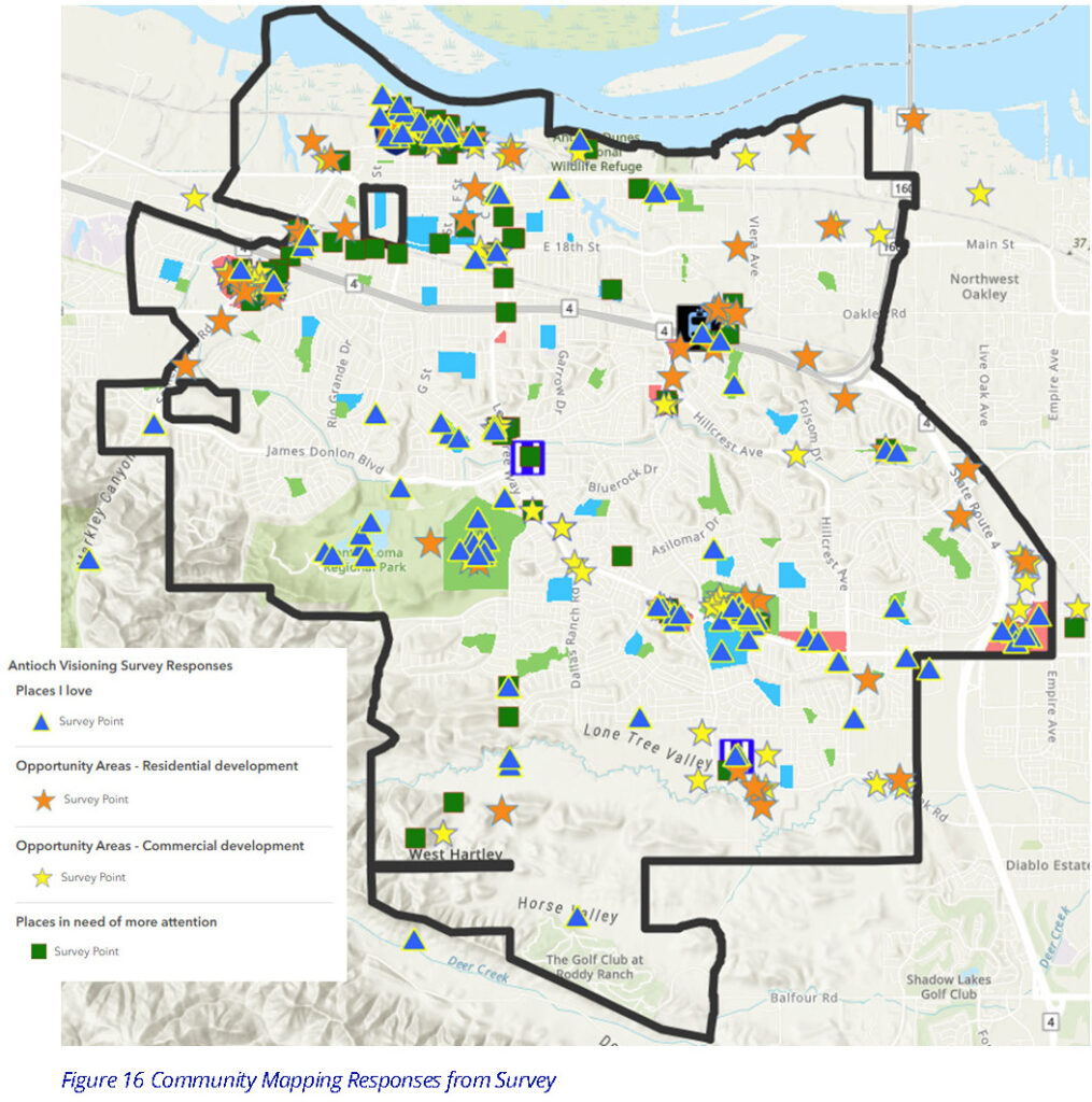
According to the staff report, the update process is currently in Phase One, Visioning. Across all Phase One activities, the City received 100 online survey responses, hosted two community workshops attended by approximately 80 participants, and held ten pop-up events.
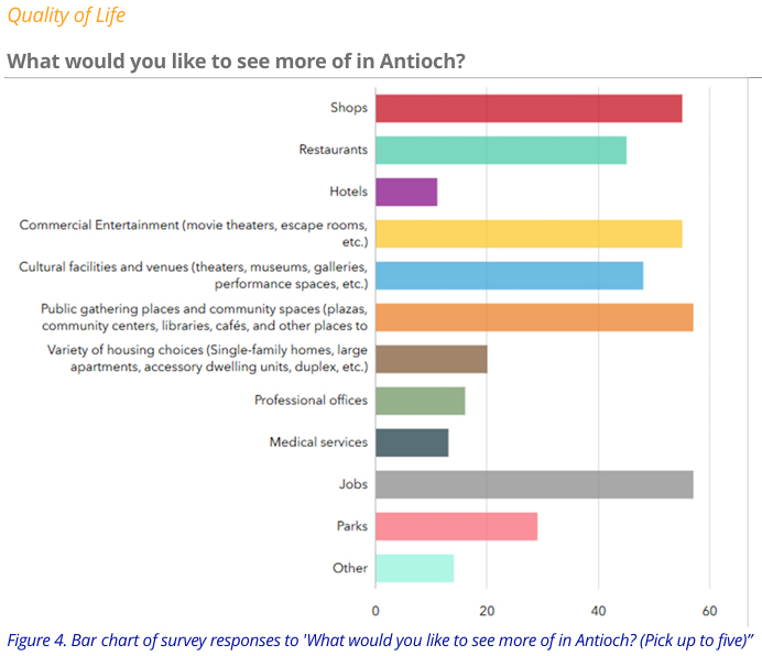
In the findings, under Quality of Life Issues in response to the question, “What would you like to see more of in Antioch?” the top responses in order are Jobs, Public gathering places and community spaces and Restaurants.
Source: City of Antioch
Under item 5.2, the committee members will be provided with a Land Use Introduction by Thompson and Laws. As part of the General Plan Update process, the City will revise the General Plan Land Use Map.
The meeting will be held in the Antioch City Council Chambers at City Hall located at 200 H Street in historic, downtown Rivertown.
The agenda and meeting materials can be found here.
Source: City of Antioch
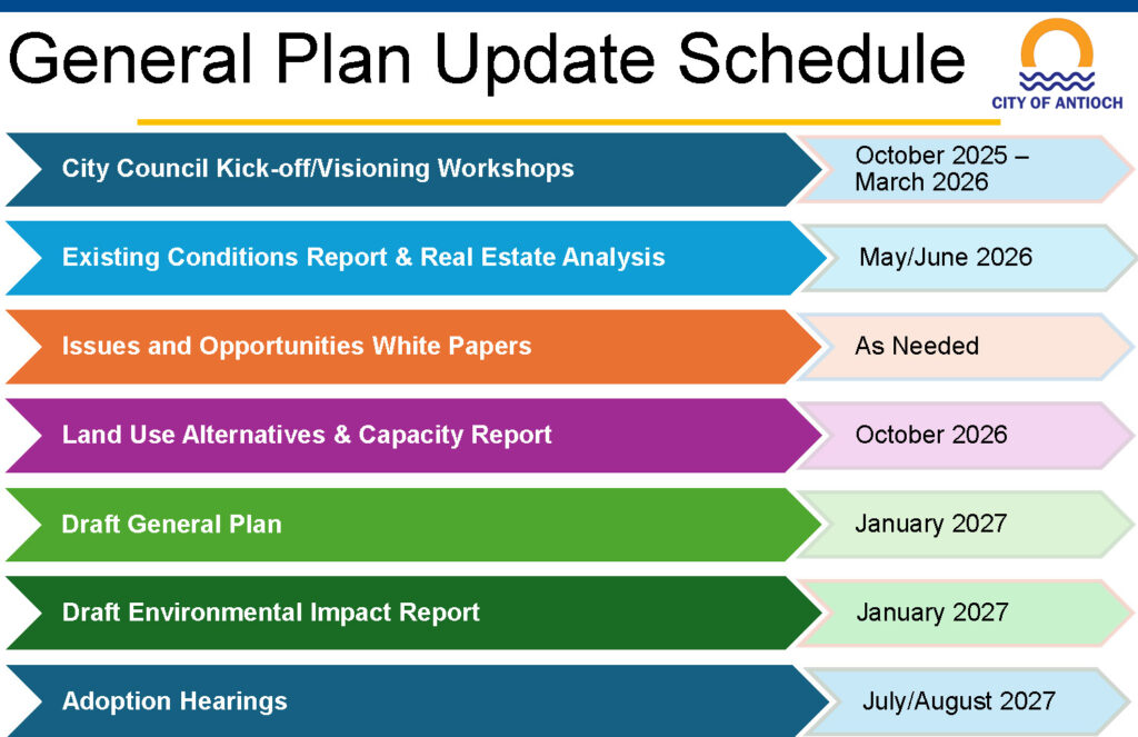
The updated General Plan is expected to be adopted by the city council in August 2027. To stay up to date on the General Plan Update process you can visit the project website at: https://antioch.generalplan.org/
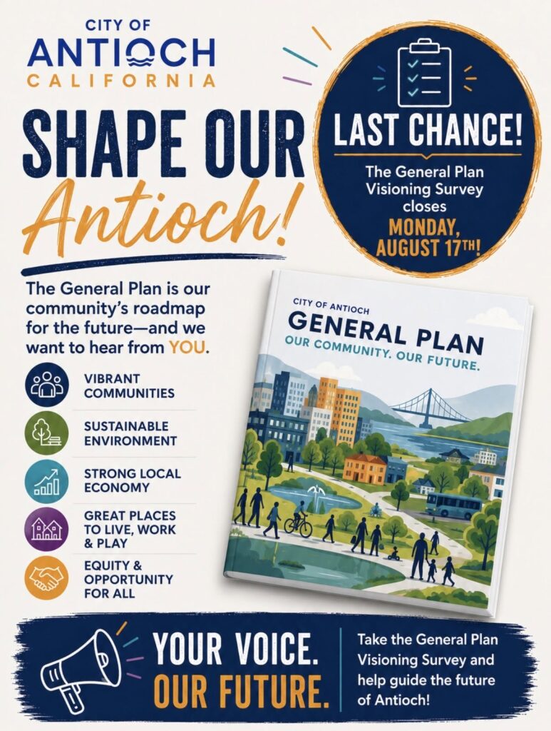
City of Antioch’s General Plan Visioning Survey closes Monday, August 17
By City of Antioch
The City’s General Plan will help guide decisions about Antioch’s future, including how our community grows, develops, and evolves in the years ahead.
The City of Antioch is updating its General Plan, which provides goals, policies, and guidelines for the physical development of the City for the next ten to twenty years. The General Plan is intended to reflect the goals, values, and priorities of the Antioch community. The following questions will help the City gain a broad perspective of views and values in the community to help craft a General Plan that is reflective of local concerns and priorities. Your opinion and input are greatly appreciated. Please complete one survey per person.
This survey is available in English and Spanish. Please use the language selector at the top left of the survey to choose your preferred language.
Esta encuesta está disponible en inglés y español. Utilice el selector de idioma en la parte superior izquierda de la encuesta para elegir su idioma preferido.
Your input matters. If you haven’t taken the survey yet, now is the time to make your voice heard.
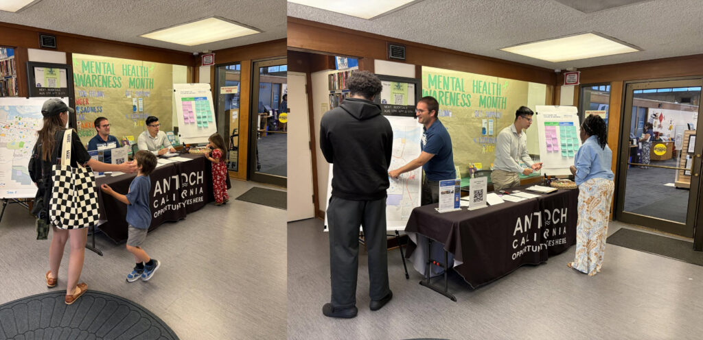
We were at the Antioch Library today, Wednesday, July 29, 2026, for a General Plan Visioning Workshop, as part of the General Plan Update process, connecting with residents to hear what they love about Antioch and what they’d like to see in the years ahead.
Thank you to everyone who stopped by to share ideas, ask questions, and help shape the vision for our community’s future.
Missed us today? There’s still another opportunity!
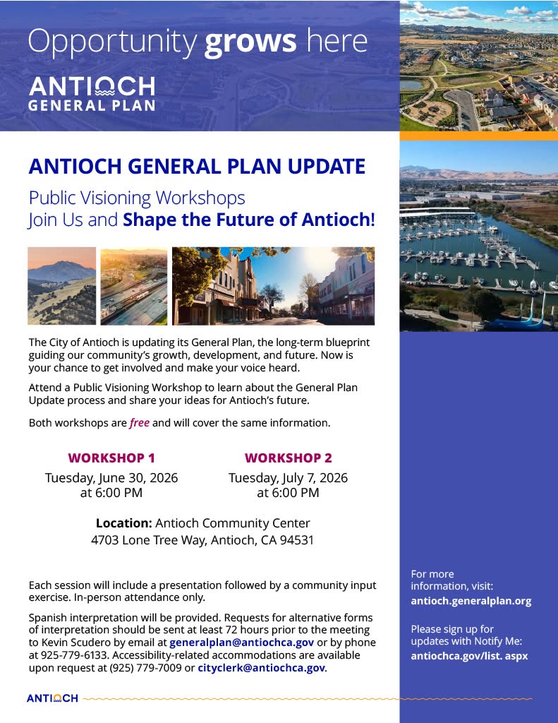
ANTIOCH, CA — The City of Antioch is launching an update to its General Plan, the long-term policy document that guides the community’s growth and development, addressing physical, economic, social, and environmental changes for years to come. As part of this effort, the City is hosting two Public Visioning Workshops this summer and is encouraging all residents to attend and share their vision for Antioch’s future.
The workshops will be held on Tuesday, June 30, 2026, and Tuesday, July 7, 2026, both beginning at 6:00 PM at the Antioch Community Center, located at 4703 Lone Tree Way, Antioch, CA 94531. Both events are in person, free and open to the public and will cover the same information.
Each workshop will begin with a presentation designed to educate participants on relevant topics related to the General Plan Update, followed by a structured exercise to gather community input. The City will convene a total of four community workshops throughout the Update process, and this summer’s Visioning Workshops are the first opportunity for residents to get involved.
“Our General Plan is more than a policy document. It’s a blueprint of who we are, and as importantly, want to become as a community. These workshops are an open invitation to every resident to help shape that future. I encourage all of Antioch to come, participate, and make sure your voice is part of the vision we build together,” said Mayor Ron Bernal.
Community input gathered at these workshops will directly inform the development of the General Plan Update, ensuring the final document reflects the needs, values, and priorities of Antioch residents.
“The strength of this plan depends on hearing from as many residents as possible. Whether you’ve lived in Antioch your whole life or just moved here, your perspective matters. I hope our neighbors will take this first opportunity to get involved and help guide decisions that will affect our community for years to come,” said Economic and Community Development Interim Director Kevin Scudero.
For more information about the General Plan Update and to sign up for project notifications, visit https://antioch.generalplan.org/.
Spanish interpretation will be provided. Requests for alternative forms of interpretation should be sent at least 72 hours prior to the meeting to Kevin Scudero by email at generalplan@antiochca.gov or by phone at (925) 779-6133. Accessibility-related accommodations are available upon request at (925) 779-7009 or cityclerk@antiochca.gov.
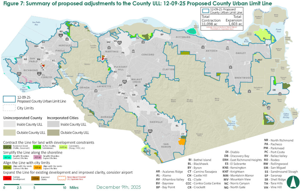
The Proposed 2026 County ULL renewal map shows areas of contractions and expansions. Source: Contra Costa County
Would allow for expansion near Byron Airport, contractions elsewhereincluding next to Antioch
Will not affect Antioch’s ULL
By Allen D. Payton
On Tuesday’s Primary Election ballot in Contra Costa County is Measure A, the 2026 Voter-Approved Contra Costa County Urban Limit Line also referred to as the Urban Limit Line and Land Preservation Plan Amendment Measure. Voters are asked whether or not to extend the County’s current Urban Limit Line (ULL) for 25 more years, as well as expand and contract it, placing a net of almost 9,500 more acres outside the line.
The ballot language reads, “Shall the measure amending the Contra Costa County General Plan and the County’s 65/35 Land Preservation Plan Ordinance to continue protections to the County’s non-urban, agricultural, and open space areas by extending the term of the County’s Urban Limit Line through December 31, 2051; adopting an updated Urban Limit Line map; requiring voter approval, except under limited circumstances, to expand the Urban Limit Line by more than 30 acres; and retaining the 65/35 Land Preservation Standard, be adopted?”
The county’s first ULL was voter-approved in 1990 and was renewed in 2006 which lasted 20 years.
Each of the 19 cities have their own voter-approved ULL, which supersede the County’s ULL, in order to receive local street maintenance funds from Measure J, the county’s half-cent sales tax for transportation. The City of Antioch did that when voters there established their own line and moved the County’s line back out in 2004, after the Board of Supervisors moved it in and cut off the land previously planned for the Roddy Ranch golf course and housing development. That land was later sold to the East Bay Regional Park District and is planned for a park.
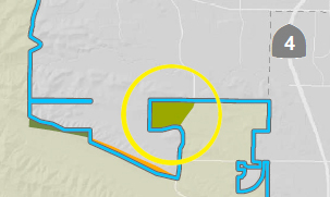
The Ginochio West property (inside yellow circle) adjacent to Antioch’s city limits (inside the blue line) would be moved outside the County’s ULL if Measure A passes. Graphic source: Contra Costa County
So, Measure A will not affect each city’s ULL, only land in the unincorporated portions of the county. But it will move outside the County’s ULL a section of land, currently outside the Antioch city limits bordered by Deer Valley and Empire Mine Roads, where long-time Antioch residents might remember the “party barn” was located, on property now known as Ginochio West in planning documents. It would be constrained to public or easement use.
Will Extend County ULL by 25 Years, Allow Expansion Near Byron Airport, Contractions Elsewhere
According to the County Counsel’s Impartial Analysis of the measure,“In 2004, voters approved Measure J-2004, which extended a local transportation sales tax (Measure C-1988) by 25 years and allowed the County to receive a share of those sale tax proceeds provided the County had a voter-approved ULL.
“In 2006, voters approved Measure L-2006, which extended the term of the ULL to December 31, 2026. In order (for the County) to continue to be eligible to receive transportation sales tax proceeds after 2026, the ULL must be extended beyond 2026. This measure would extend the County’s ULL for 25 years, through December 31, 2051.
In addition, “the measure would amend the County’s 2045 General Plan and the 65/35 Ordinance to accomplish the following: (1) extend the term of the 65/35 Ordinance from December 31, 2026, through December 31, 2051; (2) require four-fifths vote of the County Board of Supervisors and voter approval to expand the ULL by more than 30 acres (except under limited circumstances); (3) provide for periodic reviews of the ULL by the Board of Supervisors and a required review involving an evaluation of housing and job needs; (4) update and expand the criteria for moving land outside the ULL; (5) incorporate a revised ULL map that among other things delineates an area of future potential expansion near the Byron Airport; and (6) retain the 65/35 land preservation standard and protections for the County’s prime agricultural land. This measure will become effective immediately if approved by a majority of the voters voting on the measure.”
The proposed County ULL would include contractions totaling 11,098 acres and expansion of 1,603 acres for net 9,495 more acres placed outside the Urban Limit Line. (See map). However, the acreage does not include the Byron Airport Potential ULL Expansion Area.
Yes on A Campaign’s Main Argument
The main argument of the Yes on Measure A campaign, paid for by Save Mount Diablo and supported by nine other organizations, is “The Urban Limit Line helps prevent traffic from getting worse. The more people have to drive, and the more cars on the road, the worse traffic gets. This election, say YES to protecting our open space and agriculture, safety from wildfire, limiting traffic, and encouraging housing where it makes sense.”
No on A Campaign’s Main Argument
The main argument of the No on Measure A campaign, paid for by the Contra Costa Taxpayers Association is that “Measure A removes an additional 9,460 acres — equivalent to 14.78 square miles — from any possible urban housing use through 2051. That is larger than 10 of the 19 cities in Contra Costa County. Calling this a routine renewal misleads voters about what is actually on the ballot.”
The campaign also claims, “When Contra Costa restricts its land supply, families don’t disappear. They move — and commute back.”
Analysis: Growth is inevitable and acts much like a balloon, when it is restricted in one area, growth expands elsewhere. Such as in the Central Valley which feeds not only our state, but nation and world, and where land is cheaper and unfortunately, farmers can make more money selling to developers than farming. The result is commuters driving further to work and blowing more polluting smoke out of their tailpipes, defeating the goals of the environmentalists.
At the same time, there’s plenty of room inside the current ULL’s of the cities for more housing growth to occur, especially in East County. Plus, the measure includes a potential expansion near the Byron Airport where commercial and/or mixed-used development could occur, as the long-planned, four-lane Route 239 between Brentwood and Tracy are built, the runway is potentially extended, a fixed base operation and fuel farm are built there, and a possible transit stop located there, as well.
Rendering of the approved Wildflower Senior Apartments. Source: City of Antioch
No council approval required, no parking required but 136 spaces included; had to approve “Soviet-style” design due to state law-required waivers, concessions
Units will be offered at 30%, 50% and 60% of Area Median Income
By Allen D. Payton
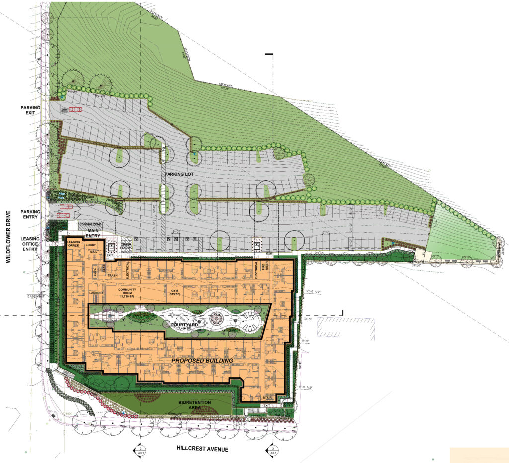
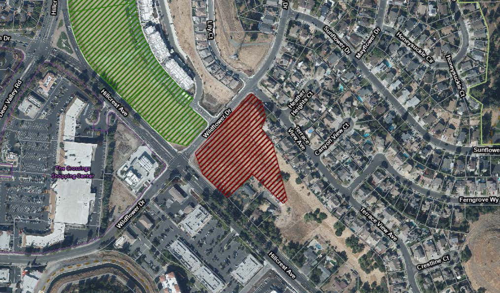
During their meeting on April 1, 2026, the Antioch Planning Commission, on a vote of 6-0, with Vice Chair Cortney Jones absent, approved the 183-unit affordable Wildflower Senior Apartments. Planned for the southeast corner of Wildflower Drive and Hillcrest Avenue, the complex will consist of 113 one-bedroom units of 559 square feet and 70 two-bedroom units of 771 square feet. It will include a parking lot, walkways and dog park on a vacant 3.77-acre parcel.
The Planning Commissioners who voted in favor of the project are Chair Seth Webber and Commissioners Don Aguilar, Jennifer Perez, Kevin Riley, William Spijker and Ramesh Suman.
Wildflower Senior Apartments Site Plan. Source: City of Antioch
The developer, Cypress Equity Investments of Brentwood in Los Angeles, according to the City staff report for the agenda item, number 7-1, the senior citizen housing project will be built on four levels. It will provide 145 residential units at 60 percent of the Area Median Income (AMI), 19 at 50 percent of the AMI, and 19 at 30 percent of the AMI. Therefore, the proposed project would be eligible for a density bonus under the State Density Bonus Law of up to 80 percent. The applicant is utilizing the bonus to increase the density from 35 dwelling units per acre to 48.54 dwelling units per acre.
Qualifies for State Density Bonus, Transit Proximity Height Increase
The proposed project “designates 100 percent of base units (132 units total) as affordable to low-income households to obtain a density bonus of 51 additional units as well as waivers from certain development standards, in accordance with State Density Bonus Law.”
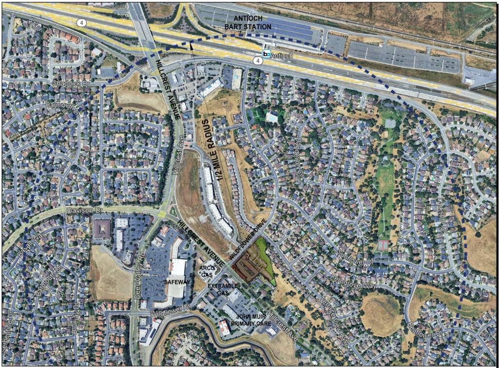
Plus, since the project is located within a half-mile of a major transit stop, specifically, the Antioch BART Station, the applicant received a height increase of up to three additional stories, or 33 feet.
Wildflower Senior Apartments Aerial Map. Source: City of Antioch
City Required to Agree to Developer’s Waiver, Concession Requests
According to City staff, the Commission had to agree to other concessions requested by the developer. “As detailed in the State Density Bonus Law portion of the staff report, the applicant is allowed waivers and concessions for the project’s architecture.” The developer requested 12 waivers and five concessions. That included more simple elevations than are required in the citywide Multi-Family Residential Objective Design Standards.
The staff report continues, “The proposed architecture of the building is contemporary. The project uses earth-tone colors: crystal white, titanium gray and muted orange. The color combination provides soft variation and transition along the building facade. The project proposes a varied parapet topped by cornices, large windows, and detailed landscaping. The project design complies with the applicable Multi-family Residential Objective Design Standards.”
However, the developer claimed, “Inclusion of the decorative elements would require added carpentry and labor, may trigger custom fabrication or waterproofing details. Strict compliance with this standard would require additional architectural detail for the density bonus project, rendering the development financially infeasible.”
That’s why it will look like a housing project straight out of the former Soviet Union. (This reporter’s opinion.)
Finally, because the project complies with existing zoning, approval by the City Council is not required, as is the case for all multi-family projects in Antioch.
Amenities
The project does include some amenities for the residents. “The central courtyard is comprised of seating areas with tables, fire pits, BBQ facilities, succulent gardens, and pedestrian pathways to seamlessly connect the complex and provide the amenities required in the Multi-Family Objective Design Standards for common open space areas. The enclosed dog park includes a water fountain, hose, benches and waste station.”
Wildflower Senior Apartments Location Map. Source: City of Antioch
No Parking Required But 136 Spaces Included
Also, according to the staff report, “Because the proposed development is a 100 percent affordable multifamily senior housing project, within half a mile of a major transit stop, there is no parking requirement. However, the applicant is proposing to provide 136 parking spaces, which equates to about .74 stalls per unit. Senior Housing projects generally have less parking due to utilizing public transit and services such as paratransit.”
Affordable Housing Agreement with City
The project will include an Affordable Housing Agreement with the City. According to the City staff report, “the applicant shall enter into an agreement with the City to ensure the continued affordability of all affordable units. Prior to receiving a building permit, such agreement shall be recorded as a covenant against the property.”