Archive for the ‘Transportation’ Category

This week’s Highway 4 corridor projects, lane closures and detours – Feb 14-20

Saturday, February 14th, 2015

FULL FREEWAY CLOSURES:

There are no full freeway closures planned for this week.

HIGHWAY LANE CLOSURES:

State Route 4 (SR4):

There will be highway lane closures in the westbound direction of SR4 between California Avenue/Harbor Street and Bailey Road on Tuesday, Wednesday and Thursday between 11:00 am and 7:00 pm.

There will be highway lane closures in the eastbound direction of SR4 between Hillcrest Avenue and the SR4/SR160 connector ramp on Friday evening from 11:59 pm to 6:00 am.

There will be highway lane closures in the westbound direction of SR4 between Hillcrest Avenue and the SR4/SR160 connector ramp on Friday evening from 11:00 pm to 6:00 am.

State Route 160 (SR160):

There are no highway lane closures of SR160 planned for this week.

RAMP CLOSURES:

State Route 4 (SR4):

The SR4 westbound off ramp at Hillcrest Avenue will be closed on Friday evening from 11:59 pm to 4:00 am.

State Route 160 (SR160):

There are no ramp closures of SR160 planned for this week.

LOCAL STREET CLOSURES:

Contra Loma Boulevard will be closed in all directions between the SR4 on and off ramps on Thursday and Friday evenings from 11:59 pm to 5:00 am.

There will be single lane closures in the northbound and southbound directions of Contra Loma/L Street between Claudia Court and Fitzuren/Buchanan Road on Thursday and Friday evenings from 7:00 pm to 6:00 am.

There will be single lane closures on Lone Tree Way in both directions between Canada Valley Road and Jeffery Way Tuesday through Friday from 9:00 am to 3:00 pm.

Please see the detour maps by clicking here. Hwy 4 Lane Closures Week of 2-14-15

For questions or comments please send e-mail to info@4eastcounty.org.

Highway 4 corridor construction projects lane closure and traffic information – Week of February 7 – 13, 2015

Monday, February 9th, 2015

FULL FREEWAY CLOSURES:

There are no full freeway closures planned for this week.

HIGHWAY LANE CLOSURES:

State Route 4 (SR4):

There will be highway lane closures in the westbound direction of SR4 between California Avenue / Harbor Street and Bailey Road on Tuesday, Wednesday and Thursday between 11:00 am and 5:00 pm.

State Route 160 (SR160):

There are no highway lane closures of SR160 planned for this week.

RAMP CLOSURES:

There are no ramp closures planned for this week.

LOCAL STREET CLOSURES:

There will be single lane closures on Lone Tree Way/A Street in both directions between the SR4 on and off ramps Monday through Friday from 9:00 am to 3:00 pm. See the Detour Route Map on Page 2 of this week’s report, by clicking here LC WEEK OF 2 7 15.

Cavallo Road will be closed in all directions between Sunset Drive and East Tregallas Road underneath the State Route 4 overpass on Saturday between 7:00 am and 3:30 pm.

There will be single lane closures on Lone Tree Way in both directions between Canada Valley Road and Jeffery Way Monday through Friday from 9:00 am to 3:00 pm.

For questions or comments please send e-mail to info@4eastcounty.org.

Highway 160 northbound closure Thursday night, A Street underpass closed evenings and early mornings

Thursday, February 5th, 2015

FULL FREEWAY CLOSURES:

There are no full freeway closures planned for this week.

HIGHWAY LANE CLOSURES:

State Route 160 (SR160):

As part of the Highway 4 (State Route 4) and Highway 160 connector ramp construction, there will be highway lane closures in the northbound direction of State Route 160 between the SR4/SR160 connector ramp and Main Street on Thursday, February 5, from 7:00 am to 3:00 pm.

State Route 4 (SR4):

There will be highway lane closures in the eastbound direction of SR4 between Bailey Road and Loveridge Road on Wednesday and Thursday evenings starting at 7:00 pm and ending at 1:00 pm on the following day.

There will be highway lane closures in the westbound direction of SR4 between California Avenue/Harbor Street and Bailey Road on Wednesday and Thursday starting at 10:00 am and ending at 5:00 am on the following day.

There will be highway lane closures in the westbound direction of SR4 between Contra Loma Boulevard and California Avenue/Harbor Street on Wednesday and Thursday evenings between 6:00 pm and 5:00 am.

RAMP CLOSURES:

There are no ramp closures planned for this week.

LOCAL STREET CLOSURES:

There will be single lane closures in the southbound direction of Contra Loma Boulevard between Buchannan Road and St. Francis Drive Monday through Friday from 9:00 am to 3:00 pm.

Lone Tree Way/A Street will be closed between the SR4 on and off ramps on Saturday evening from 10:00 pm to 5:00 am and again on Monday through Friday evenings from 10:00 pm to 5:00 am.

There will be single lane closures on Lone Tree Way/A Street in both directions between the SR4 on and off ramps Monday through Friday from 9:00 am to 3:00 pm.

There will be single lane closures on Lone Tree Way in both directions between Canada Valley Road and Jeffery Way Monday through Friday from 9:00 am to 3:00 pm.

To see the detour map for the A Street closure, click here: Highway & Street Closures 1/31-2/6/15.

For questions or comments please send e-mail to info@4eastcounty.org.

Current Highway 4 lane, ramp and street closures

Friday, January 30th, 2015

HIGHWAY LANE CLOSURES:

There will be Highway lane closures in the eastbound direction of SR4 from Lone Tree Way to the SR4/SR160 connector ramp on Wednesday and Thursday evenings between 11:00 pm and 5:00 am and again on Friday evening between 11:59 pm and 6:00 am.

There will be Highway lane closures in the westbound direction of SR4 from the SR4/SR160 connector ramp to Lone Tree Way on Friday evening between 11:00 pm and 6:00 am.

RAMP CLOSURES:

The SR4 westbound off ramp at Hillcrest Avenue will be closed Friday evening from 11:59 pm to 5:00 am.

LOCAL STREET CLOSURES:

Lone Tree Way/A Street will be closed between the SR4 on and off ramps on Saturday evening from 10:00 pm to 5:00 am and again on Monday through Friday evenings from 10:00 pm to 5:00 am.

Please note: Lone Tree Way/A Street will be open to the Hillcrest Avenue westbound off ramp detour traffic on Thursday and Friday evenings.

There will be single lane closures on Lone Tree Way/A Street in both directions between the SR4 on and off ramps on Friday from 9:00 am to 3:00 pm.

There will be single lane closures on Lone Tree Way in both directions between Canada Valley Road and Jeffery Way Monday through Friday from 9:00 am to 3:00 pm.

See detour maps by clicking here: Highway 4 closures.

For questions or comments please send e-mail to info@4eastcounty.org.

New website lets residents monitor Bay Area’s Vital Signs

Thursday, January 29th, 2015

Data Shed Light on Health, History of Region’s Transportation Network

OAKLAND, Calif., Jan. 28, 2015…The Metropolitan Transportation Commission (MTC) today unveiled its innovative Vital Signs website (vitalsigns.mtc.ca.gov), an interactive tool that Bay Area residents can use to track the region’s progress toward reaching key transportation, land use, environmental and economic policy goals. Residents also can consult the new website to learn more about historical trends, differences and similarities among the Bay Area’s many communities, and how the nine-county region stacks up with other major U.S. metro areas.

The first phase of the Vital Signs initiative examines 14 different indicators by which the health of the Bay Area’s transportation systems can be monitored. These include several measures of Bay Area transit agencies’ performance; a detailed look at pavement conditions on state highways, city streets and county roads; and a rank-ordered list of the 139 most congested freeway segments in the region. Phase II of the Vital Signs project, slated for completion this spring, involves land use and economic development measures. Data for Phase III, which will focus on environmental and safety questions, is due for release this summer.

Vital Signs is a wonderfully descriptive and appropriate name for this effort,” said MTC Chair and Orinda City Councilmember Amy Rein Worth. “In the same way that temperature, pulse and blood pressure can reveal a lot about a person’s overall health, measures such as transit cost-effectiveness, freeway delay, housing construction or neighborhood poverty rates can be used to gauge our region’s overall well-being.”

Dave Vautin, MTC’s Vital Signs project manager, says the website was designed to provide both access to data and a unique online experience. “This information is not just useful to researchers but genuinely interesting to the public at large. We’ve worked hard to develop customizable charts and maps, combined with high-quality graphics, that will allow all Bay Area residents to better understand what’s happening in their county, city and neighborhood.“

Among the key findings in the first set of Vital Signs data is that Bay Area commuters are committed to their choice of transportation. Solo drivers account for two-thirds of all commuters in the region, a statistic that has remained constant for decades. Still, among the nation’s 10 largest metro areas, the Bay Area has the third-lowest number of commuters who drive to work alone, trailing only New York and Washington, D.C. The percentage of Bay Area commuters who ride transit similarly has held steady at about 10 percent since the 1980s. The most significant shift in recent decades is the increasing number of residents who choose to bike to work or to telecommute. These gains have come at the expense of carpooling, which has declined in popularity over time. San Francisco leads all Bay Area cities with 32.6 percent of residents commuting to work by transit. Other cities in which the share of residents commuting via transit tops 20 percent include Albany, Colma, El Cerrito, Berkeley and Daly City.

While the Bay Area remains one of the nation’s most transit-oriented metro areas, and overall ridership in the region has grown in recent years, it is still well short of the modern-era peak achieved in 2001. Total transit ridership dipped 3 percent from 2002 to 2012 (the latest year for which National Transit Database information was available for Phase 1 of the Vital Signs project) and per-capita ridership declined 10 percent over this time. New York, Chicago, Philadelphia and Miami all experienced notable growth in both overall and per-capita transit ridership from 2002 to 2012. The only major metro areas with greater declines in ridership than the Bay Area are Houston, Dallas-Fort Worth and Atlanta. Indeed, considering the growth of the Bay Area population, the region has for two decades become less dependent on public transit, with the average resident boarding a bus, train, ferry, light-rail vehicle or cable car 79 times in 1991, compared to just such 68 trips in 2012.

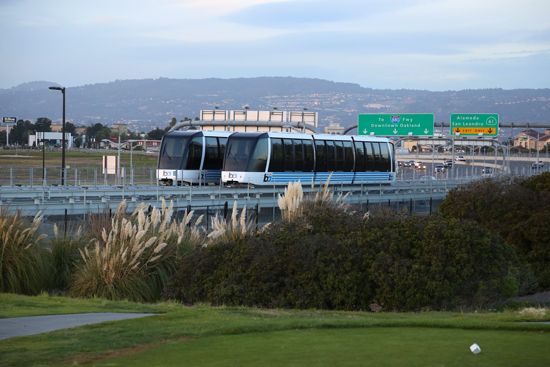
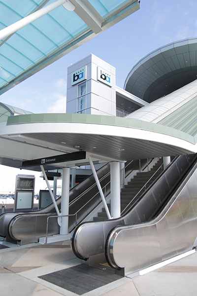
Several major Bay Area transit operators carried fewer riders on a typical weekday in 2012 than they did in 1991, with declines ranging from 7 percent for San Francisco Muni to 30 percent for SamTrans. Ridership slipped 13 percent at the Santa Clara Valley Transportation Authority (VTA) and 17 percent at AC Transit. In contrast, BART and Caltrain ridership has climbed to record highs, with Caltrain carrying over 140 percent more riders each weekday than it did in 1991 and BART’s weekday ridership rising nearly 50 percent over this period.

The complete list of transportation performance measures now available on the Vital Signs website includes:

  • Commute Mode Choice (by residential and employment location)

  • Commute Time (by residential and employment location)

  • Commute Patterns

  • Traffic Volumes at Regional Gateways

  • Time Spent in Congestion

  • Miles Traveled in Congestion

  • Travel Time Reliability

  • Transit Ridership

  • Transit System Efficiency

  • Daily Miles Traveled

  • Street Pavement Condition

  • Highway Pavement Condition

  • Bridge Condition

  • Transit Asset Condition

MTC is the transportation planning, financing and coordinating agency for the nine-county San Francisco Bay Area.

NOTE: The Vital Signs initiative is further illuminated by several short videos posted on MTC’s website at: http://mtc.ca.gov/news/press_releases/vitalsigns_launch.htm.

Transportation Commission seeks to fill vacancies on Advisory Council, one from Contra Costa, one at-large

Monday, January 26th, 2015

OAKLAND, Calif., – The Metropolitan Transportation Commission – the Bay Area’s transportation planning, financing and coordinating agency – is recruiting interested Bay Area residents to fill three vacancies on its Policy Advisory Council. In Contra Costa County, there is an opening for an individual representing disabled interests. In Santa Clara County, the vacancy is for an individual to represent either the economy or the environment. And the third vacancy is an at-large seat, to be filled by an individual representing either the economy or the environment from any of the nine Bay Area counties. The Council meets the second Wednesday of the month from 1:30-3:30 p.m. in Oakland, and advisors are reimbursed for their transportation to and from the meeting.

Created by the Commission in November 2009 to advise MTC on transportation policies in the San Francisco Bay Area, the Policy Advisory Council incorporates diverse perspectives relating to the environment, the economy and social equity. The Council advises MTC on a range of dynamic topics, including:

  • Regional planning efforts linking transportation, housing and land-use plans to reduce greenhouse gas emissions.

  • Public transit service productivity improvements to produce more efficiency from the region’s existing transit investments.

  • Pursuit of new revenues to support a transportation system that better serves all Bay Area residents.

    The Commission wants and needs to hear various viewpoints when making transportation policy and investment decisions,” said MTC Chair Amy Rein Worth. “Incorporating different perspectives enhances our decision-making process. The Policy Advisory Council helps the Commission to improve mobility for all Bay Area residents.”

Applications for the three vacancies will be accepted through February 9, 2015. No specific educational background is needed for most seats – just a background in the specific application category, and an interest in transportation and how it affects residents in the nine Bay Area counties. Experience working on public policy issues or community-related issues is desirable. Appointed advisors are expected to attend monthly meetings at MTC’s offices in Oakland and will serve through the term ending in July 2017. While positions are voluntary, advisors do receive a small stipend for their attendance at certain meetings.

MTC’s appointing Commissioners will review the applications, and the full Commission is scheduled to approve the selections in March. The selected applicants will attend their first meeting on April 8, 2015. To apply for a vacant position or to learn more about the Policy Advisory Council, visit www.mtc.ca.gov/get_involved/advisory or call (510) 817-5757.

Highway 4 closures for construction work, this week

Monday, November 10th, 2014

The Contra Costa Transportation Authority (CCTA) is constructing the State Route 4 (SR4) Sand Creek Road Interchange and 4-Lane Widening through Antioch and Brentwood. As part of the SR4 Widening, the contractor will be performing the following work activities on the following dates:

 The westbound SR4 on- and off-ramps at Sand Creek Road will be closed from 10:00 PM to 4:00 AM starting on Wednesday, November 12th and ending on Friday, November 14th. (See detour map by clicking here: CCTA TRAFFIC ADVISORY 2014-11-06)

Reversing traffic control will be in place on SR4 between Balfour Road and Sand Creek Road during the same time. Work will consist of paving operations.

Motorists are advised to use the provided detour or alternate routes and should allow extra time for their commute. For the detour map, please see attachment. The ramps will be closed concurrently.

This work is weather dependent. If it is delayed due to weather conditions, it will be rescheduled for a later time.

Please drive with caution through the work area and leave a safe traveling distance between your vehicle and the vehicle ahead of you. CCTA appreciates your patience as we work to improve mobility in East Contra Costa County. For the most current information please contact the project hotline number at 925-206-3002 or go to www.4eastcounty.org.

BART’s Oakland Airport connector to open November 22 in time for Thanksgiving travel

Monday, November 10th, 2014

BARTOAKtrainsIt’s fast, it’s frequent, it’s convenient, and it’s about to open.  BART’s new train to plane service, “BART to OAK,” which provides an easy connection to Oakland International Airport, will open in time for Thanksgiving travel on Saturday, November 22, 2014.

BART_OAK_promoTo mark this exciting moment in BART’s history, a public celebration will be held on Friday, November 21, to give the community a chance to check out the new stations, the beautiful art work, and to take a free ride before it opens.

The project broke ground in 2010 and construction cost $484 million for the 3.2 mile, automated guideway, or $151.25 million per mile. It was designed and built by the project team of Flatiron, Parsons and Doppelmayer (for more information, click here) which has already won awards for the systems’ innovative engineering and forward use of technology.

The new connector will replace the AirBART buses and is expected to reduce vehicle traffic on the freeways, as it will be easier for travelers to take BART directly to the airport. Ridership is estimated to be between 4,780 to 5,730 riders per day in the first year, doubling the current the number of estimated AirBART riders, and as much as 10,300 to 14,070 riders per day by 2030, according to a 2009 report by Wilbur Smith Associates, which can be viewed here.

Clean, Easy, and Quick Service 

BART to OAK - Oakland International Airport (OAK) Station.

BART to OAK – Oakland International Airport (OAK) Station.

Starting on Saturday, November 22, 2014, riders will be able to board one of four three-car automated people movers at either the Coliseum Station or the Oakland International Airport Station and take the eight-minute ride at 30 mph.  

The ride and the experience alone are memorable,” said BART General Manager Grace Crunican. “Riders get a 360 degree view from the windows surrounding the entire car as you travel over the traffic below.  It’s a cable propelled system with light-weight and quiet trains, so it’s like gliding through the air.”

Trains arrive every 5 minutes during peak commute hours (weekdays 8am-8pm) and drop off and pick up riders just steps away from both terminals at OAK.  BART riders have a quick and easy train to train transfer at the Coliseum station.  Riders can use a BART ticket or a Clipper Card. The complete schedule can be found below.

Sample one-way adult fares between the new Oakland International Airport Station and various stations throughout the system include: from Downtown Oakland stations: $7.85; from Downtown San Francisco stations: $10.05; from Downtown Berkeley station $8.50; from Walnut Creek station $9.70; from Fremont $9.85; from Dublin Pleasanton station: $9.80.  Fare listings can be found here: http://www.bart.gov/tickets/calculator

As of Saturday, November 22nd, AirBART buses will no longer be in operation.

Get a Sneak Peek, Join the Celebration

A public celebration will take place on Friday, November 21st at the Coliseum Station from 11am-3pm. The festivities include commemoratives and local music.  All costs of the celebration have been paid through the generous donations of various sponsors. More details can be found at www.bart.gov/grandopening.

Learn more about the newly installed, original art at the Coliseum Station side of the station here, and the Oakland International Airport Station here.  Follow the excitement of the grand opening on our Storify page.