Participate in 90th Anniversary “Explore Your Parks” Adventure Series
By Dave Mason, Public Information Supervisor, East Bay Regional Park District
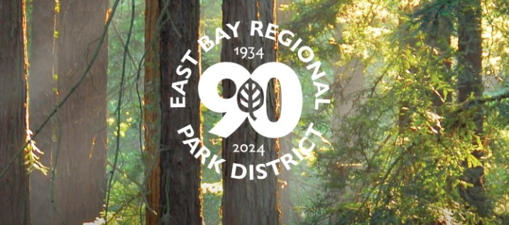
Welcome to the East Bay Regional Park District’s 90th Anniversary year. After 90 years, the Park District has grown to be the largest regional park district of its kind in the nation, with 73 regional parks available for hiking, biking, swimming, horseback riding, boating, fishing, picnicking, camping, and nature discovery. The Park District manages over 125,000 acres of parklands, 55 miles of shoreline, and more than 1,300 miles of trails in Alameda and Contra Costa counties. Wherever you live in the East Bay, there is a beautiful regional park close to you.
To celebrate 90 years of land preservation, environmental conservation, and recreation, the District is planning a series of events and programs throughout the year, including a community birthday celebration on May 11 and monthly naturalist led “Explore Your Parks” adventure programs, among others. Additional events and programs will be announced throughout the year.
“Join us in celebrating the Park District’s 90 years of milestones and history of environmental conservation and positive experiences in nature,” said Park District General Manager Sabrina Landreth. “We invite the public to enjoy their regional parks and shorelines and celebrate with us throughout the year at events and programs commemorating our 90 years of service to the community.”
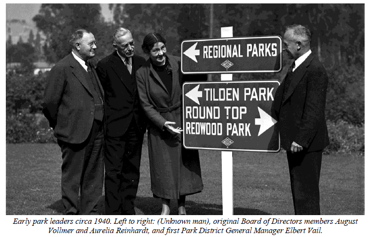
The East Bay Regional Park District’s story began in the late 1920s when thousands of acres of watershed land in the East Bay Hills suddenly became available for development. Civic leaders came together with a vision: preserve the land forever, and balance environmental conservation with public enjoyment.
To aid the cause, they enlisted renowned landscape architect Frederick Law Olmsted, Jr. and National Park Service’s Chief Naturalist Ansel Hall to survey the watershed lands for potential park use. The resulting 1930 Olmsted-Hall report titled “Report on Proposed Park Reservations for East Bay Cities” brought national credibility to the effort and is largely considered the founding document of the East Bay Regional Park District.
Four years later, in the heart of the Great Depression, civic leaders placed a measure on the ballot to establish the Park District and tax themselves for land preservation. The measure passed on November 6, 1934, by a resounding 71 percent – even during trying times and economic instability. On June 4, 1936, the District purchased land from the East Bay Municipal Utility District to create its first three parks – Upper Wildcat Canyon (Tilden), Temescal, and Roundtop (Sibley).
For 90 years, the East Bay Regional Park District has preserved and protected open space and provided safe and welcoming parks for recreation and nature viewing.
90th Anniversary “Explore Your Parks” Adventure Series
Throughout 2024, Park District naturalists are hosting a series of programs and events to celebrate the District’s 90th Anniversary. Look for these events to discover new parks, activities and ways to celebrate 90 years of connecting parks and communities. Celebrate with us!
KING TIDE WALK
Hayward Regional Shoreline (West Winton Ave. Staging Area)
Jan 13 (Sat), noon-1:30 p.m.; Feb 10 (Sat), 11 a.m.-12:30 p.m.
What are king tides? How do they affect plants and animals, and what can we learn from them? Be prepared for muddy shoes! Drop-in program; no registration is required.
COMMUNITY SCIENCE BIO BLITZ
Sunol Wilderness Regional Preserve (Sunol)
Jan 27 (Sat), 10 a.m.-noon
Love nature and want to contribute to real scientific studies? Learn how apps like Seek, iNaturalist, and others are used to help scientists gather data, while enhancing your next hike! Drop-in program; no registration is required.
CELEBRATING BLACK HISTORY WALKS
Thurgood Marshall Regional Park (Concord)
Sundays in February, 10 a.m.-1 p.m.
In honor of Black History Month, tours will explore the southern end of the new Thurgood Marshall Regional Park – Home of the Port Chicago 50, where attendees can learn about the natural and human history of the land. Registration required. www.ebparks.org/calendar.
WINTER WALK
Carquinez Strait Regional Shoreline (Port Costa Staging Area)
Feb 23 (Fri), 9am-noon
Take in the spectacular views of Carquinez Strait and look for signs of spring’s approach along this rolling, paved trail. Heavy rain cancels. Drop-in program; no registration is required. The East Bay Regional Park District is the largest regional park system in the nation, comprising 73 parks, 55 miles of shoreline, and over 1,300 miles of trails for hiking, biking, horseback riding, and environmental education. The Park District receives more than 25 million visits annually throughout Alameda and Contra Costa counties in the San Francisco Bay Area
Get your free Guidebook and T-shirt at Black Diamond Mines Jan. 4 & 5
Every year more than 10,000 people participate in this FREE self-guided hiking and bicycling program to explore the East Bay regional parks and to keep fit outdoors. Trails Challenge is made possible with the generosity of the Regional Parks Foundation and Kaiser Permanente, who have sponsored Trails Challenge since 2005.
For the past 31 years, the Park District has promoted healthy recreation and time in nature through its annual Trails Challenge program. The free program connects people to nature through hiking and biking by providing 20 designated trails ranging from easy to challenging. The Trails Challenge is part of the global Healthy Parks Healthy People (HPHP) movement that underscores the connection between a healthy green environment and community health.
The 2024 Guidebook includes 20 detailed trail descriptions available for all levels of fitness, from easy to challenging. There are trails open to hikers, bicyclists, dogs, and equestrians, and Trails Challenge 2024 offers increased accessibility with trails that have been evaluated and identified as usable by persons with mobility limitations (see pages 7-13).
To complete the challenge, hike five of the 20 trails, or 26.2 miles of trails within East Bay Regional Park District. You can submit your log, online or by mail, by December 1, 2024, and receive a commemorative pin, while supplies last.
All 20 featured trails are available on the AllTrails app. First download the free app, sign up and log in. Then go to www.alltrails.com/lists/ebrpd-trails-challenge-2024-01c6fc8 and click on “Copy to my lists”, followed by “Continue in App”. The featured trails will show under ‘Lists’ in ‘Saved’. The app indicates where you are on the trail, enabling easy return to the trail if you stray from it. You can also record your hikes and share your photos and comments with other park users.
Black Diamond Mines
Make sure to stop by our Greathouse Visitor Center at Black Diamond Mines Regional Perserve on a Friday (10am-2pm) or a Saturday/Sunday (10am-4pm) to pick up your new trails challenge booklet and shirt! New year, new trails to try out! Happy hiking! Or
Images of previous park projects funded by the Statewide Park Development and Community Revitalization Grant Program. Top left: Old Depot Bike Park grand opening in Placerville, California. Top right: Xabatin Park grand opening in Lakeport, California. Bottom photos: Nogales Park grand opening in Walnut Park, California. Photos from California State Parks.
SACRAMENTO, Calif.— California State Parks announced Thursday, Dec. 28, 2023, $41.9 million in grant funding to support the diversity of California’s park needs. Under “Round Four” of the Statewide Park Development and Community Revitalization Grant Program, the state of California is delivering new park access to an additional eight communities across the state.
To date, the Statewide Park Development and Community Revitalization Grant Program has provided approximately $1.2 billion to California’s communities. Round Four received the highest amount requested in State Parks’ nearly 50-year history of grant administration.
“Having access to outdoor spaces is critical for all Californians and these projects will contribute to the quality of life for many people who seek local parks to improve their physical, mental and social well-being,” said California State Parks Director Armando Quintero. “State Parks is incredibly grateful to all the organizations who applied for grant funding this round.”
Reedley: City of Reedley,Camacho Park Project: $4,049,992 to construct a new walking path, group picnic area, restroom, signage, and public art. Renovate three existing baseball/softball fields, existing restroom/storage/concession stand, and landscaping and lighting throughout the park.
Kern County
Bakersfield: County of Kern,Potomac Park Neighborhood Project: $7,384,000 to construct a new soccer field with lighting, splash pad with shade, dog park, basketball court with lighting, three shade structures over existing picnic tables, walkways with lighting, parking lot with lighting, and restroom. Renovate the existing group picnic pavilion, basketball court with lighting, inclusive playground with lighting, and landscaping throughout the park.
Los Angeles County
Hawthorne:Los Angeles Neighborhood Land Trust, Zela Davis Park Renovation: $963,060 to construct a new playground with shade, basketball court, picnic area with shade, walking path and hardscape elements, exercise equipment, public art, restroom building, and landscaping and lighting throughout the park.
Los Angeles: Los Angeles Neighborhood Land Trust,Jefferson Park Project: $5,800,000 to create a new park which will include a new playground with shade, sand and water play area, picnic area with shade, exercise area, public art, skate spot, walking path, and lighting and landscaping throughout the park.
Paramount:City of Paramount, Paramount Park Community Center Expansion: $7,372,213 to construct a new expansion of an overused Center’s Senior Center and renovate existing building spaces to create dedicated senior activity spaces. The expansion and renovations would include fitness, music, craft, billiards, card, and conference rooms, two screened outdoor lounge areas, reconfiguration of the stage area to make it fully accessible and viewable from the auditorium/dining space, and installation of landscaping along the exterior of the center.
Sacramento County
Sacramento: Southgate R.P.D., Jack N. Sheldon Park & Florin Creek Trail: $8,500,000 to acquire approximately 8.77 acres and construct a new dog park with lighting, disc golf course, basketball court, exercise equipment stations, four pickleball courts with lighting, gazebo and BBQ area, practice wall, playground, soccer field with lighting, multiuse trails, informal trails, electric vehicle charging stations, ping-pong with shade cover, educational arboretum, pathways with lighting, two shade structures with picnic tables, public art, and lighting and landscaping throughout the park. Renovate six tennis courts with lighting, a multiuse trail, playground, soccer field and parking with lighting.
San Joaquin County
Stockton: City of Stockton,Van Buskirk Park Renovation: $7,016,086 to construct a new skate park, two full-size basketball courts, and BMX/Bike Trails with lighting and landscaping.
Yolo County
Knight’s Landing: County of Yolo, Knights Landing Community Park: $814,649 to create a new park which will include a new soccer field, little league/softball field, full-size basketball court, ball wall, children’s playground, perimeter 6’ wide walking/jogging path, shaded picnic and BBQ area, open natural grass area, parking lot, plaza area with picnic tables, shade trees, and farmers market/food truck areas for community gathering space. Renovate the existing restroom.
On March 21, 2021, California State Parks’ Office of Grants and Local Services (OGALS) received $2.42 billion in grant requests for Round 4 of the Statewide Park Program. The department was able to award $548.3 million to projects throughout California; however, approximately, $1.87 billion in requests were left unfunded. An additional appropriation of $41.9 million was provided through the 2023/2024 State Budget. This additional funding is now being awarded to unfunded Round 4 applications.
Funding for the grant program was first made available through Proposition 84 (2006 Bond Act) Sustainable Communities and Climate Change Reduction. Proposition 68 (2018 Bond Act) and additional general fund money continue this program’s legacy.
Since 2000, California State Parks’ OGALS has administered more than $3 billion in local assistance grants from a variety of funding sources. The funding has established indoor and outdoor recreation in every corner of the state, built trails, acquired and restored sensitive habitat, built natural and cultural interpretative facilities, and fostered outdoor natural experiences for thousands of children, youth and families. Approximately 8,000 California parks have been created or improved through these grant programs. To view previous park projects created through OGALS, visit this link.
The California Department of Parks and Recreation, popularly known as State Parks, and the programs supported by its Office of Historic Preservation and divisions of Boating and Waterways and Off-Highway Motor Vehicle Recreation provide for the health, inspiration and education of the people of California by helping to preserve the state’s extraordinary biological diversity, protecting its most valued natural and cultural resources, and creating opportunities for high-quality outdoor recreation. Learn more at parks.ca.gov.
Learn more about mushrooms at the Tilden Fungus Fair Jan. 20-21
By Dave Mason, Public Information Supervisor, East Bay Regional Park District
With the return of winter rains, park visitors may have noticed mushrooms popping up in the Regional Parks. Mushrooms are an ecologically important part of our parklands and can look beautiful – but some of them contain dangerous toxins.
The death cap (Amanita phalloides) and western destroying angel (Amanita ocreata) are two of the world’s most toxic mushrooms, and both can be found in East Bay Regional Parks during the rainy season.
The death cap and western destroying angel mushrooms contain amatoxins, molecules that are deadly to many animals. Symptoms may not appear until up to 12 hours after consumption, beginning as severe gastrointestinal distress and progressing to liver and kidney failure if treatment is not sought immediately. Both mushrooms can be lethal to humans and pets if consumed. They are mainly associated with oak trees and can be found growing anywhere oak roots are present.
The death cap is a medium to large mushroom that typically has a greenish-gray cap, white gills, a white ring around the stem, and a large white sac at the base of the stem. Although the death cap is mainly associated with oak trees, it has been found growing with other hardwoods. It was accidentally introduced to North America on the roots of European cork oaks and is now slowly colonizing the west coast. The death cap is not native to California.
The western destroying angel is a medium to large mushroom that usually has a creamy white cap, white gills, a white ring around the stem that can disappear with age, and a thin white sac at the base. It fruits from late winter into spring. It is associated exclusively with oaks. Unlike the death cap, it is a native California mushroom.
The Park District urges the public to be safe and knowledgeable about toxic mushrooms when encountering them in the parks. Collecting any mushrooms in East Bay Regional Parks is not allowed.
Pet owners should contact a veterinarian immediately if they suspect their pet may have eaten a toxic mushroom.
While the death cap and western destroying angel mushrooms are responsible for most cases of mushroom poisonings in California, deadly toxins can also be found in Galerina and Lepiota mushroom species, which also occur in the Bay Area. For more information about toxic mushrooms, visit www.ebparks.org/safety/trails/toxic-mushrooms.
Learn More About Fungi – Tilden Fungus Fair, January 20-21, 2024
Celebrate the fruits of winter! View hundreds of local mushroom specimens, mingle with the mycological community, and enjoy presentations by guest speakers at this two-day special event. Saturday, January 20, and Sunday, January 21, from 10:00 a.m. to 4:30 p.m. at Tilden Nature Area. For more information, visit www.ebparks.org/events/tilden-fungus-fair.
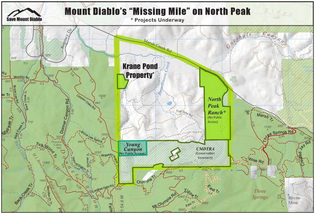
Permanently protecting almost 7 acres on slopes of Mt. Diablo’s North Peak
By Laura Kindsvater, Senior Communications Manager, Save Mount Diablo
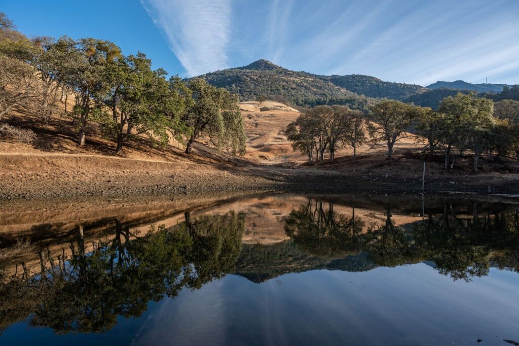
CLAYTON, CA—On Wednesday, December 20, 2023, Save Mount Diablo closed escrow on the 6.69-acre Krane Pond property on the slopes of Mount Diablo’s North Peak, permanently protecting it.
The Krane Pond property is part of the “Missing Mile,” a square mile of partly unprotected land on Mount Diablo’s North Peak.
The property has been a priority of Save Mount Diablo’s since our founding in 1971, in part because of its large pond, one of the largest on Mount Diablo’s north side, and its position directly adjacent to Mount Diablo State Park. (See related articles here and here)
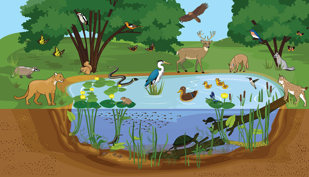
Wildlife that could potentially benefit from Krane Pond. Illustration by James Woods Marshall.
Krane Pond is a vital water source for Mount Diablo’s wildlife, one that contains water throughout most summers, unlike many of the creeks and other ponds found on Mount Diablo. The ecological significance of Krane Pond far eclipses its size.
Save Mount Diablo secured the option agreement to purchase Krane Pond in the fall of 2022, with a year to raise the necessary funds to complete the purchase. Save Mount Diablo had one year to raise the $500,000 needed to cover the various project costs for acquiring the Krane Pond property.
We are particularly grateful to have received 257 donations totaling $61,361 from the readers of Joan Morris’s East Bay Times and Mercury News column. Their gifts arrived close to the fundraising deadline, when it was a race against time to acquire the remaining funds to complete the purchase.
The Krane Pond property is directly adjacent to Mount Diablo State Park and harbors a large pond that is essential for wildlife. Photo: Sean Burke
A development lies along one of the property’s borders, a very real reminder of how the land could have been graded and paved over had Save Mount Diablo not acquired it.
In 1978, Walt and Roseann Krane purchased 6.69 acres of land on the outskirts of Clayton, bordered by Mount Diablo State Park and the meridian on the west side, Mount Diablo Creek on the north side, and property held by ranchers to the east.
Although the Krane family initially had plans to build a house on the property, they decided to preserve the land and eventually sold it to Save Mount Diablo.
Map of the location of the Krane Pond property in the “Missing Mile” on the north slopes of Mount Diablo’s North Peak. Map by Save Mount Diablo
About Save Mount Diablo
Save Mount Diablo is a nationally accredited, nonprofit land trust founded in 1971 with a mission to preserve Mount Diablo’s peaks, surrounding foothills, watersheds, and connection to the Diablo Range through land acquisition and preservation strategies designed to protect the mountain’s natural beauty, biological diversity, and historic and agricultural heritage; enhance our area’s quality of life; and provide educational and recreational opportunities consistent with protection of natural resources. To learn more, please visit www.savemountdiablo.org.
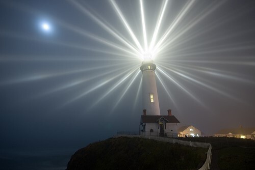
Pigeon Point Lighthouse at night. Photo by California State Parks using Fresnel lens.
To begin in early 2024
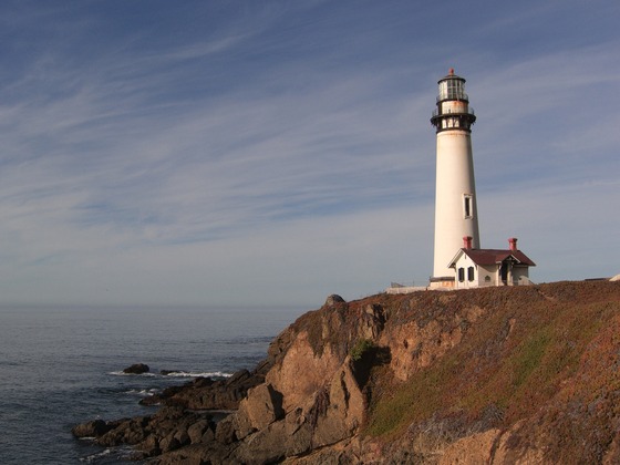
PESCADERO, Calif.— California State Parks today announced the selection of a contractor to rehabilitate the Pigeon Point Lighthouse, located within Pigeon Point Light Station State Historic Park. The $16 million rehabilitation project will start construction in early 2024 and is expected to be completed within two years.
Named for the 1853 wreck of the clipper ship Carrier Pigeon, Pigeon Point Lighthouse was first lit on Nov. 15, 1872. The 115-foot structure is the tallest operating lighthouse on the West Coast. Pigeon Point Light Station is listed on the National Register of Historic Places—a reminder of the days when whalers and Gold Rush-era clipper ships fought gales, stiff seas, jagged coastal rocks, and unforgiving fog. The lighthouse has been closed to the public since late 2001, when it was deemed unsafe after two large pieces of brick and iron fell from the top of the building. Funding issues, COVID-19 and a thoughtful process to ensure a contractor with the special skills to work on a lighthouse was selected have been the reasons for the continued closure of this historic building.
“California State Parks looks forward to once again providing public access to this historic landmark that continues to guide mariners along the rocky San Mateo County coast,” stated Santa Cruz District Superintendent Chris Spohrer. “Thank you to our partners for their support over the years and the public for their patience.”
Pigeon Point Lighthouse during the day. Photo from California State Parks by J. Barrow
Sustainable Group, Inc. of Moraga, CA, and subcontractor ICC Commonwealth of North Tonawanda, New York, have extensive experience in lighthouse rehabilitation and restoration in the United States. Jointly, they have worked on nearly 100 lighthouses, including several built to the same blueprints as Pigeon Point, including Bodie Island, North Carolina; Currituck Beach, North Carolina; and Yaquina Head, Oregon, as well as numerous other tall lighthouses. For the Pigeon Point Lighthouse, the contractors will refurbish or replace all the ironwork throughout the building. Masonry elements will also be repaired or replaced as needed. A major focus of the project will be the upper belt course or cast-iron ring where two large pieces broke away in late 2001, compromising the building’s structural integrity.
Pigeon Point Light Station State Historic Park relies upon its collaborative relationships with its nonprofit partners, including Coastside State Parks Association, California State Parks Foundation and Friends of Santa Cruz State Parks. These organizations provide support for the tower restoration, the operation of the park and the development of visitor-serving programs and amenities.
To learn how the public can support the Pigeon Point Lighthouse Restoration project or enhance the visitor experience at Pigeon Point Light Station State Historic Park, please visit CoastSideStateParks.org. Restoration project updates are available at parks.ca.gov/PigeonPointLighthouseRestoration.
The California Department of Parks and Recreation, popularly known as State Parks, and the programs supported by its Office of Historic Preservation and divisions of Boating and Waterways and Off-Highway Motor Vehicle Recreation provide for the health, inspiration and education of the people of California by helping to preserve the state’s extraordinary biological diversity, protecting its most valued natural and cultural resources, and creating opportunities for high-quality outdoor recreation. Learn more at parks.ca.gov.
SACRAMENTO, Calif.— California State Parks announced on Tuesday, Dec. 19, 2023, a new approach to reserving the highly sought after Steep Ravine Cabins at Mount Tamalpais State Park. Using a lottery-style system to make a reservation, the department’s new pilot program aims to enhance access and equity by allowing outdoor enthusiasts to apply for free for a reservation drawing up to eight months in advance. The drawings are selected randomly and conducted seven months ahead of the reservation dates through California’s state park reservation system, ReserveCalifornia.
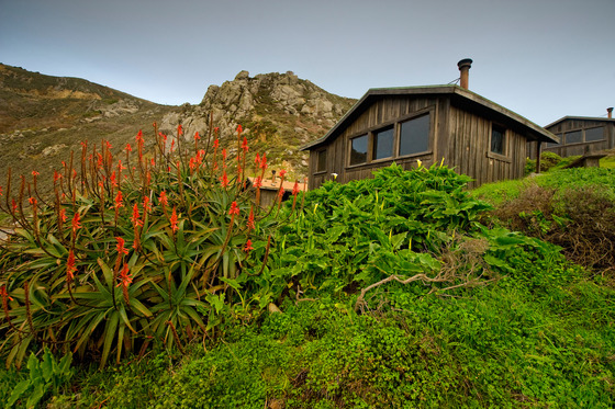
Just north of San Francisco’s Golden Gate Bridge, Mount Tamalpais State Park rises majestically from the heart of Marin County. The park offers hiking, picnicking, wildlife watching and camping opportunities. Perched on the cliffs of Mount Tamalpais, the Steep Ravine Cabins have long been a cherished destination for outdoor enthusiasts seeking a unique camping experience. Each cabin has a small wood stove, picnic table, sleeping platforms, and an outdoors barbecue, but no running water.
Launched in October of this year, the reservation lottery system ensures a fair and equitable distribution of reservations. Guests interested in reserving one of these iconic cabins will have the opportunity to enter the free drawing for a chance to secure their stay. This approach eliminates the rush and competition that often accompanies traditional booking processes, allowing more individuals and families to access the cabins at the park. If a visitor is awarded their reservation choice, they must claim and pay for the reservation within 30 days to keep it. Any unclaimed inventory will be released for reservation six months in advance.
Some key features of the pilot program at the Steep Ravine Cabins include:
Equal Opportunity: The lottery system provides an equal opportunity for anyone interested to secure a reservation, regardless of their location or previous booking history.
Transparency: The drawing process will be conducted, ensuring transparency and fairness in cabin allocation.
Accessible Information: Detailed instructions on how to participate in the drawings are available on ReserveCalifornia website, making it easy for anyone to enter.
Thus far, close to 3,400 applicants have signed up for the drawings. The pilot program is part of the department’s ongoing efforts to enhance accessibility, preserve its natural resources, and promote outdoor experiences for all.
The California Department of Parks and Recreation, popularly known as State Parks, and the programs supported by its Office of Historic Preservation and divisions of Boating and Waterways and Off-Highway Motor Vehicle Recreation provide for the health, inspiration and education of the people of California by helping to preserve the state’s extraordinary biological diversity, protecting its most valued natural and cultural resources, and creating opportunities for high-quality outdoor recreation. Learn more at parks.ca.gov.
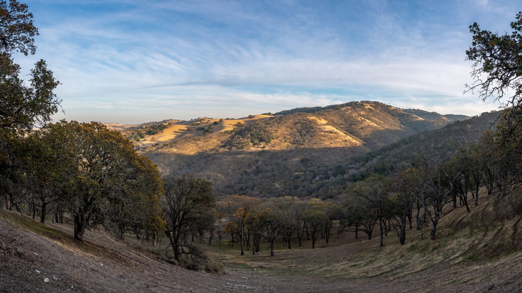
View from the Ginochio Schwendel Ranch. Photo by Scott Hein.
Rare volcanic habitat in the Dark Canyon part of Marsh Creek
SMD must raise $1.5 million within 12 months.
ByLaura Kindsvater, Senior Communications Manager, Save Mount Diablo
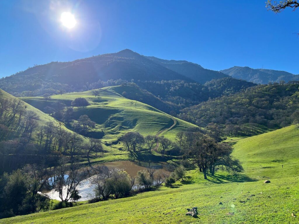
Just in time for the holidays, Save Mount Diablo (SMD) has optioned the 98-acre Ginochio Schwendel Ranch on Marsh Creek Road between Clayton and Brentwood. The $30,000 option payment holds the property for 12 months while Save Mount Diablo raises almost $1.5 million for acquisition and other project expenses.
It’s the first property Save Mount Diablo is purchasing directly from Contra Costa County’s Ginochio cattle ranching family, which owns nearly 7,000 acres on and around Mount Diablo. The property includes extremely rare dacite volcanic habitat along Marsh Creek’s Dark Canyon section. The Ginochio Schwendel Ranch is the fifth acquisition project Save Mount Diablo has participated in this year. Save Mount Diablo expects to close escrow on its Krane Pond property next week on December 20th.
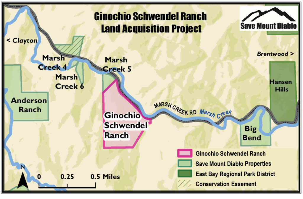
Map showing the location of the Ginochio Schwendel Ranch and other properties protected by Save Mount Diablo along Marsh Creek, the least-disturbed stream in Contra Costa County. Map by Roxana Lucero.
Save Mount Diablo’s Executive Director, Ted Clement, stated, “We are so thankful for our Save Mount Diablo team, including our amazing supporters, and the Ginochio family who together have enabled us to enjoy so much success this year in advancing our time-sensitive land conservation mission, even in the waning days of 2023. This is the first time Save Mount Diablo has bought a property directly from the Ginochio family, the most important landowning family in Contra Costa County. The Ginochios own several high priority properties on the slopes of the mountain. They’ve been amazing stewards of their land for generations. The Ginochio Schwendel Ranch will expand our abutting Marsh Creek 5 preserve. They both share very unusual volcanic geology and are in the high priority Marsh Creek wildlife corridor. If we don’t protect the Ginochio Schwendel Ranch, the property will eventually be divided up and developed, causing its special conservation values to be lost. We’re going to need help from our generous donors and agency partners to fund this project in the next 12 months.”
The Ginochio Family
The Ginochio family arrived in Contra Costa in 1867 and settled in Concord and the coal mining town of Nortonville, and then diversified into ranching. Over 156 years, they created and have stewarded the biggest cattle ranching operation in the county.
The Ginochios own nearly 7,000 acres, including the most important ranches remaining west, north, and east of Mount Diablo. Much of the land is in the Marsh Creek watershed, like the Ginochio Schwendel Ranch. But each generation has more family members, and over time, ranching has become more difficult.
Historically when the family has sold property, they’ve used the funds to buy more agricultural land. When another of their properties was condemned after World War II, the Ginochios bought the Schwendel Ranch. They will continue to own 665 acres north of Marsh Creek Road.
According to John Ginochio, a member of the ranching family, “I’m pleased to make this deal with Save Mount Diablo. When you think of influence, people often think about big environmental groups. Personally, I think Save Mount Diablo is the most influential environmental organization in our area. I’ve worked cooperatively with them for over 50 years. They’re financially sound and have the funds to make solid deals and the integrity to go with it. We graze cattle on a number of SMD properties. I’m happy to see this part of the Ginochio Schwendel Ranch go to Save Mount Diablo because they have always been a good neighbor.”
Added Ginochio, “This parcel south of Marsh Creek Road hasn’t been especially useful for cattle grazing but it’s always been interesting because of its unusual pink soil. I learned more about its volcanic character from Save Mount Diablo as they sponsored research on their neighboring property. I’m really happy we can help expand the protected volcanic habitat instead of more houses.”
The 98-acre Ginochio Schwendel Ranch would expand on Save Mount Diablo’s adjacent 7.4-acre Marsh Creek 5 preserve, an unusual volcanic dome. Marsh Creek 5 was protected in 2011. That same year and one parcel away, Save Mount Diablo also protected a similar volcanic dome, its 5.7-acre Marsh Creek 6 preserve, where the organization demolished a house overlooking the canyon and restored habitat.
According to Seth Adams, Save Mount Diablo’s Land Conservation Director, “The Ginochio Schwendel Ranch is part of the east-west Marsh Creek riparian, road, and trail corridor, and near the western end of the Dark Canyon section of the riparian corridor. Solid blue oak and live oak woodland, it is part of the wooded habitat corridor from Black Diamond Mines through Clayton Ranch south to Morgan Territory Regional Preserve and Mount Diablo State Park. Steep wooded slopes rise from Marsh Creek Road to flatter meadows, then climb higher in one direction, while dropping into a canyon in another. I consider John Ginochio a good friend and I hope this is just the first conservation project with the family.”
Ginochio Schwendel Ranch is a beautiful wooded 98-acre property, most of a steep volcanic knoll rising from 530 feet to 1,140 feet—with dramatic views. The property is quite visible from a variety of protected lands and from both directions of Marsh Creek Road. Development of the property would degrade the visual value of the road corridor, a Contra Costa County General Plan–designated “Scenic Route.” The most likely development threat is minor subdivision and ongoing fragmentation to more houses over time. Development would destroy the habitat, wells would damage the unusual hydrology, and roads and pads would require removal of many trees. Dark Canyon is a critical fire danger area, and part of the property burned several years ago.
Save Mount Diablo and our partners have protected more than 15 miles of the 33-mile Marsh Creek riparian corridor. Marsh Creek is the second longest, least-disturbed creek in Contra Costa County. The creek is across the road in this case, but the overall corridor and this upland habitat are very rich.
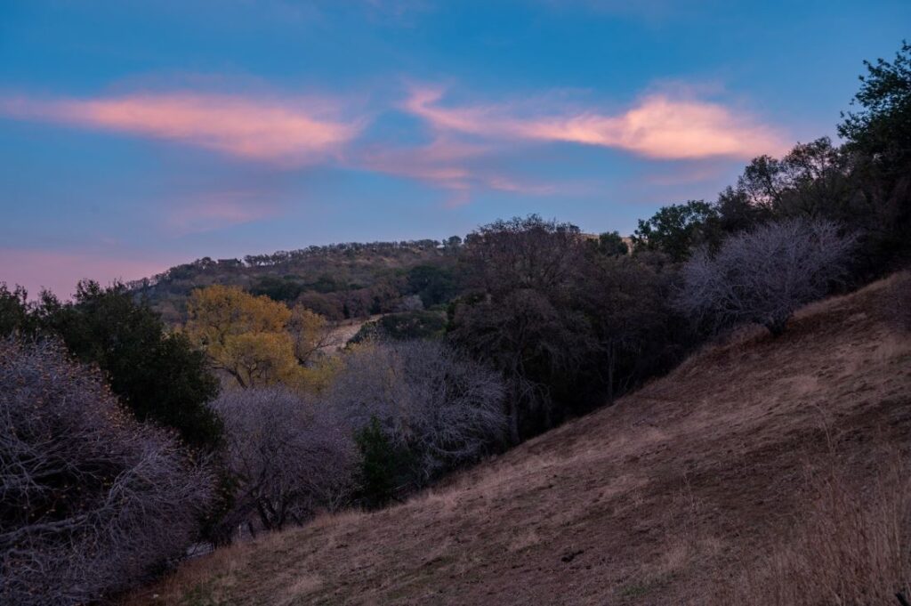
The Ginochio Schwendel Ranch at sunset in November 2022. Photo by Scott Hein.
As with our neighboring Marsh Creek 5 preserve, we know the property supports listed species such as Alameda whipsnake and California red-legged frog, along with a whole suite of rare or unusual plants such as endemic Contra Costa manzanita and Mount Diablo fairy lantern, western hop tree, and Hartweg’s umbrellawort. An on-site fire road accesses the property and will allow much better access to our neighboring Marsh Creek 5 preserve. In the future, we hope the property will help with the creation of a section of the Clayton to Round Valley Marsh Creek Trail.
The Ginochio Schwendel Ranch is the fifth acquisition project Save Mount Diablo has participated in this year. After a successful community-based public fundraising campaign this fall, Save Mount Diablo expects to close escrow on its 6.69-acre Krane Pond property next week. Save Mount Diablo recently made its eighth installment payment on the 87-acre North Peak Ranch. In August, Save Mount Diablo purchased the critical 10-acre Balcerzak inholding within Mount Diablo State Park, situated in Curry Canyon, including the most remote house on Mount Diablo, in just a few weeks. And in April, the East Bay Regional Park District closed escrow on the $11.2 million 768-acre Finley Road Ranch property with Save Mount Diablo’s assistance, providing a location for a new regional staging area for Riggs Canyon and Morgan Territory Regional Preserve.
The Schwendels
We’re just getting to know the history of the property. The Schwendel Ranch was originally pieced together from homesteads and holdings by the heirs of railroad interests. One owner was Joseph or “Josef” Schwendel, a well-known Austrian musician who played the violin or cornet until his death in 1930. He was the organizer of the Clayton Silver Cornet Band in the 1870s. Frank Schwendel was born about 1883. Sometime during that period, Frank Schwendel took ownership of part of the land. Apparently, Mary Berendsen owned another part in 1927. When her husband died, she married Frank. They were still living in the area in 1940 when he was 57 and she was 63, and he still owned the land in 1946 when he granted an easement to PG&E. Schwendel children married members of the Frank family, who arrived in Clayton in the 1870s, and the Cakebread family. The Ginochio family bought their part of the Schwendel Ranch after World War II.
“Anna (Berendsen) Berkheimer has lived in Brentwood since 1981, but Clayton will always be her home. Berkheimer was born in Clayton . . . in a building that is known as the Clayton Club, a country and western bar,” according to the Clayton Historical Society and reprinted from an article that ran in the Brentwood News on August 13, 1987. “’Before Prohibition my father ran the saloon and mother took care of the dining room.’. . . ”Berkheimer was the daughter of Carl Berendsen, who emigrated to the United States from Denmark at the age of 17. Her mother’s parents were also from Denmark. . . . In 1926 her father drowned in Marsh Creek after driving his vehicle off the bridge and her mother subsequently married Frank Schwendel, who was born and raised in the Marsh Creek area. Schwendel owned 1,200 acres between Brentwood and Clayton and Berkheimer assisted with many of the chores on the ranch. ‘I learned how to milk cows, drive a tractor, and quite a few other things, but I really enjoyed it even though it was hard work,’ she said.”
The Ginochio Schwendel Ranch harbors oak woodland and rare volcanic plant habitat. Photo by Scott Hein.
Why Does the Ginochio Schwendel Ranch’s Geology Matter?
Complex geology = complex soils = rich botany. As rocks break down, soils are formed, and when the geology is complex, so are the soils. Because they’re high in some minerals, chemicals, and trace elements, and deficient in others, rocky soils often exclude some plants and are speciation sites where others evolve into new forms. These volcanic dacite intrusions are high silica and break down into sands that hold water and support a different plant community and rare plant species, often with springs on their slopes or base. Their vegetation is brighter green and lusher than surrounding areas, often dense with trees or poison oak.
A dozen volcanic, mostly dacitic intrusions have been mapped along Marsh Creek at the northeast corner of Mount Diablo State Park. In 2011, Save Mount Diablo protected 7.4-acre Marsh Creek 5, including one volcanic dome and then later that year a similar dome, 5.7-acre Marsh Creek 6. Another volcanic dome is found in Mount Diablo State Park at Perkins Canyon, which is easily accessible. Marsh Creek 5 and Marsh Creek 6 are two volcanic exposures on either side of the Marsh Creek Springs resort. These properties form a volcanic habitat found nowhere else in central or eastern Contra Costa County. The 98-acre Ginochio Schwendel Ranch is part of this same volcanic area.
The volcanic domes at Save Mount Diablo’s Marsh Creek 6 and Marsh Creek 5 preserves, with Ginochio Schwendel Ranch rising beyond. Photo by Scott Hein.
There’s not as much igneous rock in Contra Costa County as in the North Bay, but it’s not all that unusual, especially on Mount Diablo. The most common igneous rocks on Mount Diablo are old ocean crust formed deep out at sea. These rocks included parts of Diablo’s main peaks. Also, present are pillow basalts formed at underwater eruptions along a mid-ocean ridge. These pieces of igneous rock were carried to North America and added to the continent by the movement of tectonic plates.
In the Oakland hills, more recent volcanoes erupted and spread lava and ash locally years ago. And in various places around Contra Costa County, ash from eruptions farther away are consolidated as “tuff” beds. The pink Lawlor Tuff is an age marker around Diablo, laid down on a flat to rolling landscape before the peaks were exposed, and steeply folded as Mount Diablo emerged.
Save Mount Diablo’s Marsh Creek 5 and Marsh Creek 6 properties are different. So is the Ginochio Schwendel Ranch.
We began studying the geology of the volcanic deposits after we acquired these Marsh Creek properties and sponsoring research into their origin in grants in 2018 and 2019 from our Mary Bowerman Science and Research program. Ultimately a chapter was included, “Neogene volcanism on the eastside of Mount Diablo, Contra Costa County, California” with findings in a new geology book, Regional Geology of Mount Diablo, California in 2021.
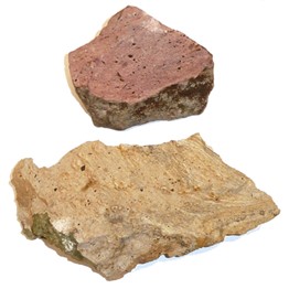
Volcanic rocks from Save Mount Diablo’s Marsh Creek 5 preserve and Ginochio Schwendel Ranch acquisition project. Photo by Save Mount Diablo.
“Neogene volcanic rocks are located to the east and north of Mount Diablo, near the eastern boundary of the San Andreas fault system . . . probably associated with the northward migration of the Mendocino Triple Junction along the western plate boundary in California . . . This event produced a series of volcanic centers along the plate boundary . . . referred to as the Coast Range Volcanic Suite.”
These spots are of high silica, much younger igneous rock visible in mound- or dome-like surface exposures, within a four-mile northwest-southeast band, a mile and a half wide. They’re strangely steep because they resist erosion and look like mushroom caps, compared to more erosive sedimentary Great Valley Group geology nearby. Marsh Creek threads through them near the intersection of Morgan Territory and Marsh Creek roads. The volcanic intrusions are also one of the most limited habitats in the East Bay, retain water more than surrounding areas, and are often associated with springs and rare plants. The Ginochio Schwendel Ranch includes part of the biggest mapped exposure of these dacite intrusions.
The rare geology and plant habitat on the Ginochio Schwendel Ranch is just one more thing that makes Mount Diablo special.
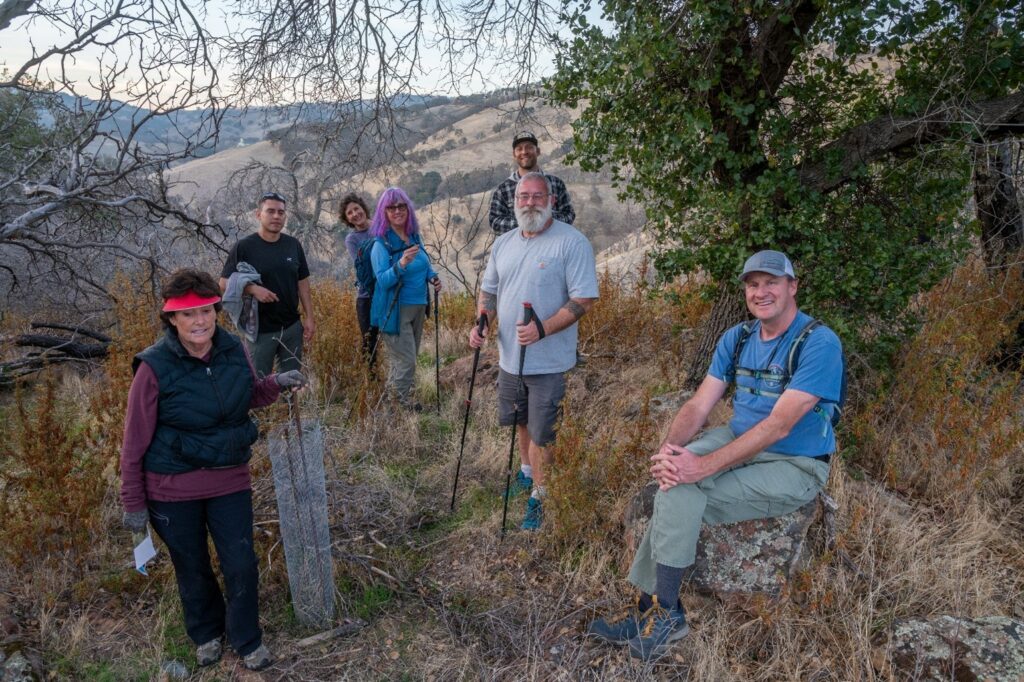
Save Mount Diablo staff and committee members on a land tour on November 22, 2022 to investigate the Ginochio Schwendel Ranch and Save Mount Diablo’s Marsh Creek 5 preserve. Left to right: Joan Duffield, Juan Pablo Galván Martínez, Margaret Kruse, Shirley Langlois, Seth Adams, Sean Burke, and Ted Clement. Photo by Scott Hein.
About Save Mount Diablo
Save Mount Diablo is a nationally accredited, nonprofit land trust founded in 1971 with a mission to preserve Mount Diablo’s peaks, surrounding foothills, watersheds, and connection to the Diablo Rangethrough land acquisition and preservation strategies designed to protect the mountain’s natural beauty, biological diversity, and historic and agricultural heritage; enhance our area’s quality of life; and provide educational and recreational opportunities consistent with protection of natural resources. To learn more, please visit www.savemountdiablo.org.