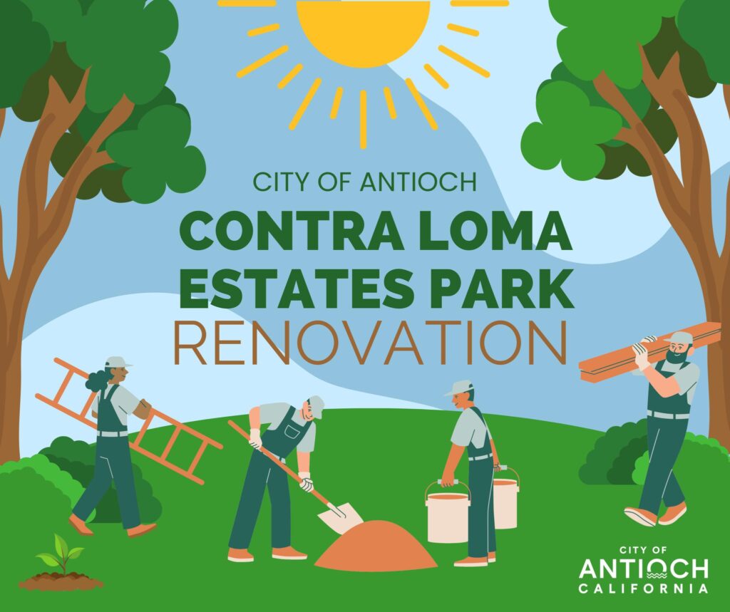
Beginning Monday, April 29 – will include new dog park, restroom and more.
By City of Antioch
Exciting News for Antioch residents in the Sycamore area.
Get ready for a whole new level of fun and relaxation at Contra Loma Estates Park! The City of Antioch is gearing up for some major renovations, and we couldn’t be more thrilled to share the details with you.
Starting Monday, April 29th, we’ll be rolling up our sleeves and diving into construction to give your beloved park a fresh new look! Here’s what’s in store:
A Pawsome Addition: Get tails wagging with the construction of a brand-new DOG PARK! Let your furry friends frolic and play in a safe and designated space just for them.
Convenience at Your Fingertips: We’re installing a much-needed RESTROOM facility for your comfort and convenience.
Light Up Your Path: Enjoy evening strolls with a newly LIGHTED WALKING PATH, perfect for soaking in the beauty of the park after sunset.
Fitness Fanatics Rejoice: Say hello to fantastic EXERCISE EQUIPMENT, helping you stay active and healthy while enjoying the great outdoors.
Game On: Shoot some hoops under the stars with upgraded LIGHTING for the basketball court!
And that’s just the beginning! With a host of other amenities in the pipeline, the future of Contra Loma Estates Park is brighter than ever before.
Please note: The park will be closed to the public during construction for everyone’s safety. Have questions or eager to learn more? Reach out to our Capital Improvements Department at (925) 779-7050 – we’re here to help!
Get ready to experience a whole new level of fun, relaxation, and community at Contra Loma Estates Park. Together, let’s make memories that last a lifetime!
By Dave Mason, Acting Community Relations Manager, East Bay Regional Park District
Before logging in the mid-1800s, the East Bay had expansive redwood forests with huge trees. Ship captains sailing near the Golden Gate wrote about two redwoods at the top of a ridge in the Oakland hills that towered over others. At the time, they used the tall redwoods as landmarks to navigate their ships around the treacherous Blossom Rock, hidden just beneath the surface of the bay between Alcatraz and Yerba Buena Islands. Today, redwoods in the East Bay are mostly second and third-growth – still tall and magnificent.
Where you can see redwoods in the East Bay:
Tilden Regional Park, Berkeley – Walk the meandering paths through redwoods in the Regional Parks Botanic Garden.
Roberts Regional Recreation Area, Oakland – Walk Roberts Ridge Trail to find the Old Growth Redwood Heritage Viewing Deck and Interpretive Exhibit. Have a picnic in Redwood Bowl.
Reinhardt Redwood Regional Park, Oakland – Stroll past ferns and along Redwood Creek on the paved Stream Trail. You will see the descendants of the original Blossom Rock forest.
March is Women’s History Month, a time to celebrate and honor the accomplishments and contributions of the groundbreakers and trailblazers who have improved and advocated for parks, nature, and the environment. There are two naturalist-guided programs scheduled that celebrate women in parks, including Wonderful World of Women Naturalists on Saturday, March 16, at 6:30 p.m. at Big Break in Oakley, and Bay Area Women in Botany on Sunday, March 17, at 9:00 a.m. at Huckleberry Botanic Regional Preserve in Oakland. Both programs are drop-in; no registration required. For more information or to learn more about the contributions of women to the Park District and its mission, visit the District’s Women’s History Month page at www.ebparks.org/we-celebrate/womens-history-month.
Special 90th Anniversary “Explore Your Parks” Adventure Programs
Explore nature at your own pace and in your own way at Big Break’s All Abilities Day on Tuesday, March 26, from 10 a.m. to 1 p.m. A special 90th Anniversary presentation will kick off the fun! This free drop-in program is inclusive and for all abilities, offering something for everyone. American Sign Language and Spanish interpreters will be on site.
Other March “Explore Your Parks” Adventure Programs include Day by the Water at Del Valle Regional Park in Livermore on Saturday, March 23, from 10:00 a.m. to 3:00 p.m., and 90th Anniversary Sunday Stroll and Picnic at Temescal Regional Recreation Area in Oakland on Sunday, March 24, from 9:30 a.m. to 11:00 a.m. For more information, visit the Park District’s 90th Anniversary webpage at www.ebparks.org/celebrating-90-years.
Spring Means Wildflower Season in Regional Parks
Each year, from the end of March to the beginning of May, a rich diversity of wildflowers bloom throughout the Regional Parks. Visit Sunol Wilderness Regional Preserve, Ohlone Wilderness Regional Preserve, or Black Diamond Regional Preserve, where the hillsides and meadows come alive with a kaleidoscope of colors, from the cheerful orange of California poppies to the delicate purple of lupines. These floral displays delight the eye and provide essential nectar for native pollinators like bees and butterflies. To see these impressive displays of flowers and celebrate the season, visit a park or join a variety of naturalist programs, including wildflower walks and hikes, videos, and art activities. For more information, visit www.ebparks.org/calendar and search “wildflowers.”
The East Bay Regional Park District is a major employer of youth in Alameda and Contra Costa counties, with seasonal employment opportunities ranging from lifeguards to park gate attendants. The Park District is a great place to work for those who care about parks, nature learning, and enjoy outdoor recreation. The District is currently hiring lifeguards, recreation leaders, interpretive student aides, public safety student aides, and student laborers/gate attendants. For more information, visit www.governmentjobs.com/careers/ebparks and search for “seasonal.”
The East Bay Regional Park District is the largest regional park system in the nation, comprising 73 parks, 55 miles of shoreline, and over 1,330 miles of trails for hiking, biking, horseback riding, and environmental education. The Park District receives an estimated 30 million visits annually throughout Alameda and Contra Costa counties in the San Francisco Bay Area.
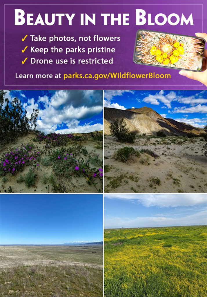
Top: Current wildflower bloom at Anza-Borrego Desert SP. Bottom left: Sparse flowers are starting to show at Antelope Valley California Poppy Reserve State Natural Reserve (SNR). Bottom right: Goldfields currently adorn the Tule Elk SNR. Source: CA State Parks
Public asked to keep the beauty in the bloom by staying on designated trails and taking only photos, not flowers.
SACRAMENTO, Calif. – This spring, California’s desert state parks could potentially be adorned with a sea of rainbow colors as the wildflower season is expected to be an impressive one, and California State Parks is asking all visitors to enjoy them responsibly.
“In recent years, California has been lucky to see spectacular wildflower blooms in many public lands, including in state parks,” said State Parks Director Armando Quintero. “We welcome all Californians and visitors from around the world to experience this natural phenomenon and ask all to keep the ‘Beauty in the Bloom’ by staying on designated trails and taking only photos, not flowers.”
Current Bloom Situation
Depending on the park, visitors may see colorful lupine, coreopsis, desert sunflowers, evening or brown-eyed primroses, desert bells, desert poppies or desert lilies.
Anza-Borrego Desert State Park: Blooms are arriving in the heart of Borrego Springs along Henderson Canyon Road, the lower sandy dune portions of Coyote Canyon and in the southern portion of the state park along Highway S2 southeast of Agua Caliente County Park. Additionally, areas near June Wash moving northeast toward Fish Creek and Arroyo Tapiado are beginning to show the early bloomers like primrose, phacelia, and wooly sunflower. If moving south along the Highway S2, four-wheel-drive vehicles are recommended on any unpaved park road.
Antelope Valley California Poppy Reserve State Natural Reserve: Sporadic individual poppies are already starting to bloom. From mid-March to May, this park expects a variety of wildflowers to bloom. Poppies, fiddleneck, and red stem filaree have sprouted throughout the Poppy Reserve in large, dense quantities. Live updates from this park are available through the PoppyCam live feed. If the weather remains mild, the bloom is expected to be better this year compared to last year. If the weather turns hot, this could affect the bloom in the next few months.
Detailed information, in Spanish and English, on this year’s potential wildflower blooms and park rules is available at parks.ca.gov/WildflowerBloom.
Recreate Responsibly
For those wishing to visit areas where the blooms are popping, State Parks is providing visitors with tips on how to explore safely and responsibly, especially in the desert parks where the landscapes may have changed due to recent storms.
Understand the Area
Cell coverage can be spotty or nonexistent in some parks—be prepared.
Read about your state park destination online and download a map prior to your visit, especially if you are visiting a desert. Many GPS and map apps will take you to dirt roads requiring four-wheel drive vehicles.
Know your vehicle’s limits. Know which areas allow off-highway vehicle recreation.
Visit the parks during the week and arrive early to beat the crowds.
Remember to pull off the roadway when viewing wildflowers, wildlife or to take photos. Please leave roadways clear for vehicle traffic.
Leave an itinerary of your trip with a family member or friend with information such as time of departure and expected return, site visit location and names of everyone in your group. This will ensure law enforcement personnel have a better understanding of your location in the event of a rescue.
Check the Weather
While planning your trip, check weather conditions. Be prepared and plan for all types of weather.
Make sure your equipment and clothing are appropriate for the expected weather.
Respect the Landscapes
Each park has unique landscapes. Stay on designated trails whenever possible. Tread lightly in the desert. Do not trample flowers.
When viewing the blooms, take only pictures. Flower picking is prohibited.
If dogs are permitted, they must remain on leash, on designated roads, in campgrounds and in picnic areas. Dogs are not allowed on hiking trails, in the backcountry or in the wildflower fields. Do not leave dogs unattended in your vehicles—temperatures can reach lethal levels.
Drone use may be prohibited. If drone use is allowed, a filming permit from individual state park units must be requested.
Help keep the landscapes pristine, leaving it better than when you arrived by packing out anything you packed in—pack it in, pack it out.
Know Your Body Limitations
Bring plenty of food and water. There are often no restaurants, gasoline stations or stores near the bloom areas.
Drink plenty of water prior to your visit to remain hydrated and avoid heat-related emergencies.
Outdoor conditions can change quickly, especially in the desert. Bring sunscreen, a hat, layers of clothing and closed-toe shoes to avoid injury.
Walk at a pace that allows you to talk easily. If you are too out of breath to speak, you are probably working too hard. Take a rest or stop exercising.
In the event of an emergency, call 911.
Background
In 2017, 2019 and 2023, wildflowers carpeted state parks like Antelope Valley California Poppy Reserve SNR, Anza-Borrego Desert SP and Ocotillo Wells State Vehicular Recreation Area (SVRA), attracting hundreds of thousands of people from around the world to view this rare occurrence in nature. These wildflower blooms vary from year to year based on multiple factors: Precipitation levels, the timing of that precipitation, amount of sunlight, humidity levels and seasonal temperature patterns can all affect both the bloom timing and number of flowers seen across the region. Since California was fortunate to receive more rain last fall and this winter, public land managers are expecting a “good” to “better-than-average” wildflower blooms in spring, depending on the continued weather conditions.
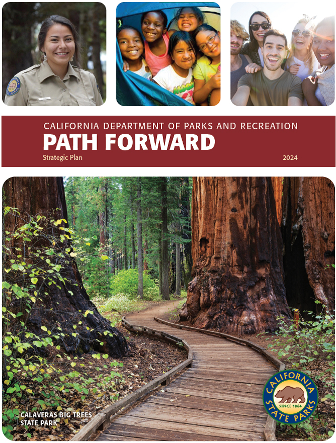
SACRAMENTO, Calif. — The California Department of Parks and Recreation (State Parks) has developed a five-year strategic plan to help shape the future direction of the state park system and the many recreational and conservation programs that serve California’s communities.
Named Path Forward, the strategic plan aligns with Governor Gavin Newsom’s Equity Executive Order N-16-22, 30X30 and Outdoor Access for All initiatives and will guide State Parks in strengthening operations to focus on key priorities and directing energy and resources toward meeting the goals and objectives. The themes, goals, and objectives in the plan are based on the foundational elements of access, inclusivity, and equity to provide optimal public service, strengthen partnership development, and empower the department’s workforce.
“The Path Forward strategic plan is about resilience and focusing on how we prepare the department for the century ahead,” stated State Parks Director Armando Quintero. “California needs these natural and cultural resources for everyone’s wellbeing. State Parks leadership, employees, and partners are committed to caring for your California. This is where you live.”
An employee workgroup composed of more than 100 frontline staff, managers, and supervisors representing all field regions, headquarters, and all program areas, was assembled to develop the Path Forward Plan. The vision, themes, goals, objectives, and core values were created and refined over several virtual meetings and reviewed by a partner and stakeholder advisory committee, employees, commissions, and executive staff along the way.
The input and perspective of stakeholders and partners helped to inform the final version of the plan and to ensure that the future of State Parks reflects the diverse experiences and priorities represented in the State of California.
Two factors set Path Forward apart from previous change efforts. Department staff from all levels developed the plan with input from partners, rather than an executive team taking a top-down approach. The second factor will begin in winter 2024 and involves an actionable implementation plan led by a committee made up of key leaders representing all program areas. The implementation plan includes interdisciplinary teams to carry out and manage projects tied to the goals and objectives of the plan. These teams will use a designated project management tool to develop specific plans, timelines, and evaluation metrics to achieve each goal. The teams will provide regular progress and status updates.
By using this strategic plan as a guide, a course of action has been developed to support State Parks in meeting challenges. The plan will also create new strategies for institutional growth and optimization.
With 280 park units, California’s State Park System is a world-class network of incomparable lands, waters, and features vitally important to the well-being of the state’s environment, economy, and people. State Parks manages these precious natural and cultural resources while providing hundreds of recreational and conservation programs and services for millions of Californians and visitors from all over the world.
The Path Forward Plan is available in English and is translatable to several other languages at parks.ca.gov/PathForward.
By Jen Vanya, Public Information Specialist, East Bay Regional Park District
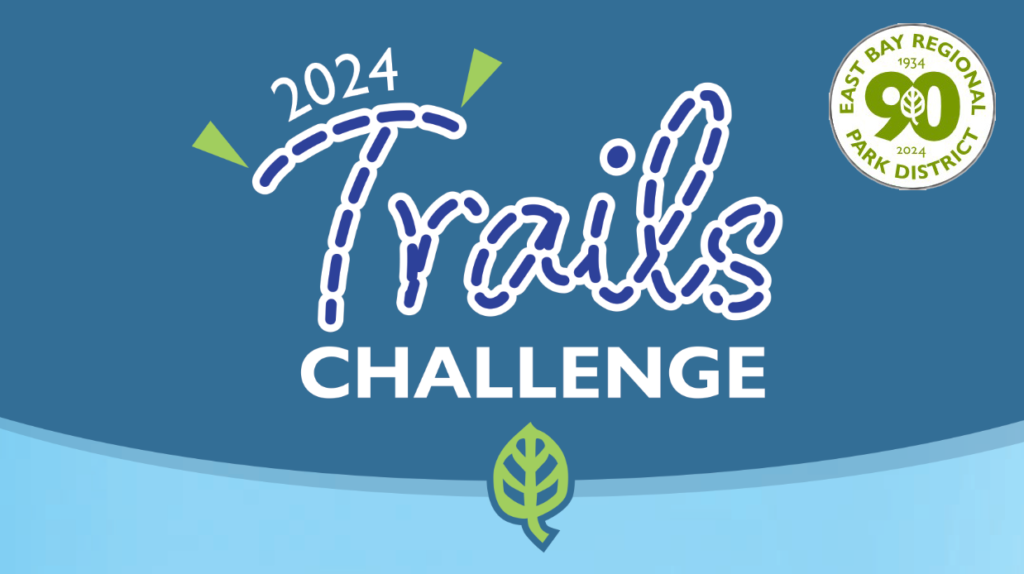
For the past 31 years, the East Bay Regional Park District has encouraged the public to explore their Regional Parks through its annual Trails Challenge program. The free program connects people with nature and healthy recreation by providing 20 designated trails for each year’s challenge.
The 2024 Guidebook includes 20 trails available for all levels of fitness, ranging from easy and moderate to challenging. There are trails open to hikers, bicyclists, dogs, and equestrians. Trails Challenge 2024 also offers increased accessibility with trails that have been evaluated and identified as usable by persons with mobility limitations.
To complete the challenge, hike five of the 20 trails, or 26.2 miles (the distance of a marathon) of trails within East Bay Regional Park District. You can submit your log, online or by mail, by December 1, 2024, and receive a commemorative pin, while supplies last.
Trails Challenge is made possible in partnership with the Regional Parks Foundation and Kaiser Permanente, who have both sponsored Trails Challenge since 2005.
Download the 2024 Trails Challenge and learn more at ebparks.org/TC.
Tips for the Trails
East Bay Regional Parks are popular with hikers, bikers, equestrians, and nature viewers, among others. Help keep trails enjoyable for all by following these tips for the trails:
Hikers: Stay to the right and stay alert
Bikers: Slow down around others and call out or ring your bell when passing
Equestrians: Keep to the right around other trail users and let them know how to pass your horse safely
The East Bay Regional Park District is the largest regional park system in the nation, comprising 73 parks, 55 miles of shoreline, and over 1,300 miles of trails for hiking, biking, horseback riding, and environmental education. The Park District receives an estimated 30 million visits annually throughout Alameda and Contra Costa counties in the San Francisco Bay Area.
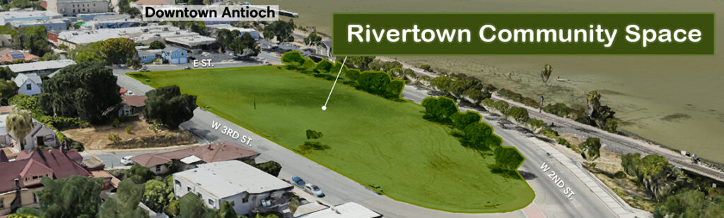
Input process continues for Rivertown Community Space begun last May following council direction in Nov. 2021
By Allen D. Payton
The City of Antioch is continuing its effort to obtain public input on the development of a new gathering place in Antioch’s historic, downtown Rivertown. All residents are invited to share their vision for what is expected to be that part of town’s future central attraction. The empty, dirt lot is bordered by W. 2nd and 3rd and E Streets.
City staff is asking for input stating, “This new outdoor public space is uniquely situated along the Sacramento-San Joaquin River. It will benefit our diverse community by fostering a vibrant, thriving downtown. Share your thoughts on what this space should look like and what features it should include.”
The process began last May with an online survey and will continue during two Community Design Workshops on Thursday, Feb. 8 at the Antioch Community Center in Prewett Family Park, 4703 Lone Tree Way and Sunday, Feb. 18 from 4:00 – 6:00 p.m. at the Nick Rodriguez Center, 213 F Street.
The effort follows the city council decision to support the River Town Square proposal by Save The Yard led by former Councilwoman Joy Motts. As previously reported by the Herald, during the Nov. 23, 2021 Antioch City Council meeting, after years of advocating for a park and event center on the former Antioch Lumber Company lot the group was given the go ahead by all five council members to pursue the idea.
“We can begin a process for exploring a community gathering space, a green space,” then-City Manager Ron Bernal said at the conclusion of the meeting.
Weekend Mining History and Hazel-Atlas Mine Tours at Black Diamond Mines in Antioch
By Dave Mason, Public Information Supervisor, East Bay Regional Park District
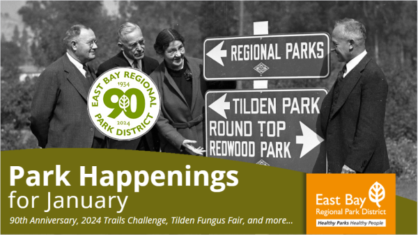
Welcome to the East Bay Regional Park District’s 90th Anniversary year. Established in 1934, the Park District has grown to be the largest regional park district of its kind in the nation, with 73 regional parks available for hiking, biking, swimming, horseback riding, boating, fishing, picnicking, camping, and nature discovery. Wherever you live in the East Bay, there is a beautiful regional park close to you.
We will be hosting numerous special events and programs throughout the year to commemorate our anniversary, including a community birthday celebration on May 11 and monthly naturalist-led “Explore Your Parks” adventure programs. Join us for the next “Explore Your Parks” adventure program, Community Science Bio Blitz at Sunol Wilderness Regional Preserve in Sunol on Saturday, January 27, from 10:00 a.m. to noon. For more information about the Park District’s 90th Anniversary, including events and activities, visit www.ebparks.org/celebrating-90-years.
The East Bay Regional Park District’s 2024 Trails Challenge program is underway, offering 20 new trails for the new year. In its 31st year, the annual Trails Challenge program encourages the public to explore and enjoy their Regional Parks. The free guide provides 20 designated trails for all levels, ranging from easy and moderate to challenging and is open to hikers, bicyclists, dogs, and equestrians. The 2024 Trails Challenge program also offers increased accessibility with trails that have been evaluated and identified as usable by persons with mobility limitations. The trail guide is available online at www.ebparks.org/TrailsChallenge
To complete the challenge, hike five of the 20 trails, or 26.2 miles (the distance of a marathon) of trails within the East Bay Regional Park District. The Trails Challenge program is made possible with help from the Regional Parks Foundation and Kaiser Permanente. To get started, visit www.ebparks.org/TrailsChallenge.
Celebrate the fruits of winter at the Tilden Fungus Fair! View hundreds of local mushroom specimens, mingle with the mycological community, and enjoy presentations by guest speakers at this two-day special event, Saturday, January 20, and Sunday, January 21, from 10:00 a.m. to 4:30 p.m. at Tilden Nature Area. For more information, visit www.ebparks.org/events/tilden-fungus-fair.
Black Diamond Mines has begun offering weekend Mining History Tours and Hazel-Atlas Mine Tours again, in addition to their Coal Mine Experience tours. From the mid-1920s to the mid-1940s, the Hazel-Atlas Mine produced silica sand to make jars, bottles, and other glass items. Tour participants can now take a walk into the mine to see mine workings, ore chutes, the shifter’s office, and ancient geological features. For safety reasons, you may tour the mine only as part of a guided tour, and all participants must be at least seven years old. For more information, visit www.ebparks.org/calendar and search “Mine Tours.”
Water’s Amazing Journey at Coyote Hills! Water surrounds Coyote Hills, but where does it come from, and where does it go? In winter, we expect rain to fall from the clouds (precipitation) and land on mountains, lakes, and rivers. Some of this water is soaked up by plants and seeps into the ground, replenishing groundwater. Explore the Coyote Hills watershed, discover where your water comes from, and learn how we are connected and responsible for our watersheds at the Water, Water, Everywhere program on Saturday, January 27, from 10:30 a.m. to noon at Coyote Hills Visitor Center. For more information, visit www.ebparks.org/calendar and search “Water, Water, Everywhere.”
The East Bay Regional Park District is the largest regional park system in the nation, comprising 73 parks, 55 miles of shoreline, and over 1,330 miles of trails for hiking, biking, horseback riding, and environmental education. The Park District receives an estimated 30 million visits annually throughout Alameda and Contra Costa counties in the San Francisco Bay Area
By Dave Mason, Public Information Supervisor, East Bay Regional Parks District
Police Chief Roberto Filice. Source: EBRPD
After a nationwide search, the East Bay Regional Park District announces the appointment of Salinas Police Chief Roberto Filice as its new Assistant General Manager of Public Safety and Police Chief at the public agency. The East Bay Regional Park District’s mission is to preserve a rich heritage of natural and cultural resources and provide open space, parks, trails, safe and healthful recreation and environmental education. An environmental ethic guides the District in all of its activities. Chief Filice will be sworn in and begin in the role on January 22, 2024.
As the largest regional park district in the country, the park system spans Alameda and Contra Costa counties and serves an estimated 30 million visitors a year through park and trail access, visitor centers, and programs. Its workforce provides services that encompass 73 parks, 55 miles of shoreline, and over 1,300 miles of trails. With an expansive area and diverse lands, the Park District’s Public Safety Division comprises Police, Fire, and Lifeguard Services. The Police Department includes the Air Support Unit, Marine Patrol, Equestrian Patrols, Investigations Unit, and a 24-hour per day 9-1-1 Communications Center.
“We are pleased to welcome Chief Roberto Filice, a highly seasoned leader and law enforcement executive with over 25 years of dedicated public service, to the East Bay Regional Park District,” said Sabrina Landreth, General Manager at the East Bay Regional Park District. “We look forward to his leadership and strong sense of community service in this important role that prioritizes public safety, quality of life, and exceptional park experiences.”
“I am excited to be part of an organization that cares about engaging with the public and providing positive experiences in nature and recreational opportunities with safety in mind,” said Chief Roberto Filice. “With a community-focused and team-oriented approach, I am ready to build partnerships, mentor and support career development opportunities, collaborate to enhance our work, and commit to serving the public in my role at the East Bay Regional Park District.”
The Assistant General Manager of Public Safety and Police Chief position will further enhance the vital work of Fire, Police and Lifeguard Services, knowing that public safety and quality of life are both personal and shared responsibilities for all community members.
With decades of experience, Chief Filice has served as the Chief of the Salinas Police Department since 2021, following his tenure there as Assistant Chief for four years. During his distinguished tenure, his strategic vision, in alignment with the principles of 21st Century Policing, was centered on crime reduction, fostering new opportunities for officer career development, enhancing organizational efficiency through technological advancements, and a steadfast commitment to refining and cultivating community relationships.
Chief Filice’s academic achievements include the successful completion of the FBI National Academy (Session 255), Senior Management Institute in Policing (SMIP), FBI Law Enforcement Executive Development Seminar (LEEDS), Peace Officers Standards and Training Executive Certificate, a Master of Business Administration in Public Administration and Master of Science degrees in Criminal Justice Administration from Columbia Southern University. Additionally, Chief Filice holds a Bachelor of Science degree in Criminal Justice from Mountain State University and is currently attending the prestigious Executive Leaders Program at the Naval Postgraduate School in Monterey.
Chief Filice actively participates in various professional associations, reflecting his commitment to ongoing learning and collaboration. He is a member of the International Association of Chiefs of Police (IACP), the Police Executive Research Forum (PERF), Salinas Faith-Based Organizations, California Police Chiefs Association, FBI National Academy Associates, serves as the Central California Representative on the CalChiefs Board of Directors, and is a Board Member of the Marina Police Activities League.
The East Bay Regional Park District is the largest regional park system in the nation, comprising 73 parks, 55 miles of shoreline, and over 1,300 miles of trails for hiking, biking, horseback riding, and environmental education. The Park District receives an estimated 30 million visits annually throughout Alameda and Contra Costa counties in the San Francisco Bay Area.