


Participate in the State Route 4 Corridor Vision Study
Take the 1-minute survey to share your input on the future of the Hwy 4 corridor.
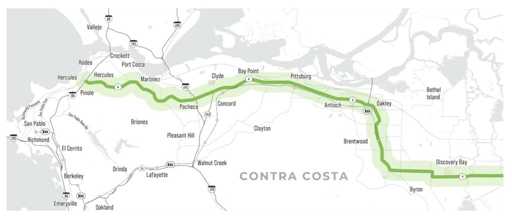
The Contra Costa Transportation Authority (CCTA) is developing the State Route 4 (SR-4) Corridor Vision Study in order to develop a long-term, comprehensive transportation plan for SR-4 that addresses congestion, safety, and other mobility concerns in Contra Costa County. SR-4 is the primary east-west highway in the northern portion of Contra Costa County, beginning in Hercules in the west and continuing into San Joaquin County in the east. This work is being done in partnership with the California Department of Transportation (Caltrans).
With this new vision established, CCTA will be able to make forward-thinking investments along SR-4 and the surrounding local roads, railways, waterways, transit systems, and bike and pedestrian connections.
What is a Comprehensive Multimodal Corridor Plan (CMCP)?
This study is a crucial step in CCTA’s efforts to fund transportation infrastructure investments by meeting Senate Bill (SB) 1 Congested Corridor Program requirements for a Comprehensive Multimodal Corridor Plan (CMCP). A CMCP is developed with state, regional, and local partners and is consistent with the Regional Transportation Plan.
A CMCP aims to:
- Provide holistic guidance for transportation investments.
- Reduce congestion in highly traveled corridors.
- Provide more transportation choices for residents, commuters, and visitors while balancing the character of the local community.
- Create opportunities for neighborhood enhancement projects.
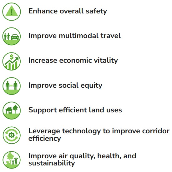
State Route 4 Corridor Vision Study Goals
For more information and to take the survey visit State Route 4 Corridor Vision Study – Contra Costa Transportation Authority (ccta.net).
the attachments to this post:

SR-4-Map

SR4 Corridor Vision Study Goals