


Antioch Council approves changes to home sizes and designs in Sand Creek development
Wednesday, May 27th, 2020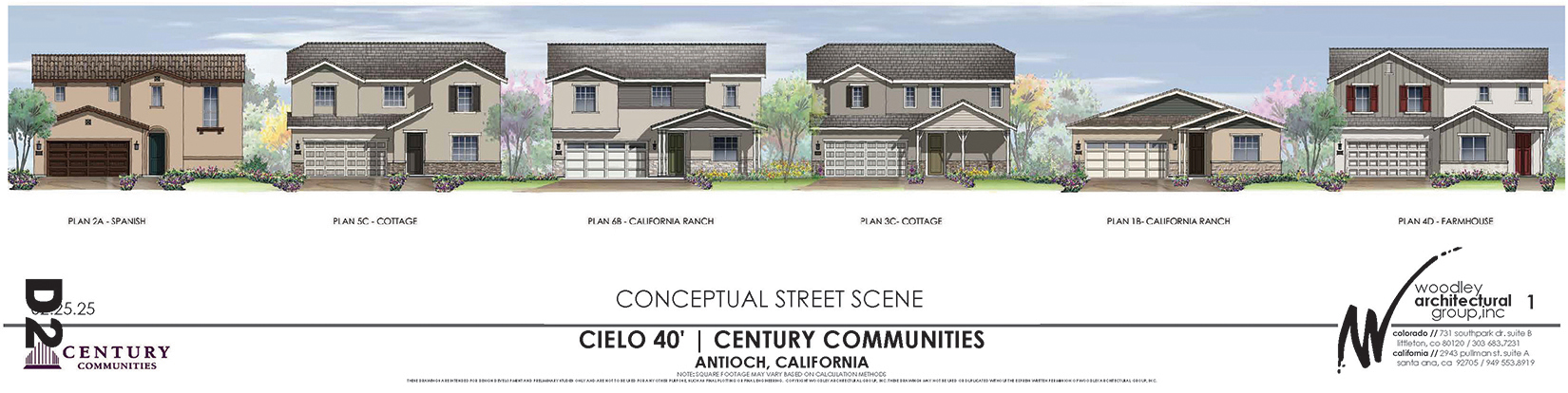
Requires all-ability playground, option for community garden if residents want it
By Allen Payton
During their regular meeting on Tuesday night, May 26, 2020 the Antioch City Council unanimously approved changes to the designs and sizes for the homes in the new home subdivision in Sand Creek, but spent most of their discussion ensuring an all-abilities playground in the park and a possible community garden, should the future homeowners want it.
The city had high hopes for a senior housing community by Century Communities in the Sand Creek area. “Unfortunately, that project did not sell as well as we thought it would,” said City Manager Ron Bernal.
Jose Cortez, Associate Planner in the Community Development Department provided the staff presentation.
“The 10 new designs fit on the existing lot sizes,” he said. “Sizes range from 1,500 square feet to 2,700 square feet. Changes…should not have any adverse effects to what was approved for size.”
The Planning Commission approved the changes and staff recommended the council adopt the changes.
No member of the public spoke on the matter, not even the developer who, as the proponent
“In the removing of certain items from the active adult community…I would ask the community garden be put back in. That’s unique,” said Councilwoman Lori Ogorchock. “The park, I believe all parks built in the city, should be all abilities. Wheelchair can get in there. But we should not allow parks where children cannot get in there.”
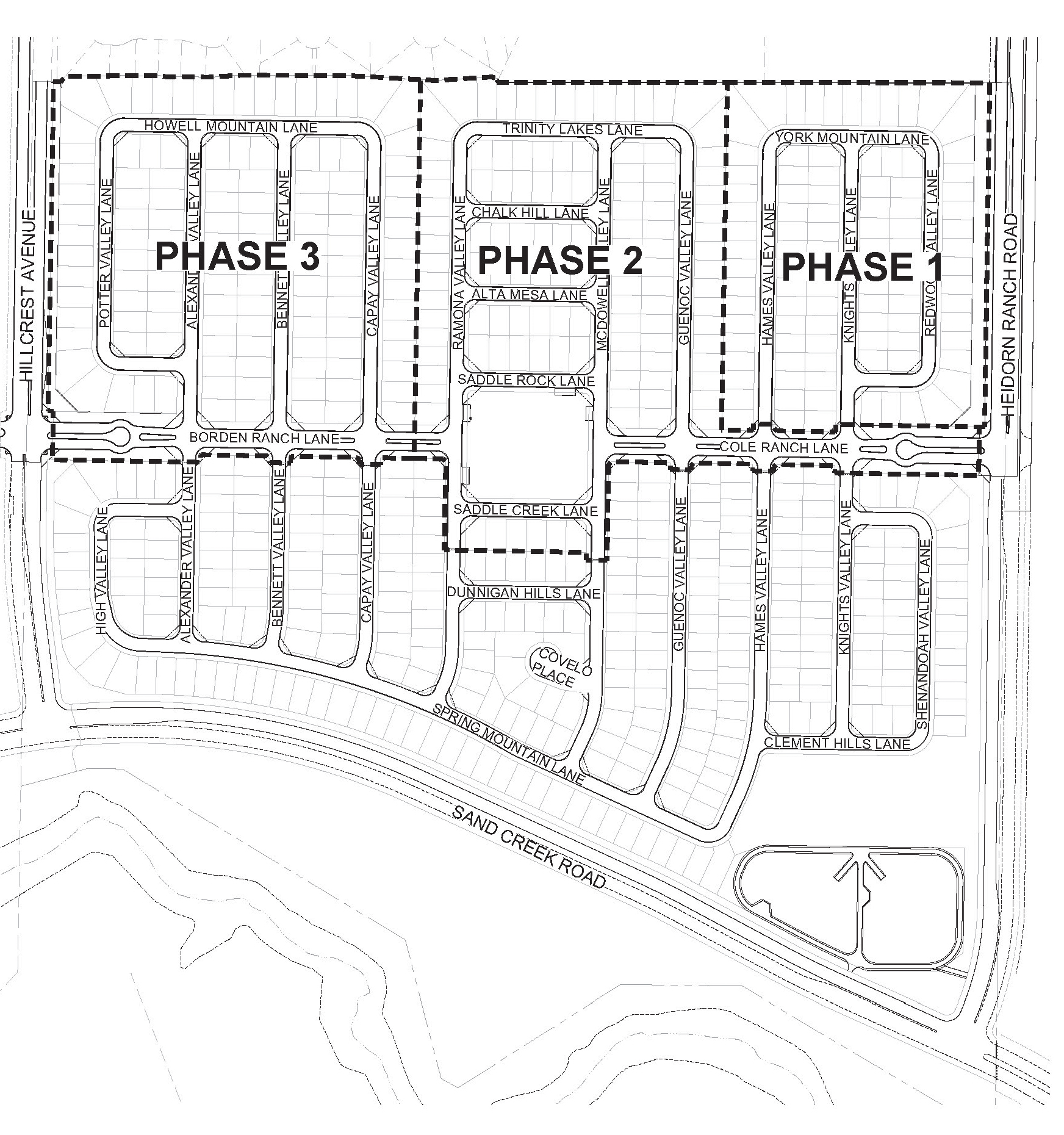
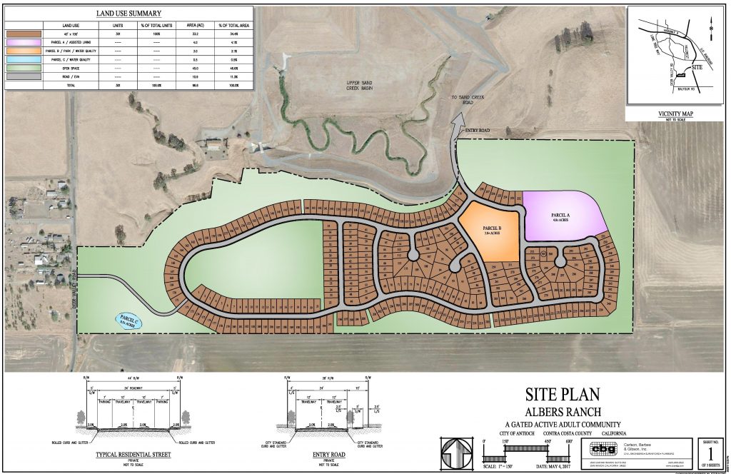
Phase map of the Cielo at Sand Creek development.
A representative from Cielo was on the phone, named, Jeff Inabmnit, representing Century Communities.
“These changes will make a real positive impact on the project,” he said. “The project is focused on the family buyer profile.”
“A private garden is for high-density projects,” Inabmnit said. “The homes have 21-foot back yards which should be adequate. If a community garden isn’t supported, it becomes an eyesore.”
Thorpe then said, “Aren’t all we really doing tonight is looking at home size and designs?”
“Any modifications to the parks and recreation amenities go back to the Planning Commission,” said City Planner Alexis Morris. “Any changes to the homes go to the council.”
Mayor Pro Tem Joy Motts wanted the developer to set keep the community garden that was in the development’s originally approved plans.
“As much as I like a community garden, I’d leave that up to the residents, if the HOA wants that,” Councilwoman Monica Wilson said. “If they don’t want it, it becomes an eyesore.”
Councilman Lamar Thorpe then made the motion to approve the modifications to the home designs and sizes.
“You’re talking about 5,000 square foot lots or less,” Ogorchock pointed out.
“Just like my community,” interjected Wilson.
Ogorchock continued to argue in favor of the community garden and pushing for an all-ability park for the children.
Thorpe then said, “On the community garden side, this is going to return to staff. Volunteers don’t suffice. I’m not for this community garden idea. This was going to be a retirement community of 55 plus.”
“In terms of it being an all-abilities park you guys are still open to that,” he asked.
“We’ve added the play equipment recommended by the Parks and Recreation Department, which is an acceptable structure with paths to get to it,” Iabmnit responded.
“I would still like to see you go ahead with the waterline in case the homeowners’ association would like to do the community garden, if you’re amenable to that,” Motts said.
“Yeah. I’m fine with that,” Inabmnit said.
“Jeff has said they will build the pipe…if the people want it they want it,” Thorpe said. But he and Wilson accepted the amendment to their motion.
They then also added language to the motion to ensure the park was all-abilities.
The council then voted unanimously to approve the motion and changes to the design and sizes of the homes.


 At former Antioch Councilman’s urging, Supervisors direct DA’s office to reopen 2005 Lafayette murder case; approve new land development fees