Archive for the ‘Transportation’ Category

Avoid travel headaches: Check 511 during APEC 2023 Summit Nov. 13-19

Sunday, November 12th, 2023
Photos: MTC

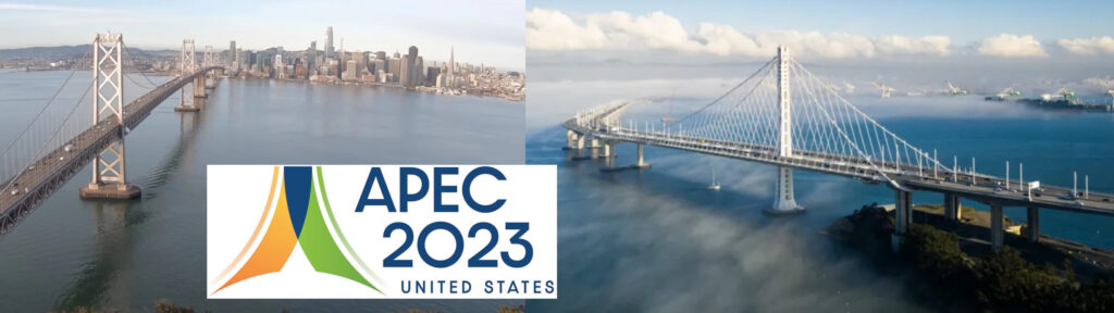
Two lanes of Bay Bridge will be closed.

Various ramps and ped/bike path closures scheduled along I-80 and U.S. 101 in San Francisco due to Asia-Pacific Economic Cooperation 2023 Summit

Information from MTC, CalTrans & CHP

People traveling to, from and within San Francisco next week can expect heavy congestion and traffic delays; transit reroutes, delays and crowding; and reduced or inconvenient pedestrian and bicycle access during the Asian-Pacific Economic Cooperation (APEC) 2023 Summit taking place in the city from Monday, Nov. 13, through Sunday, Nov. 19. 

APEC is expected to draw more than 20,000 people, including heads of state and dignitaries from over 20 member economies, to downtown San Francisco. MTC encourages people to avoid traveling to San Francisco next week if possible. For those who must travel to or through the city, MTC encourages them to ride transit and to visit 511.org for critical travel alerts related to street closures and transportation delays. 

 In cooperation with the California Highway Patrol, and in coordination with our federal, state, and local law enforcement partners, Caltrans is implementing enhanced safety measures throughout our highway systems in and around San Francisco during the Asia-Pacific Economic Cooperation (APEC) 2023 summit starting Wednesday, November 15. The U.S. Secret Service recently designated the APEC summit as a National Special Security Event, requiring heightened security measures in and around the city of San Francisco.

Closures: At the request of federal, state, and local law enforcement agencies, Caltrans will be implementing the following closures to ensure the safety and security of all attendees and residents:

San Francisco / Oakland Bay Bridge

Closures of #1 (left) lane on Eastbound I-80 and #5 (right) lane on Westbound I-80

o Tuesday, November 14 through Friday, November 17, 2023.

o 4 Day Closure, beginning 11/14 at 5:00 AM, ending 11/17 at 9:00 PM.

o Controlled access to Bay Bridge Ped/Bike Path.

o No impacts to transit bus services.

o Treasure Island on-/off-ramps, Fremont Street off-ramp remain open.

Closures of 4th Street off-ramp from Eastbound I-80 and 5th Street off-ramp from Westbound I-80

o Wednesday, November 15 through Friday, November 17, 2023.

o 5:00 AM to 9:00 PM (Daily).

Closure of NB U.S. 101 Dana Bowers Vista Point off-ramp

o Tuesday, November 14 through Saturday, November 18 (Five Day Closure).

o No access to Dana Bowers Vista Point for vehicles, bicycles, or pedestrians.

o Golden Gate Bridge Pedestrian Path closed at north end of bridge; no pedestrian access from Marin County.

o Bicycle Path on west side of bridge to remain open between Marin County and San Francisco.

California Highway Patrol officers will be present to enforce these closures. We understand that these closures may cause temporary inconvenience, but they are essential to ensure the safety and security of this significant event and to promote immediacy and availability for emergency response. We encourage you to plan your travels, accordingly, allow extra time for your commute, and consider using alternative routes or public transportation during this period. Your patience and cooperation are greatly appreciated as we work to ensure the success of the APEC 2023 summit and the safety of our community.

Muni will reroute several transit lines from Nov. 13-19, and Muni Metro T-Third service will be suspended. For more details, visit SFMTA’s APEC information page. BART, Caltrain and the San Francisco Bay Ferry do not anticipate any major APEC-related impacts to their services.

For the Golden Gate Bridge, the Dana Bowers Vista Point off-ramp from northbound U.S. 101 will be closed from Nov. 14-18. There will be no access to the Vista Point for vehicles, bicyclists or pedestrians. The Golden Gate Bridge Pedestrian Path will be closed at north end of bridge, and there will be no pedestrian access from Marin County.

Most APEC activities will take place in the South of Market and Nob Hill neighborhoods. Due to the scale of the gathering, APEC also may create travel impacts on travel in other areas. People should expect a range of street impacts in and around the United States Secret Service security zones (Vehicle Exclusion Zones)(link is external) established for the conference and conference-related events. Pedestrians will be banned from APEC security zones unless they live or work there; and bicycles, whether traditional or e-bikes, also will be barred.

For 24/7 traffic updates, please visit 511.org: https://twitter.com/511SFBay.  MTC operates 511 in partnership with Caltrans, the California Highway Patrol and other transportation agencies.

For real-time traffic, click on Caltrans QuickMap: http://quickmap.dot.ca.gov/

MTC, partners launch massive Bay Area Travel Survey effort

Thursday, October 12th, 2023

Thousands of invitations to be mailed

SAN FRANCISCO, Oct. 12, 2023 . . . The Metropolitan Transportation Commission (MTC) this fall is teaming with the San Francisco County Transportation Authority (SFCTA), the Santa Clara Valley Transportation Authority (VTA) and other partners to conduct a major survey designed to learn more about how people travel throughout the Bay Area. Beginning today, some 750,000 households throughout the nine-county region will receive invitations to participate in what is known as the Bay Area Travel Study.

The Bay Area Travel Study is designed to help MTC and other transportation agencies plan for a more efficient and more effective regional transportation network.

“Our goal is a Bay Area that is affordable, connected, diverse, healthy and economically vibrant for all of our residents and is also a great place for all our region’s visitors to enjoy,” observed MTC Chair and Napa County Supervisor Alfredo Pedroza. “Knowing more about how, when and why people go from place to place will help the Commission develop the right policies and make the smartest investments to achieve that goal.”

MTC expects to mail these invitations in four separate waves between now and December. Those who receive an invitation letter can expect to receive a follow-up postcard about a week later. A unique code will be provided to each household that accepts the invitation to participate, and each household will be assigned a date on which to start logging its travel activity in a survey diary. Respondents will be able to complete the study online, by phone, or through the rMoveTM smartphone app developed by RSG, a Vermont-based research firm hired by MTC as a consultant for the study.

MTC is the transportation planning, financing and coordinating agency for the nine-county San Francisco Bay Area. More information about the Bay Area Travel Study may be found on the MTC website at https://bayareatravelstudy.mtc.ca.gov.

Op-Ed: CCTA working to keep pedestrians safe

Thursday, October 12th, 2023

By Tim Haile, Executive Director, Contra Costa Transportation Authority

Tim Haile. Photo: CCTA

October marks Pedestrian Safety Month, an ideal time to shed light on pedestrians’ safety challenges while navigating our roads. With California’s diverse landscapes, vibrant cities, and outdoor lifestyle, the state naturally encourages walking and biking, while also facing some alarming statistics regarding pedestrian safety. 

According to preliminary data from the Governor’s Highway Safety Association, California’s pedestrian fatality rate is significantly higher than the national rate coming in at 1.29 per 1000,000. 504 pedestrians were killed in crashes involving vehicles in California in 2022, a nearly 10% increase over 2019.

As Executive Director of Contra Costa Transportation Authority (CCTA), I find these numbers to be unacceptable. During Pedestrian Safety Month, it’s crucial to recognize the importance of safeguarding our most vulnerable road users: pedestrians. Every day, hundreds of Contra Costa residents walk to work, school, and leisure activities, contributing to our county’s sustainability and quality of life. The first step to making the streets safer for all is through smart transportation systems and plans.

CCTA, in partnership with Contra Costa County, is actively addressing these concerns through the Vision Zero Safety Policy and Implementation Guide. Vision Zero is a comprehensive strategy aimed at eliminating all traffic fatalities and severe injuries while promoting safe, healthy, and equitable mobility for all. Vision Zero has become a guiding principle in our efforts to enhance pedestrian safety. The key to Vision Zero’s success lies in its data-driven approach, which identifies high-risk areas and factors contributing to pedestrian collisions. By analyzing these insights, we can implement targeted interventions that prioritize the safety of our residents.

In our ongoing commitment to pedestrian safety, CCTA is also in the process of developing a Countywide Transportation Safety Action Plan. The plan will identify strategies to eliminate severe injuries and fatalities. It will consider how to improve safety for all people in the County, including people biking, driving, walking, and taking the train or bus, as well as freight transportation. This plan considers the insights and feedback received from our residents, ensuring that it reflects the real-world experiences and concerns of those who use our streets daily. Residents can use the CCTA’s map-based tool to show where safety is a concern for pedestrians, cyclists, motorists or people with disabilities. 

Pedestrian safety also starts with you. Drivers play a pivotal role in ensuring the well-being of those on foot. Drivers can prevent death and injury by adhering to speed limits and slowing down at intersections, always being prepared to stop at marked and unmarked crosswalks, refraining from blocking crosswalks while waiting to turn, and never driving under the influence of alcohol or drugs. By following these guidelines, drivers can actively contribute to a safer environment for pedestrians and all road users, reducing the risk of collisions and promoting a culture of responsible and attentive driving.

When walking, it’s vital to prioritize safety by remaining alert and attentive, avoiding distractions. Whenever possible, make use of designated signalized crosswalks, as these are locations where drivers are more likely to anticipate pedestrian activity. Keep a vigilant eye out for approaching vehicles and always exercise caution when crossing streets. 

As we celebrate Pedestrian Safety Month, let us not only acknowledge the importance of pedestrian safety but also recognize the role of efficient transportation planning and community input in achieving this critical goal. By prioritizing safety, investing in infrastructure, and fostering a culture of responsible transportation, we can ensure that pedestrians can move about our beautiful county with confidence, knowing that their safety is a top priority.

Highway 4 in Brentwood to close for trail overcrossing construction tonight, Tuesday night, Oct. 9 & 10

Monday, October 9th, 2023

Between Lone Tree Way and Sand Creek Road

Single-lane closures Wed.-Sat. nights, Oct. 11-14

By City of Brentwood

The construction of the Mokelumne Trail Bicycle and Pedestrian Overcrossing span over State Route 4 (“SR4”) in Brentwood requires a temporary nighttime freeway closure in both directions for two consecutive nights.  Additionally, there will be single lane closures for several subsequent nights.   

 The highway will be closed in both directions, between Lone Tree Way and Sand Creek Road on the following dates/times:   

Monday, October 9, 2023 from 10:00 p.m. until 4:00 a.m., the following morning.

Tuesday, October 10, 2023 from 10:00 p.m. until 4:00 a.m., the following morning.

Detours will be in place as follows:

Eastbound traffic will be directed to exit at Lone Tree Way, go eastbound to Shady Willow Lane, then southbound on Shady Willow Lane to Sand Creek Road, before proceeding westbound on Sand Creek Road to the eastbound State Route 4 on-ramp.

Westbound traffic will exit on Sand Creek Road and go eastbound on Sand Creek Road to Shady Willow Lane, then northbound on Shady Willow Lane to Lone Tree Way, and proceed westbound on Lone Tree Way to the westbound State Route 4 on-ramp.

There will be single-lane closures in the eastbound and westbound directions on the following dates/times:

Wednesday, October 11, 2023 from 10:00 p.m. until 4:00 a.m., the following morning.

Thursday, October 12, 2023 from 10:00 p.m. until 5:00 a.m., the following morning.

Friday, October 13, 2023 from 11:00 p.m. until 7:00 a.m., the following morning.

Saturday, October 14, 2023 from 11:00 p.m. until 8:00 a.m., the following morning.

Visit the Mokelumne Trail Bicycle and Pedestrian Overcrossing web site for more information on the project.

Celebrate Transit Month in September with events, prizes and more

Saturday, September 2nd, 2023

Start logging your rides today.

Enjoy the Mokelumne Trail Bridge Bike Ride from Antioch BART Station Plaza on Sept. 30

Friday, September 1, 2023, marked the official start of the Bay Area’s eighth-annual Transit Month. Hosted by San Francisco Transit Riders and Seamless Bay Area with support from local transit agencies, including BART, Transit Month toasts the many trains, buses, and ferries that connect the region and uplift its communities, economies, and cultures.  

During Transit Month, riders are encouraged to explore the region by taking local transportation. The month is hallmarked by a multitude of free events, a Ride Contest, ride-a-longs with transit leaders, a Rider First Awards ceremony, and more. 

Some of the BART-centric events to look forward to this year include: 

Mokelumne Trail Bridge Bike Ride from Antioch BART Station Plaza on Sept. 30, organized by Bike East Bay 

Ride with Bike East Bay to the new bike/walk bridge over Hwy 4 in deep east Contra Costa County. The bridge now provides a safer route between Antioch and Brentwood, including a connection to the Mokelumne Trail which continues to the east through Brentwood, and to the west through Pittsburg and Bay Point. On this ride we will explore the connection from the Antioch eBART station to the bridge, and then back along the Delta de Anza Trail.

Details: September 30, 2023 | 10:00 am – 1:00 pm 

Address: Antioch BART Station Plaza, 1600 Slatten Ranch Rd, Antioch, CA 94509

RSVP: https://bikeeastbay.org/events/mokelumne-trail-hwy-4-bike-bridge-grand-opening-ride-antioch/

Hosted by: Bike East Bay

Meet the BART Anime Mascots on Sept. 16  
Beat the Ridership Record All Aboard Bay Area Transit Day on Sept. 16 
Transit CEO Ride-Along and Happy Hour on Sept. 29 
BART Scavenger Hunt from Sept. 1 through 21, organized by Young Professionals in Transportation

Read about the upcoming events and RSVP here.   

Source: Seamless Bay Area

Last year, riders logged more than 3,000 regional transit trips during the monthlong celebration, and we’re hoping to see even more rides logged this year! 

“It’s no secret that the past few years have been hard on our transit, and though we scraped by a budget win recently, it’s not enough. That’s why we need to uplift transit all September long and highlight how necessary it is to keep our city equitable, equal, and fun,” said Thea Selby, Board Co-Chair of San Francisco Transit Riders, which created Transit Month. “It is more important than ever before that we show our elected leaders how important transit is to our city, and that we need to continue funding it. Let’s prove that to them this Transit Month by getting out and taking transit!”

Transit Month prizes are awarded to riders who log the most trips during the Ride Contest. But logging the most rides isn’t the only way to get a prize; this year, when a rider logs a trip, their name will be entered into a raffle.  

“We’re expecting Transit Month to be bigger than ever before with more events, more participating agencies, and more community group involvement,” said Ian Griffiths, the co-founder and policy director of Seamless Bay Area, which co-hosts the monthlong celebration. “One of the things we’re most excited about is our community grant program, where we’re distributing 11 small community grants to get more groups involved.” 

Transit Month prizes this year include lots of transit agency swag, as well as behind-the-scenes tours of sites not typically accessible to the public, like the Salesforce Transit Center.  

The rider who logs the most BART trips this Transit Month will win an HO scale BART A car made by Rapido Trains (the model trains are currently available for preorder on railgoods.com). This museum-quality model will arrive inside a custom-made display case, allowing the rider to proudly show off their best-in-the-Bay Transit Month performance (Delivery is estimated Summer 2024). Other BART prizes up include a BARTable swag bag with promotional prizes, a poster-size BART map, and a BART anime mascot swag bag. Hear from last year’s BART Ride Contest winner below.

Op-Ed: Unlocking the boundless potential of aging through transit

Wednesday, August 30th, 2023

CCTA partners with Choice in Aging, Mobility Matters provides free, door-through-door services for senior residents.

By Federal Glover, Chair, Board of Directors, Contra Costa Transportation Authority

Last week, on National Senior Citizens Day, we were reminded of the barriers that exist for our older community members. While we celebrated our elder citizens’ incredible contributions to society, we reflected on our responsibility to bolster resources that support independence as people age. One resource in particular, transportation, is a crucial component to enhancing our senior citizens’ quality of life and local governments have a responsibility to address the challenges to utilizing essential services.

Throughout California, there are public health and human resources that stay true to the theme of boundless potential in aging, but an element that often gets overlooked is transportation. Transportation, which has a uniquely human element in carrying people through life, has not been designed with senior citizens in mind. Instead, seniors often face countless institutional barriers that prevent them from taking trips to medical appointments or the grocery store – simple trips that are important for people’s independence.

At CCTA, we believe in equitable access for transportation and our “Mobility for All” model doesn’t just address cars, bikes, buses, or trains–but also the mobility needs of our veterans, people with disabilities, and seniors.

There is a gap in accessible transportation for seniors and it is critical to design transportation systems to meet the unique needs that come with aging.

CCTA’s job is to create transportation that all residents can access. Most importantly, we have a responsibility to understand the human element of transportation – to understand how people use our services beyond moving from “Point A” to “Point B”. Whether your destination is a doctor’s appointment, a family dinner, or a book club, transportation is necessary to bring you to and from the places that matter to you. 

CCTA has engaged with community members to understand how residents are using our service and what changes or needs they have. Since 2021, we have used the Accessible Transportation Strategic Plan (ATSP), which has given us direct insights into these community needs. The ATSP was born from the 2017 Countywide Transportation Plan (CTP). One of our goals of this strategic plan is to become a one-stop-shop for residents, to consolidate our resources so that residents can easily navigate services, and to understand the gaps in those services so that we can best serve our community.

CCTA partners with Choice in Aging, as well as Mobility Matters, which provides free, door-through-door services for senior residents. This system is fueled by over 160 volunteer drivers in the County. We are proud that this program has helped deliver 69,015 rides since 2005. We also support our transit partners’ para transit One Seat One Ride program. Our goal is for seniors and disabled individuals to have “one seat” journeys–so that a trip across the County does not have to involve multiple transfers between trains and buses.

CCTA is constantly looking at ways to use innovation to improve and expand services to older adults. To improve mobility in the Rossmoor Senior Community, early next year CCTA will launch an autonomous shuttle service. These shuttles will keep senior residents connected by bringing them to essential services and goods within their community.

CCTA is committed to continuing our efforts to improve transportation for our senior population. We encourage community feedback to best understand how to fulfill your needs. 

We’ve made remarkable strides but recognize that there is always more we can do to implement the vision of “Mobility for All”. We will continue to knock down barriers so that aging is not seen as a limitation– but rather boundless potential.

Plan Bay Area 2050+ Draft Blueprint: Tell us what you think

Thursday, August 17th, 2023

Creating the Blueprint is a key step in developing Plan Bay Area 2050+.

Public engagement is a fundamental element of the plan update process.

September 6th workshop in Contra Costa; Deadline for comment: September 7, 2023

The Plan Bay Area 2050+ Blueprint will integrate strategies across the four elements of the plan — the economy, the environment, housing and transportation — to create a more equitable and resilient future for all.

Beginning in summer 2023 and wrapping up in late 2024, staff will develop the Blueprint over two phases: the Draft Blueprint and the Final Blueprint. Given Plan Bay Area 2050’s solid foundation of 35 strategies, the Draft Blueprint phase for Plan Bay Area 2050+ will focus on making targeted refinements to select plan strategies. (See Plan Bay Area 2050 Executive Summary)

Assumptions for the select Blueprint strategies will be refined to reflect ongoing implementation efforts from Plan Bay Area 2050, while also leveraging findings from previous planning efforts that may be relevant to the post-COVID environment.

Equity and performance analyses will also be conducted during the Draft Blueprint phase to evaluate how the plan’s strategies are supporting progress towards making the Bay Area more affordable, connected, diverse, healthy and vibrant for all.

Furthermore, Transit 2050+ — the comprehensive re-thinking of the six transit-related strategies in Plan Bay Area 2050’s transportation element — will develop an integrated regional transit network that will be incorporated into the Final Blueprint.

While still remaining fiscally constrained per federal planning requirements, the focused plan update approach will consider whether to pursue targeted updates to — or to reaffirm — the Regional Growth Forecast (while maintaining its forecast methodology), as well as to the External Forces, the Growth Geographies and the Needs and Revenue Forecasts.

Culminating in late 2024, the Metropolitan Transportation Commission (MTC) and the Association of Bay Area Governments (ABAG) will consider adoption of the Final Blueprint, which will then move forward in the plan update process as the preferred alternative for environmental review.

Photo: Plan Bay Area

Getting Involved

Creating the Blueprint is a key first step toward updating the plan itself, and thus the Blueprint planning phase will require iteration and deep engagement of the public, partners and elected officials.

A first step in developing the Blueprint is to better understand what has changed as the region emerges from the pandemic. This summer, MTC and ABAG staff will be traveling across the region to speak to the community to understand how life has changed for individuals as the Bay Area enters the “new normal.”

MTC and ABAG are taking input from community members and partners to help inform the development of the Draft Blueprint.

You can make your voice heard in a variety of ways! Attend a pop-up workshop near you; participate in our survey; or submit comments via email, telephone or mail.

Find an event near you and join the conversation to help staff better understand how the last three years have impacted life across the Bay Area.

Participate in Our Survey

A first step in updating the plan is to better understand what has changed for you as the region emerges from the pandemic. MTC and ABAG want to learn how the “new normal” may be impacting your life.

The survey will close on September 7, 2023.

The survey also will help inform the development of Transit 2050+, a parallel long-range planning effort that will produce a first-of-its-kind plan to re-envision the future of the public transit network in the nine-county Bay Area, and the expenditure plan for a potential transportation revenue measure. The revenue measure is key in advancing implementation of Plan Bay Area.

Join a Pop-up Workshop

This summer, MTC and ABAG staff will be traveling across the region to speak to the community to understand how life has changed for individuals as the Bay Area emerges from the pandemic. Attend a pop-up workshop near you and tell us what the “new normal” means to you.

Contra Costa County

Diablo Valley College — Pleasant Hill Campus

Wednesday, September 6, 12 to 3 p.m.

321 Golf Club Road, Pleasant Hill, CA

About Plan Bay Area

Plan Bay Area is a long-range regional plan jointly developed and adopted by MTC and ABAG every four years.

Sand Creek Road extension breaks ground in Brentwood

Thursday, August 10th, 2023
Breaking ground for the Sand Creek Road extension during the ceremony are Supervisor Diane Burgis, Brentwood City Councilmembers Jovita Mendoza and Susannah Meyer, Mayor Joel Bryant, and Councilmembers Pa’tanisha Pierson and Tony Oerlemans on Tuesday, August 8, 2023. Photo: City of Brentwood

Will connect Deer Valley and Heidorn Ranch Roads to Highway 4

On Tuesday, August 8, 2023, a gathering of dignitaries and City of Brentwood staff marked the Sand Creek Road Extension Groundbreaking Ceremony. The long-anticipated extension is a significant milestone in enhancing Eastern Contra Costa County’s transportation infrastructure. While the City had hoped to extend an invitation to the public for the event, due to the project’s location, active construction, and concern for the safety of all participants, it was imperative to limit the total number of attendees.

With an estimated cost of $8.7M, this extension will expand Sand Creek Road at State Route 4 westward, connecting Sand Creek Road to Heidorn Ranch Road. This initiative projects to alleviate traffic congestion on adjacent streets, including Lone Tree Way, Balfour Road and Deer Valley Road. Furthermore, this extension will provide Brentwood residents and emergency personnel, an accelerated and safer route to Kaiser Permanente in Antioch. 

The Sand Creek Road extension (encircled by plastic orange fencing) will include a bridge across Sand Creek (see upper left area with trees) and connect to the current segment near the Highway 4 southbound off- and on-ramps in Brentwood. Source: City of Brentwood video screenshot.

It will “provide Brentwood residents with a direct connection to Kaiser hospital and the Innovation Center that includes the recently approved Costco to be located off of Lone Tree Plaza Drive,” Mayor Joel Bryant added.

The project will also include the bridge over the actual Sand Creek. It “was delayed a little bit. The contract was awarded back in April,” Interim Brentwood City Engineer Allen Baquilar shared.

“As we move forward with this project, we must acknowledge the efforts from past City Council and staff, who have diligently paved the way. This road extension will serve as a conduit to a healthier future, providing safety and accessibility for residents traveling to our neighboring city,” emphasized City Manager Tim Ogden. 

“With enthusiasm, we observe the commencement of this project. We recognize the community’s understanding and patience exhibited while we addressed challenges and setbacks that emerged during the project’s progression,” Assistant City Manager Darin Gale shared in a press release. “The project’s contractors, Goodfellow Sequoia Joint Venture, have demonstrated their capability to manage the project despite unexpected delays. As the work continues, we are confident in their ability to bring this project to completion, slated for late May 2024.”

“We’re excited to see this project underway and look forward to see it opened, soon,” Ogden added.

Sand Creek Road will be extended east past Heidorn Ranch Road along Antioch’s southeast city limits. Source: City of Brentwood video screenshot.

Funding source for the road project are from City of Brentwood Development Impact Fees and the Eastern Contra Costa Regional Fee and Financing Authority all provided by new housing and commercial development in the city and East County.

In an email on Thursday, August 10, Contra Costa County District 3 Supervisor Diane Burgis shared the following about the road extension:

“As East County continues to grow, our transportation and infrastructure needs are growing as well. One of the biggest local road improvements is the new Sand Creek Road extension in Brentwood.

The City of Brentwood’s staff and elected officials have been hard at work for years planning the extension, which will lead west from Highway 4 toward Dear Valley Road and connect with other extensions that are already completed.

I had the unique opportunity to speed up the project in February as Chair of the East Contra Costa Regional Fee and Financing Authority (ECCRFFA), when I, along with the four mayors of Brentwood, Antioch, Oakley and Pittsburg, voted unanimously to prioritize funding this shovel-ready extension. I’m proud of our elected officials for working together as a region and putting taxpayer dollars toward a project that will have immediate impacts for public safety and economic development.”

Official Project Description: The project scope includes extension of Sand Creek Road from westerly of the existing terminus at State Route 4 to Heidorn Ranch Road approximately 2,300 linear feet. The improvements include constructing the central 56 feet of roadway (2 – 20-foot roadway and a 16-foot median), streetlights, wet and dry utilities, full-width bridge (4-lane arterial) across Sand Creek, and related work linking State Route 4 to Heidorn Ranch Road.

To learn more about the Sand Creek Road Extension Project, please visit Sand Creek Road Extension and see video of the groundbreaking ceremony on the City of Brentwood’s Facebook page.  

Allen D. Payton contributed to this report.