


State releases new earthquake maps for Antioch, East County, Concord
The California Geological Survey (CGS) has released five official Seismic Hazard Zones maps affecting communities in Contra Costa and San Mateo counties. The maps identify areas with potential for earthquake-induced landslides and liquefaction, and come with certain requirements for landowners and local governments.
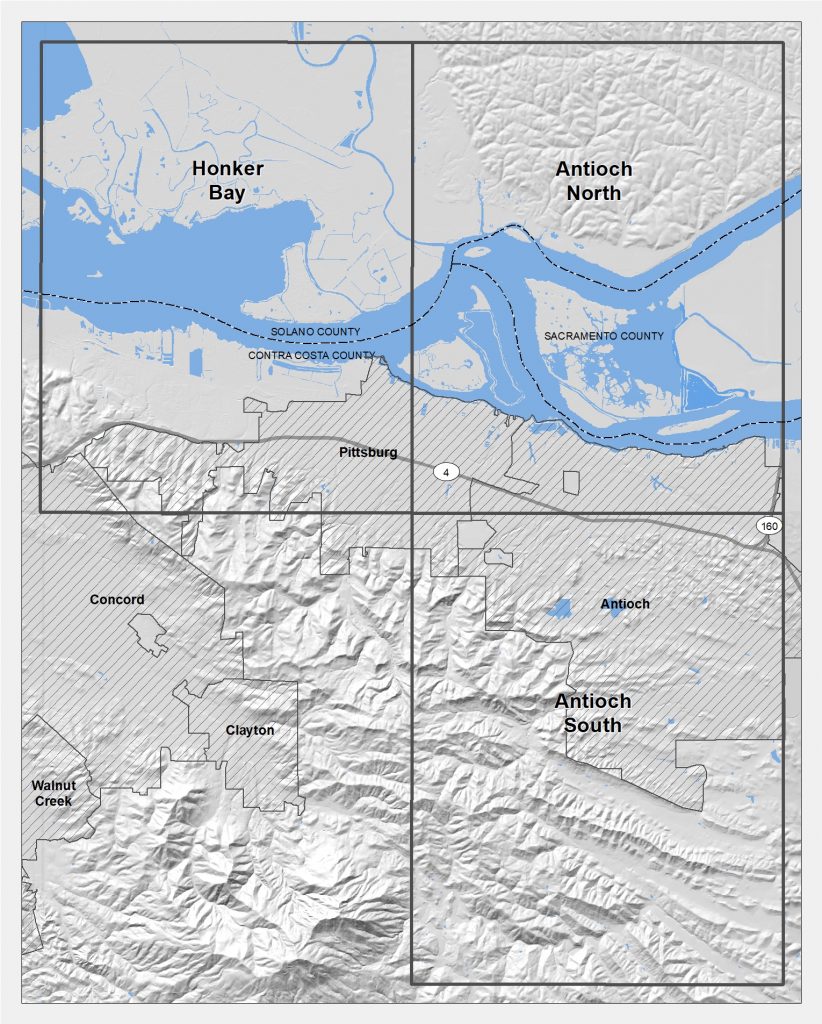
There are three maps covering parts of Contra Costa County, including all or portions of the communities of Antioch, Concord, Brentwood, Oakley, Pittsburg, and Bay Point.
There are two new maps impacting San Mateo County, including all or portions of the communities of Woodside, San Carlos, Belmont, Burlingame, Half Moon Bay, Hillsborough, Millbrae, Redwood City, San Bruno, San Carlos, Portola Valley, and Pacifica.
Earthquakes of magnitude 5.5 or greater can trigger landslides or liquefaction, a phenomenon in which soil temporarily acts like quicksand and loses its ability to support structures. While shaking does most of the damage in a large earthquake, both liquefaction and landslides caused significant damage during the 1989 Loma Prieta quake. The Seismic Hazards Mapping Act mandating the regulatory maps was passed the year after Loma Prieta.
The maps establish Earthquake Zones of Required Investigation. Now that these maps are official after a 6-month public comment period, the local building department must require — before permits are issued — that licensed geologists and engineers investigate sites proposed for development within a zone for evidence of liquefaction or landslide potential. If such evidence is found, design modifications must be made in the planning stage. Examples of these modifications include deep foundations in liquefaction zones or slope stabilization in landslide zones.
Property sellers and real estate agents must inform potential buyers if property they’re selling is in a Seismic Hazard Zone, as is the case when property is in a designated flood zone.
List of Official Maps and Reports released April 4, 2019
- Antioch North quadrangle, showing Seismic Hazard Zones only – Related: Seismic Hazard Zone Report 125
- Antioch South quadrangle, showing Seismic Hazard Zones only – Related: Seismic Hazard Zone Report 126
- Honker Bay quadrangle, showing Seismic Hazard Zones only – Related: Seismic Hazard Zone Report 127
- Montara Mountain quadrangle, showing Earthquake Fault Zones and Seismic Hazard Zones – Related: Seismic Hazard Zone Report 128
- Woodside quadrangle, showing Earthquake Fault Zones and Seismic Hazard Zones – Related: Seismic Hazard Zone Report 129
The index maps below show the general areas in Contra Costa and San Mateo counties affected by this release.
The maps are available as GeoPDF files, which can be viewed using Adobe Acrobat Reader; a GeoPDF file consists of multiple layers and gives the user greater flexibility in viewing and displaying the maps. The maps are also available as digital Geographic Information System (GIS) files. GIS files for both AP Earthquake Fault Zones and Seismic Hazard Zones released by CGS are considered Official Maps. To obtain these maps, reports and GIS data, visit the Regulatory Maps and Reports section of the CGS Information Warehouse. To view individual parcels affected by Seismic Hazard Zones and/or Earthquake Fault Zones, visit our Earthquake Hazards Zone Application (“EQ Zapp”).
the attachments to this post:
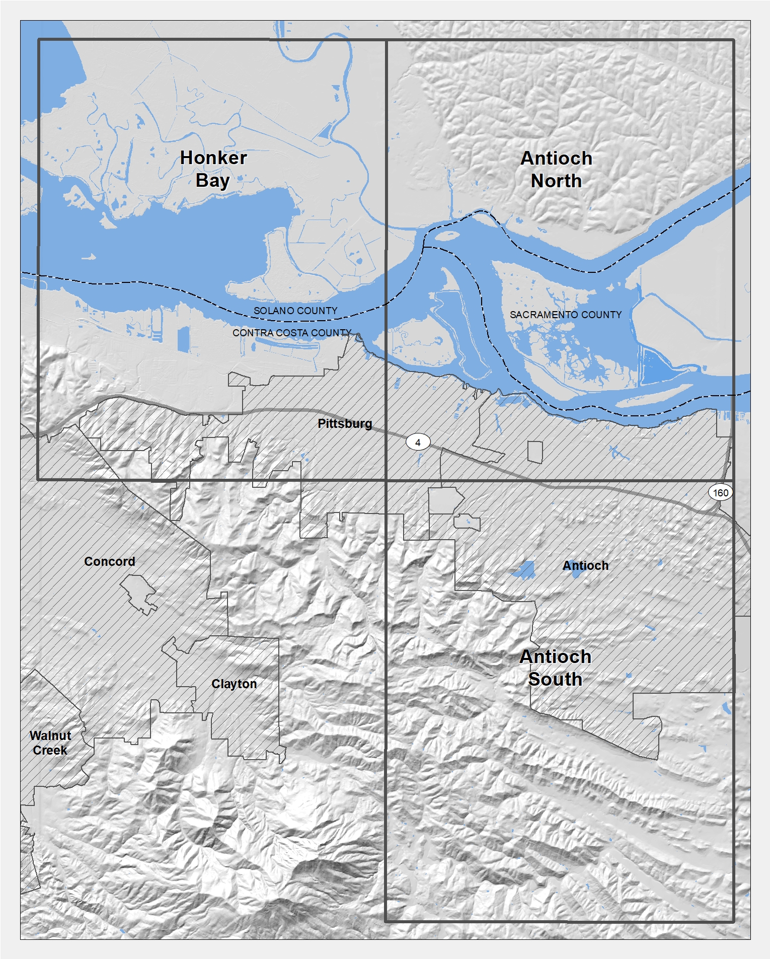
Index_Map_ContraCostaCo


Only problem with these maps is that there are no faults running under Antioch!!
Arne,
When I was on the council between 1994 and 1998, I remember we voted to de-designate a fault line that runs through Antioch as no longer active.
I believe it ran through commercial property on Country Hills Drive between Lone Tree Way and Deer Valley Road, and either through or next to Deer Valley Plaza.
I think it was called the Davis Fault, which can be seen in this diagram – http://saranap.org/images/earthquake-faults-saranap-area-2.jpg
Allen Payton, Publisher